
TPO – The Meteorological Agency forecasts that Ho Chi Minh City and other southern provinces will have scattered showers and thunderstorms in the late afternoon and evening over the weekend.
According to the Southern Hydrometeorological Station, the continental cold high pressure is currently operating stably, then weakening and gradually moving eastward. The low pressure trough with an axis of 5-8 degrees North latitude tends to slowly move southward. Above, the subtropical high pressure has an axis over the North and North Central regions.
Northeast winds are operating at moderate to strong intensity over the sea area of the Southeast region. Early this morning (November 8), Typhoon YinXing entered the eastern sea area of the northern East Sea, becoming the 7th typhoon in 2024.
In the coming days, the continental cold high pressure is forecast to weaken. The low pressure trough with an axis at about 4-7 degrees North latitude is weak. Above, the subtropical high pressure has an axis over the North Central region. The Northeast wind is strong over the sea area in the Southeast, from November 11, the wind intensity will gradually decrease.
In addition, storm YinXing operating in the northern East Sea is likely to move towards the Central Central region with gradually weakening intensity.
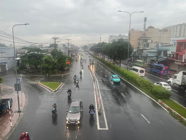 |
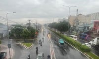
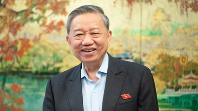
The Meteorological Agency forecasts that Ho Chi Minh City and other southern provinces will have scattered showers and thunderstorms in the late afternoon and evening over the weekend. (Illustration: Pham Nguyen) |
From the above main weather patterns, the Southern Hydrometeorological Station forecasts that Ho Chi Minh City and the southern provinces will have scattered showers and thunderstorms in the coming days (rain concentrated in the evening and at night).
Due to the influence of storm YinXing (storm No. 7), the weather in the sea area from Ba Ria - Vung Tau to Ca Mau (including the sea area of Ho Chi Minh City) has northeast winds gradually increasing to level 5, sometimes level 6, gusting to level 7-8. Wave height from 2-3m.
The sea from Ca Mau to Kien Giang and Phu Quoc has northeast wind level 3-4. Wave height 0.25-1m. In both sea areas, there will be scattered showers and thunderstorms. During thunderstorms, beware of strong gusts of wind and whirlwinds.
Meanwhile, according to the National Center for Hydro-Meteorological Forecasting, last night and this morning (November 7), in the area from Ha Tinh to Quang Nam, there was rain, showers, locally heavy rain; in the area from Quang Ngai to Ninh Thuan, there was moderate rain, heavy rain, locally very heavy rain; in the Central Highlands, there were places with heavy to very heavy rain. The rainfall from 7:00 p.m. on November 6 to 8:00 a.m. on November 7 was over 100mm in some places such as: De Gi (Binh Dinh) 197.8mm, Song Hinh (Phu Yen) 114.3mm, Ea Mdoal (Dak Lak) 111.6mm, Ho Long My (Binh Dinh) 102.8mm, ...
It is forecasted that today (November 7), in the area from Binh Dinh to Ninh Thuan, there will be rain, moderate rain, locally heavy rain to very heavy rain with rainfall from 10-30mm, locally over 80mm.
In the area from Ha Tinh to Quang Ngai and the South, there will be scattered showers and thunderstorms, locally heavy rain with rainfall from 15-30mm, locally over 60mm (in the South, rain will be concentrated in the evening and at night).
Ho Chi Minh City rain decreases, cold air increases

Cold air strengthens and diffuses, Ho Chi Minh City is about to have widespread rain for several days
Ho Chi Minh City traffic project behind schedule due to 'stuck' power poles: What do electricity industry representatives say?
Source: https://tienphong.vn/tinh-hinh-mua-dong-cuoi-tuan-o-tphcm-post1689671.tpo


![[Photo] General Secretary To Lam arrives in Minsk, begins state visit to Belarus](https://vphoto.vietnam.vn/thumb/1200x675/vietnam/resource/IMAGE/2025/5/11/76602f587468437f8b5b7104495f444d)
![[Photo] General Secretary To Lam concludes visit to Russia, departs for Belarus](https://vphoto.vietnam.vn/thumb/1200x675/vietnam/resource/IMAGE/2025/5/11/0acf1081a95e4b1d9886c67fdafd95ed)


![[Photo] National Assembly Chairman Tran Thanh Man attends the Party Congress of the Committee for Culture and Social Affairs](https://vphoto.vietnam.vn/thumb/1200x675/vietnam/resource/IMAGE/2025/5/11/f5ed02beb9404bca998a08b34ef255a6)


Comment (0)