
In particular, the district is planned to have satellite cities and airports... This is the potential and advantage for Phu Xuyen to promote local economic development.
Many industrial clusters are built
Chairman of Phu Xuyen District People's Committee Le Van Binh shared that Phu Xuyen District's regional planning is associated with the process of developing industrial economy, services, small-scale industry, agriculture and urban formation; promoting the strengths and potential of the transportation hub position... to become an attractive, diverse district at the southern gateway of the capital.
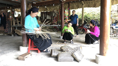
Phu Xuyen is located in the cultural development axis of the South of Hanoi according to the orientation of the Hanoi Capital Planning for the period 2021 - 2030, with a vision to 2050. The cultural values of craft villages and heritages are promoted to become the driving force for development of the district. At the same time, building competitive development models such as: craft village economy, craft village tourism , tourism along the Red River.
Phu Xuyen also aims to develop green industrial clusters (ICs), models of commune cluster centers to support effective production and business; build development complexes to promote integrated strengths, in which craft village economy - ICs are the driving force for rural economic development; develop agriculture towards large-scale production, ecological agriculture, with key products being OCOP products.
Along with that, Phu Xuyen is focusing on building connecting traffic infrastructure and irrigation to ensure production, aiming to become a district with urban - industrial, service - craft village - agricultural functions, with the nature of "Smart - creative - ecological - cultural growth pole" of the Capital.
Phu Xuyen is also considered a transportation hub connecting the southern provinces of Hanoi and is planned as a satellite city of the city; is a center for economic development, industry, services, freight transit, logistics services associated with the southern airport of the capital, oriented to develop into an airport city, with the scale of a city in the period 2040 - 2050.
Currently, the whole district has 120/345 historical relics ranked, of which 38 relics are ranked at the national level and 82 relics are ranked at the city level. Some ancient relics with typical architecture include: Gie Ha communal house (Phu Yen commune), Da Chat communal house (Dai Xuyen commune), Co Che communal house (Phuc Tien commune), Kham ancestor temple (Chieu My commune)...
Head of the Urban Management Department of Phu Xuyen District Nguyen Huu Khoa said that the district has a 500ha Nam Ha Noi supporting industrial park according to the planning until 2030, which is currently attracting many large enterprises to invest. At the same time, the district is also implementing the 204ha Phu Xuyen Industrial Park in the communes of Nam Phong, Phuc Tien, Nam Trieu and Phu Xuyen town.
According to the Approval of the Planning for the Development of Industrial Clusters in Hanoi City to 2020, with a vision to 2030 in Decision No. 1292/QD-UBND dated March 14, 2018 of the City People's Committee, Phu Xuyen district has 11 craft village industrial clusters in the communes of Dai Thang, Phu Tuc, Phu Yen, Van Tu, Hong Minh, Son Ha, Phuong Duc, Hoang Long...
Previously, from 2018 to 2020, Phu Xuyen was allowed by the City People's Committee to establish 4 craft village industrial parks, including: Phu Tuc (5.94ha), Phu Yen (10.5ha), Dai Thang (7.37ha), Van Tu (7ha). These projects are currently in the process of completing construction items to put into operation.
The district has a satellite town planned according to Decision No. 3996/QD-UBND dated August 13, 2015 of the City People's Committee approving the General Planning of Phu Xuyen Satellite Town to 2030, scale 1/10,000; Decision No. 5517/QD-UBND dated October 20, 2015 of the City People's Committee approving the General Planning of Phu Xuyen District, Hanoi City to 2030, scale 1/10,000.
Many traffic connecting routes
According to Chairman of Phu Xuyen District People's Committee Le Van Binh, Phu Xuyen has been receiving attention from the city to direct investment in the construction of a series of roads, including the eastern access road of Phap Van - Cau Gie Expressway connecting residential areas to the east of the expressway, promoting the economy and ensuring safety for the expressway.
Along with that is the western feeder route of the North-South railway through Phu Xuyen district to connect residential areas west of the railway, promote the local economy, ensure a safe corridor for the railway, the route through the satellite city, implemented according to the satellite city zoning plan.
The Southern economic axis route is the route connecting the entire western area of the district with the center of the capital, as shown in Decision No. 2016/QD-UBND of the City People's Committee on approving the red line boundary dossier at a scale of 1/500 of the Southern economic axis route (the southern axis route of the old Ha Tay province), segment from KM18+561.5 - KM41+500, with a route scale of 40m passing through the communes of Hong Minh, Tri Trung, Phu Tuc, Hoang Long, Chau Can.
According to the Master Plan for Construction of Phu Xuyen District, Hanoi City until 2030, the route ends at the intersection with National Highway (QL) 1A. However, in the Phu Xuyen District Regional Planning Project, it is proposed to extend the route to the Red River embankment, forming an economic route in the south of the district, strengthening the East-West connection. The section east of QL1A has a route scale of 30m.
In addition, there is a southern economic route connecting Tri Trung, Hoang Long, Chuyen My, Van Tu communes intersecting with National Highway 1A at N6 intersection, 13.36km long, 30m wide. In addition, there is a 15.4km long, 30m wide route connecting Nam Tien, Nam Trieu, Khai Thai, Tri Thuy, Minh Tan communes with Phu Xuyen port and Ha Nam province.
The Do Xa – Quan Son route is of great significance, creating a driving force for the socio-economic development of the southern part of the city in particular and the transit transport of the Northwest region through the capital region in general. The route starts at Van Diem port area, with a scale of 6 lanes, 36.5 – 62.0m wide with sections passing through urban and residential areas.
In parallel, there is also route 429 connecting Thuong Tin, Phu Xuyen, Thanh Oai, My Duc districts, connecting the traffic routes of National Highway 1A, the southern axis. The total length of the route through the district is 9.6km, being upgraded and expanded to 4 lanes, 25m wide, sidewalks on both sides of the road like urban roads, and a 13m safety corridor on each side.
In addition, the district also has roads 428A, 429B connecting Phu Xuyen with Ung Hoa district and Ha Nam province, which is the East-West axis connecting the traffic routes QL1, QL5B, QL38, the Southern axis, Do Xa - Quan Son route, Huu Hong dike. The length through the district is 18.4km with 4 lanes, 25m wide, with the section through the residential area arranged with sidewalks on both sides of the road like an urban road.
The route connecting the southern economic route starting point at Hoang Long commune with Phu Xuyen satellite town, ending point at Nam Phong commune is 12.9km long, 30-40m wide. The district has 23 routes, the route scale is 18-24.0m, the road level is IV-V plain. The total length of the transportation system has been, is being and will be invested in upgrading and newly building 102.3km.
“These are the factors and conditions that create potential and inherent advantages that will help Phu Xuyen district make positive changes to promote socio-economic development and improve the lives of local people in the coming time…” – Chairman of Phu Xuyen District People’s Committee Le Van Binh affirmed.
Phu Xuyen satellite town includes Phu Xuyen town, Phu Minh, Phuong Duc, Dai Thang, Quang Trung, Son Ha, Nam Trieu, Nam Phong, Nam Tien, Phuc Tien communes and part of Thuong Tin district. This is one of five satellite towns that will be formed in Phu Xuyen and basically maintains the development orientation according to the Hanoi Capital Master Plan to 2045, with a vision to 2065.
Source: https://kinhtedothi.vn/tiem-nang-va-loi-the-phat-trien-kinh-te-o-huyen-phu-xuyen.html
![[Photo] Readers line up to visit the photo exhibition and receive a special publication commemorating the 135th birthday of President Ho Chi Minh at Nhan Dan Newspaper](https://vphoto.vietnam.vn/thumb/1200x675/vietnam/resource/IMAGE/2025/5/17/85b3197fc6bd43e6a9ee4db15101005b)


![[Photo] More than 17,000 candidates participate in the 2025 SPT Competency Assessment Test of Hanoi National University of Education](https://vphoto.vietnam.vn/thumb/1200x675/vietnam/resource/IMAGE/2025/5/17/e538d9a1636c407cbb211b314e6303fd)
![[Photo] Prime Minister Pham Minh Chinh chairs meeting on science and technology development](https://vphoto.vietnam.vn/thumb/1200x675/vietnam/resource/IMAGE/2025/5/17/ae80dd74c384439789b12013c738a045)


![[Photo] Nearly 3,000 students moved by stories about soldiers](https://vphoto.vietnam.vn/thumb/1200x675/vietnam/resource/IMAGE/2025/5/17/21da57c8241e42438b423eaa37215e0e)


Comment (0)