
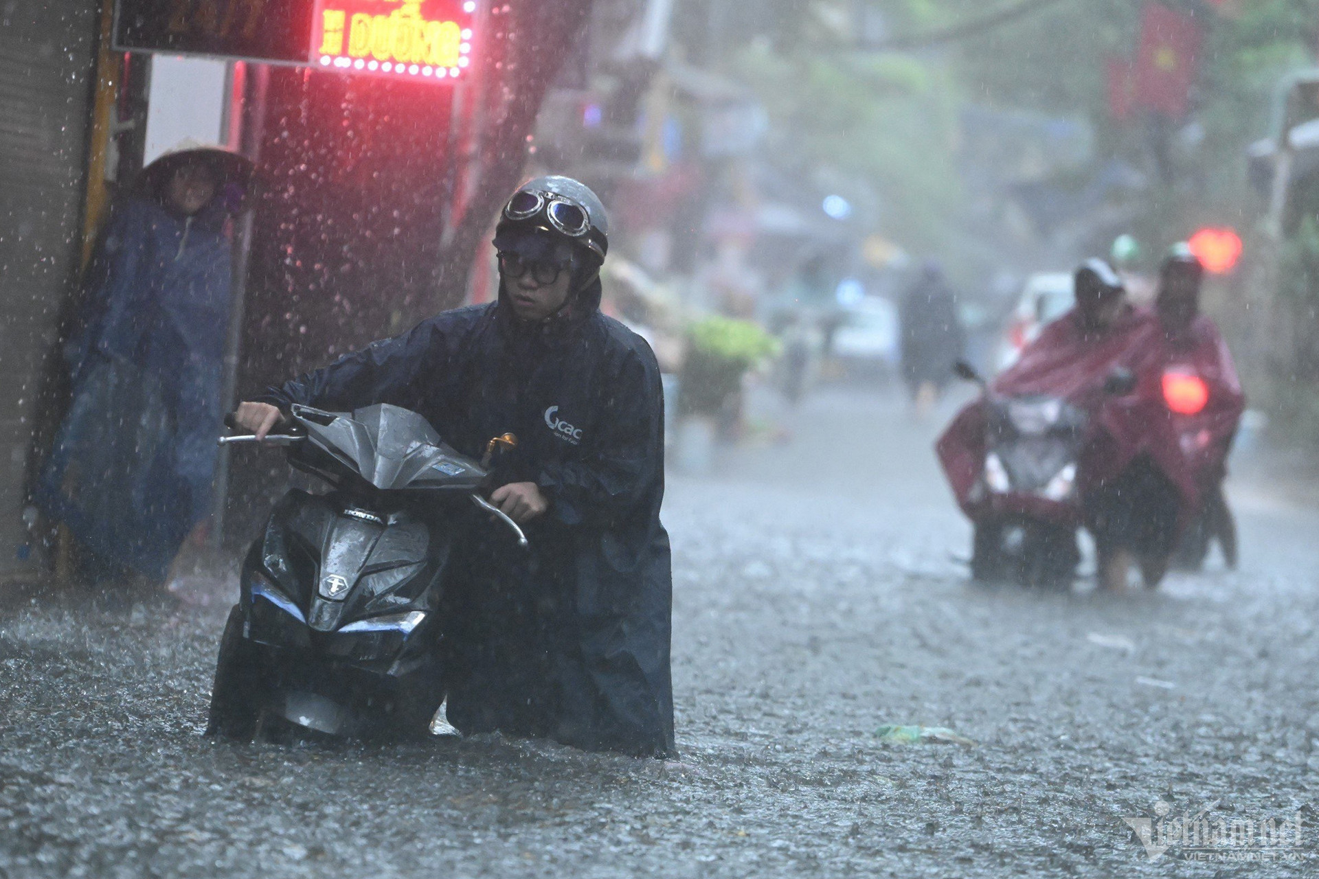
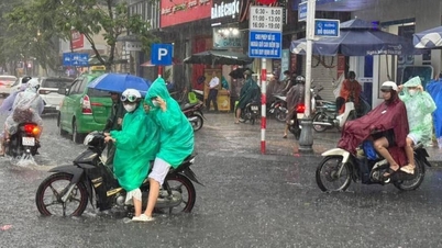
According to experts from the National Center for Hydro-Meteorological Forecasting, Hanoi's weather in the next 3 days (June 24-26), due to the influence of a low pressure trough combined with increasingly strong high-altitude wind convergence, on June 24, it will be cloudy, with occasional showers and thunderstorms, and locally heavy rain.
In particular, from the night of June 24-26, the area will have moderate to heavy rain and thunderstorms, with the possibility of tornadoes, lightning and strong gusts of wind; total rainfall will be 50-100mm, with some places exceeding 150mm.
During this time, the capital's weather is quite cool with the highest temperature around 28-32 degrees, night temperature 25-27 degrees.
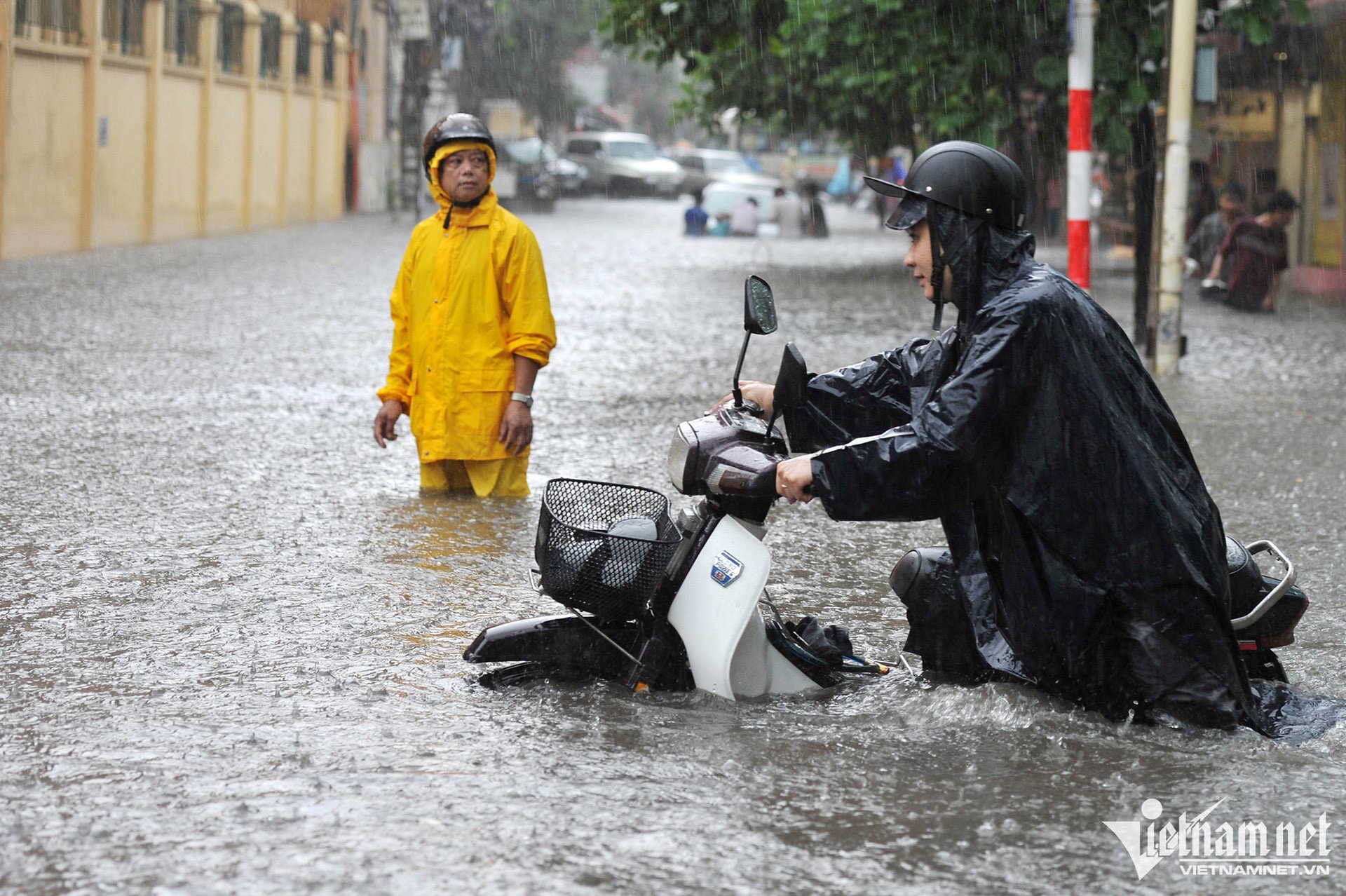
In addition, the National Center for Hydro-Meteorological Forecasting said that from the evening of June 24 to June 26, in the Northern region, there is a possibility of moderate rain, heavy rain and thunderstorms, some places with very heavy rain with common rainfall of 70-150mm, some places over 250mm.
The meteorological agency warns that thunderstorms after hot days are often accompanied by many dangerous weather phenomena, such as tornadoes, lightning, hail, and strong gusts of wind. Heavy rain and localized heavy rain can cause flash floods on small rivers and streams, landslides on steep slopes, and flooding in low-lying areas...
Weather in Hanoi capital in the next 3 days (June 24-26) :
| Day | Day (7am-7pm) | Night (7pm-7am) |
| June 24 | Cloudy with occasional showers and thunderstorms. East to northeast wind level 2-3. | Cloudy with moderate rain and thunderstorms. During thunderstorms, watch out for tornadoes, lightning, and strong gusts of wind. |
| June 25 | Cloudy with moderate rain and thunderstorms. During thunderstorms, watch out for tornadoes, lightning, and strong gusts of wind. | Cloudy with moderate to heavy rain and thunderstorms. Watch out for tornadoes, lightning, and strong winds during thunderstorms. |
| June 26 | Cloudy with moderate to heavy rain and thunderstorms. Watch out for tornadoes, lightning, and strong winds during thunderstorms. | Cloudy with moderate to heavy rain and thunderstorms. Watch out for tornadoes, lightning, and strong winds during thunderstorms. |
The North will experience heavy rain from tomorrow afternoon, over 250mm in some places.
Low pressure trough is forming in the East Sea, the North will have many days of rain
Source: https://vietnamnet.vn/thoi-tiet-ha-noi-3-ngay-toi-mua-giong-lien-tiep-nguy-co-ngap-ung-2294425.html

![[Photo] Da Nang residents "hunt for photos" of big waves at the mouth of the Han River](https://vphoto.vietnam.vn/thumb/1200x675/vietnam/resource/IMAGE/2025/10/21/1761043632309_ndo_br_11-jpg.webp)
![[Photo] Prime Minister Pham Minh Chinh meets with Speaker of the Hungarian National Assembly Kover Laszlo](https://vphoto.vietnam.vn/thumb/1200x675/vietnam/resource/IMAGE/2025/10/20/1760970413415_dsc-8111-jpg.webp)
![[Photo] Prime Minister Pham Minh Chinh received Mr. Yamamoto Ichita, Governor of Gunma Province (Japan)](https://vphoto.vietnam.vn/thumb/1200x675/vietnam/resource/IMAGE/2025/10/21/1761032833411_dsc-8867-jpg.webp)


Comment (0)