
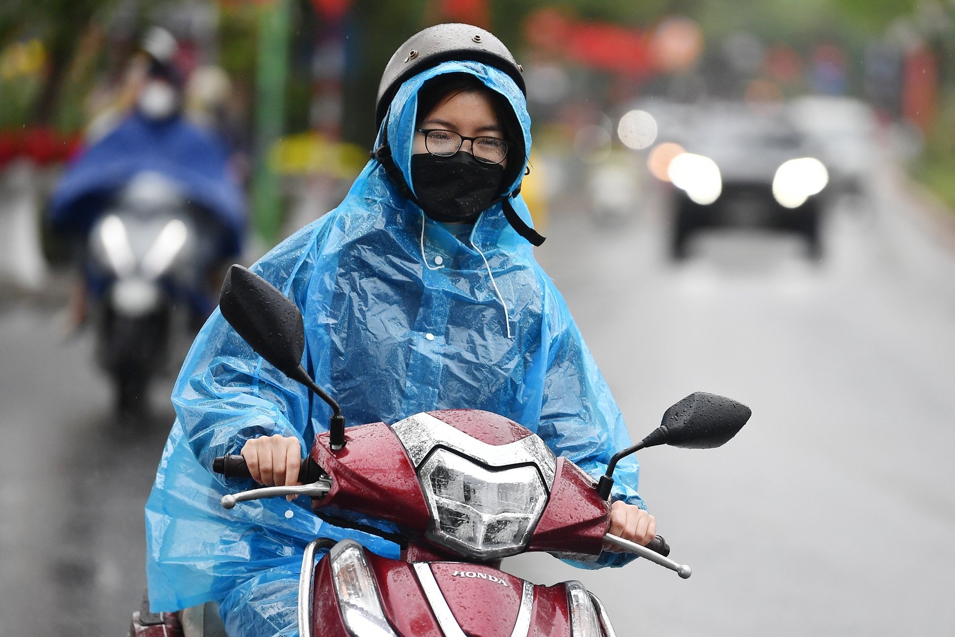
Weather forecast for Hanoi in the next 3 days (February 17-19), cold air will increase, cold weather with light rain, then fog and drizzle.
According to the National Center for Hydro-Meteorological Forecasting, Hanoi's weather in the next 3 days (February 17-19) will be affected by cold air flowing in, combined with strong westerly winds in the upper air, causing light rain, drizzle and cold in the area.
However, due to the cold air shifting to the East, the temperature does not drop much, but with the northeast wind level 2-3 and light rain, the cold feeling is still quite obvious, the air humidity is high.
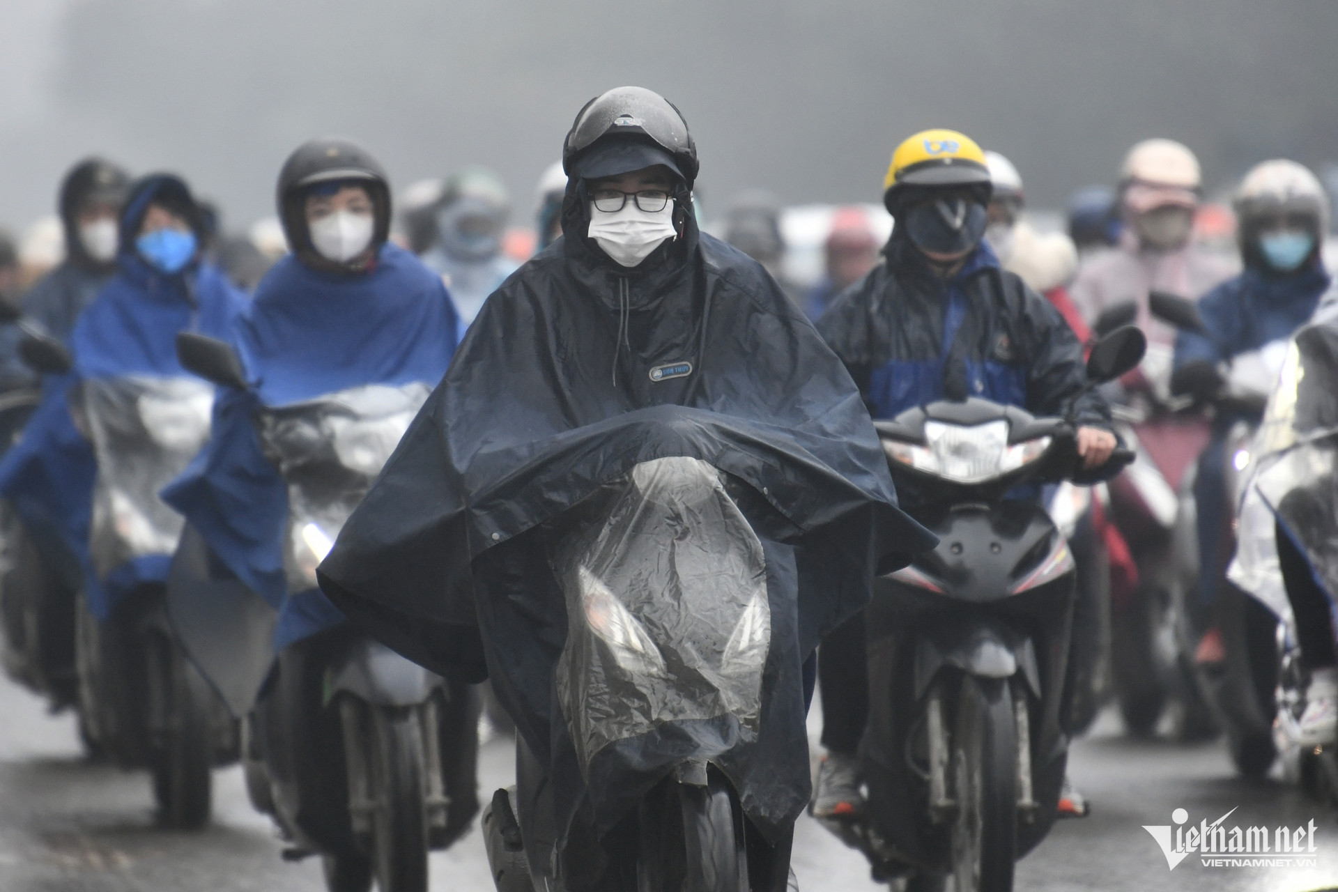
Specifically, experts say that in the next 3 days, the capital Hanoi area will be cloudy, with occasional rain and light rain; cold weather. The highest daytime temperature will range from 20-22℃, the lowest at night will be 15-18℃.
In addition, the meteorological agency said that the cold air that has been flowing since the night of February 15-16 has affected most of the North and North Central regions. The northeast wind inland is strong at level 2-3.
Due to the influence of weak cold air from the East combined with strong currents in the upper westerly wind zone from the night of February 16 to the morning of February 17, the Northeast and North Central regions will have rain, light rain.
At the same time, in the Northeast, it is cold, with some mountainous areas experiencing severe cold. The lowest temperature in this cold air mass is generally between 14-17 degrees Celsius, with some mountainous areas below 13 degrees Celsius. The Northwest region has light rain in some places, with sunny weather in the afternoon.
In Hanoi area, there will be rain, light rain; cold weather. The lowest temperature in this cold air is 14-16 degrees.
Weather in Hanoi capital in the next 3 days (February 17-19) :
| Day | Day (7am-7pm) | Night (7pm-7am) |
| 17/2 | Cloudy, occasional rain, light rain. Northeast to east wind level 2-3. Cold. | Cloudy, occasional rain, light rain. East wind level 2-3. Cold. |
| 18/2 | Cloudy, occasional rain, light rain. Light wind. Cold. | Cloudy, occasional rain, light rain. Light wind. Cold. |
| 19/2 | Cloudy with light rain, drizzle and fog in the morning, then no rain. Light wind. Cold. | Cloudy, occasional light rain. Light wind. Cold. |
The North welcomes two consecutive cold air waves, prolonged cold rain

Cold air shifts to the East, the North has many days of fog and drizzle
Source: https://vietnamnet.vn/thoi-tiet-ha-noi-3-ngay-toi-khong-khi-lanh-bao-trum-ret-kem-mua-am-trien-mien-2371871.html
![[Photo] National conference to disseminate and implement Resolution No. 66-NQ/TW and Resolution No. 68-NQ/TW of the Politburo](https://vphoto.vietnam.vn/thumb/1200x675/vietnam/resource/IMAGE/2025/5/18/adf666b9303a4213998b395b05234b6a)
![[Photo] General Secretary To Lam visits exhibition of achievements in private economic development](https://vphoto.vietnam.vn/thumb/1200x675/vietnam/resource/IMAGE/2025/5/18/1809dc545f214a86911fe2d2d0fde2e8)

![[Photo] More than 17,000 candidates participate in the 2025 SPT Competency Assessment Test of Hanoi National University of Education](https://vphoto.vietnam.vn/thumb/1200x675/vietnam/resource/IMAGE/2025/5/17/e538d9a1636c407cbb211b314e6303fd)


![[Photo] Prime Minister Pham Minh Chinh chairs meeting on science and technology development](https://vphoto.vietnam.vn/thumb/1200x675/vietnam/resource/IMAGE/2025/5/17/ae80dd74c384439789b12013c738a045)


Comment (0)