
Looking back after 50 years of the Liberation of the South and the reunification of the country, the appearance of Ho Chi Minh City has undergone impressive changes, from a post-war urban area to a modern metropolis, leading the country with iconic buildings, model urban areas and a smooth traffic infrastructure system, connecting with the Southeast and Southwest provinces, creating economic development momentum for the Southern Key Economic Zone.
In December 1996, after the city government approved the policy, along with capital poured in from foreign investors, the North Nha Be - South Binh Chanh route project (now Nguyen Van Linh Avenue) was officially started and inaugurated in 2007. Nguyen Van Linh Avenue is 18km long, considered the first and longest avenue in the city. The completed construction has changed the appearance of 3,000 hectares of the southern Saigon area. |
![[Photo] Ho Chi Minh City after 50 years of national reunification through constructions and symbols photo 1](https://vstatic.vietnam.vn/vietnam/resource/IMAGE/2025/4/15/365690befc38430d822f1b6c7bb9c099)
The opening of Nguyen Van Linh Avenue is also the premise for the formation of Hiep Phuoc Industrial Park and Hiep Phuoc Port, contributing to strongly attracting investors to Tan Thuan Export Processing Zone. Together with Phu My Bridge over Saigon River being built and exploited, the route becomes the main belt route creating a complete traffic network from the southern area of Saigon to the provinces of the Southwest and Southeast. |
![[Photo] Ho Chi Minh City after 50 years of national reunification through works and symbols photo 2](https://vstatic.vietnam.vn/vietnam/resource/IMAGE/2025/4/15/ef74bc311f1e4b589f9cc9171f39367c)
Thu Thiem tunnel is considered the most modern tunnel in Southeast Asia. The city's first boulevard project, the East-West Boulevard project (now Vo Van Kiet-Mai Chi Tho Boulevard) using ODA loans from Japan, was constructed in 2005, making the dream of connecting the east and west of the city come true. |
![[Photo] Ho Chi Minh City after 50 years of national reunification through works and symbols photo 3](https://vstatic.vietnam.vn/vietnam/resource/IMAGE/2025/4/15/d730abf8182f4a938021cbd5bd29ea48)
East-West Avenue (now Vo Van Kiet-Mai Chi Tho Avenue). With a length of nearly 22 km, the entire route was opened to traffic in 2011, creating a new axis to the south in the east-west direction, to reduce traffic congestion for Saigon Bridge, creating a traffic axis to Thu Thiem. The route also meets the requirements for traffic and transport of goods from ports to various places in the northeast-southwest direction of the city and the provinces of the Mekong Delta. |
![[Photo] Ho Chi Minh City after 50 years of national reunification through constructions and symbols photo 4](https://vstatic.vietnam.vn/vietnam/resource/IMAGE/2025/4/15/a3642dc7845547d29242160a18389479)
The Vo Van Kiet-Mai Chi Tho Avenue project has contributed to changing the entire urban landscape along both sides of the Tau Hu-Ben Nghe canal, creating a beautiful appearance for the city; at the same time, improving the source of wastewater discharged into the canal through the environmental improvement project. |
![[Photo] Ho Chi Minh City after 50 years of national reunification through constructions and symbols photo 5](https://vstatic.vietnam.vn/vietnam/resource/IMAGE/2025/4/15/471f3034d322459f85136ae344875583)
Ba Son Bridge, a cable-stayed bridge across the Saigon River, connects traffic, trade and tourism in the central area of District 1 with Thu Duc City. (Photo: THANH DAT) |
![[Photo] Ho Chi Minh City after 50 years of national reunification through works and symbols photo 6](https://vstatic.vietnam.vn/vietnam/resource/IMAGE/2025/4/15/5b07d79f22824c2e98adc29b89c30dd6)
Ba Son Bridge started construction in early 2015 and was completed and put into use in April 2022. With modern architecture, the bridge is named after Ba Son Shipyard, a historical site associated with the urban development of Ho Chi Minh City after 50 years of national reunification. |
![[Photo] Ho Chi Minh City after 50 years of national reunification through constructions and symbols photo 7](https://vstatic.vietnam.vn/vietnam/resource/IMAGE/2025/4/15/fba13c0a0e5e4b018e6962ee8b23eaa8)
District 1 center with 69-storey Bitexco building, Ben Bach Dang park, Thu Ngu flagpole, Me Linh square... symbolic works associated with Ho Chi Minh City after 50 years of national reunification. |
![[Photo] Ho Chi Minh City after 50 years of national reunification through constructions and symbols photo 8](https://vstatic.vietnam.vn/vietnam/resource/IMAGE/2025/4/15/a9385a35051a44a499ddce49852dd047)
Ba Son Bridge at night. (Photo: THANH DAT). |
![[Photo] Ho Chi Minh City after 50 years of national reunification through constructions and symbols photo 9](https://vstatic.vietnam.vn/vietnam/resource/IMAGE/2025/4/15/6cb42074a3804f0fbf9e46380e9acc73)
After many renovations, the Me Linh Square Park area, where the Tran Hung Dao statue is located in District 1, will officially come into operation in March 2022. (Photo: THANH DAT). |
![[Photo] Ho Chi Minh City after 50 years of national reunification through constructions and symbols photo 10](https://vstatic.vietnam.vn/vietnam/resource/IMAGE/2025/4/15/7dda59dfa1024f92ac0e3f29592e6a3e)
Ho Chi Minh City center seen from Thu Duc city. |
![[Photo] Ho Chi Minh City after 50 years of national reunification through constructions and symbols photo 11](https://vstatic.vietnam.vn/vietnam/resource/IMAGE/2025/4/15/a7a6e954a22c463c81c1ec5b87e138c8)
High-end residential projects, riverside parks and high-rise projects are gradually taking shape on land that used to be swampy, clearly illustrating the change in urban planning of Ho Chi Minh City. |
![[Photo] Ho Chi Minh City after 50 years of national reunification through constructions and symbols photo 12](https://vstatic.vietnam.vn/vietnam/resource/IMAGE/2025/4/15/275d48a517db4d7fa399d0136994735c)
Today, this place has become a modern urban area with the highlight being the 81-storey Landmark tower, the tallest in Vietnam. |
![[Photo] Ho Chi Minh City after 50 years of national reunification through constructions and symbols photo 13](https://vstatic.vietnam.vn/vietnam/resource/IMAGE/2025/4/15/affb13c26f1e4f60a7f5c822f20509ce)
Hanoi Highway, the main artery of Ho Chi Minh City since the 70s of the last century. (Photo: Archive) |
![[Photo] Ho Chi Minh City after 50 years of national reunification through buildings and symbols photo 14](https://vstatic.vietnam.vn/vietnam/resource/IMAGE/2025/4/15/a8c18c38ec2948aeb4cc9da5b17a7359)
Over the past 50 years, Vo Nguyen Giap Road (formerly Hanoi Highway) has witnessed an impressive transformation in terms of traffic infrastructure. From a simple two-lane road connecting Saigon with the East, this route has now been expanded to 8 to 10 lanes, equipped with overpasses, underpasses and modern intersections. |
![[Photo] Ho Chi Minh City after 50 years of national reunification through constructions and symbols photo 15](https://vstatic.vietnam.vn/vietnam/resource/IMAGE/2025/4/15/d83653d1fd754c7198d8a8d8755ca162)
The new Rach Chiec Bridge on Ring Road 2 has replaced the old narrow bridge, expanding traffic connections between District 7 and Thu Duc City. |
![[Photo] Ho Chi Minh City after 50 years of national reunification through constructions and symbols photo 16](https://vstatic.vietnam.vn/vietnam/resource/IMAGE/2025/4/15/543d474702324ff8a44ddd6c8aac9f9a)
After more than 2 years of construction, the T3 terminal project at Tan Son Nhat airport with a total investment of nearly 11,000 billion VND has reached about 99% of the construction volume, expected to be put into operation on April 30, the 50th anniversary of the Liberation of the South and National Reunification. Terminal T3 will help reduce the load and increase the capacity of the existing Tan Son Nhat airport. |
![[Photo] Ho Chi Minh City after 50 years of national reunification through constructions and symbols photo 17](https://vstatic.vietnam.vn/vietnam/resource/IMAGE/2025/4/15/0e68d5d8027549d5b41741c9bbc67b62)
The project of the road connecting Tran Quoc Hoan and Cong Hoa connecting Tan Son Nhat Airport's T3 terminal in April. |
![[Photo] Ho Chi Minh City after 50 years of national reunification through constructions and symbols photo 18](https://vstatic.vietnam.vn/vietnam/resource/IMAGE/2025/4/15/dd2afe49a4e44696a0cb21aa42530ae3)
In particular, the development of Metro Line 1 has turned Vo Nguyen Giap Street (old Hanoi Highway) into a symbol of smart urban transportation, meeting the increasing travel needs of modern Ho Chi Minh City. |
![[Photo] Ho Chi Minh City after 50 years of national reunification through constructions and symbols photo 19](https://vstatic.vietnam.vn/vietnam/resource/IMAGE/2025/4/15/5d7cac7fc40b4500a28bd3fd3a2974f0)
Metro Line 1 is not just a transportation project, but also a symbol of perseverance and long-term vision. As the trains roll, carrying thousands of passengers every day, the city continues to write its own story, a modern, connected and sustainable metropolis, ready to reach out to the world map. |
![[Photo] Ho Chi Minh City after 50 years of national reunification through constructions and symbols photo 20](https://vstatic.vietnam.vn/vietnam/resource/IMAGE/2025/4/15/eec74b52ae104b7da16ba64a3da04bc6)
Nhandan.vn
Source: https://nhandan.vn/anh-thanh-pho-ho-chi-minh-sau-50-nam-thong-nhat-dat-nuoc-qua-cac-cong-trinh-va-bieu-tuong-post872580.html


![[Photo] Prime Ministers of Vietnam and Thailand visit the Exhibition of traditional handicraft products](https://vphoto.vietnam.vn/thumb/402x226/vietnam/resource/IMAGE/2025/5/15/6cfcd1c23b3e4a238b7fcf93c91a65dd)


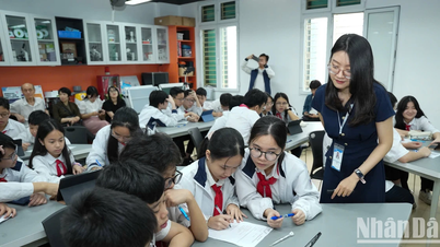

![[Video] Reduce exam pressure, choose the right school for the future](https://vphoto.vietnam.vn/thumb/402x226/vietnam/resource/IMAGE/2025/5/16/292d32461bef4e71b9161ed11f5be162)
![[Photo] Prime Ministers of Vietnam and Thailand visit the Exhibition of traditional handicraft products](https://vphoto.vietnam.vn/thumb/1200x675/vietnam/resource/IMAGE/2025/5/15/6cfcd1c23b3e4a238b7fcf93c91a65dd)


Comment (0)