
On June 25, 2015, the 13th National Assembly passed the Law on Marine and Island Resources and Environment. Article 23 stipulates that “Coastal protection corridors are coastal strips established in areas where ecosystems need to be protected, ecosystem service values and natural landscapes in coastal areas need to be maintained; coastal erosion needs to be minimized, climate change and sea level rise needs to be addressed; and people's access to the sea needs to be ensured.” On July 27, 2015, the Prime Minister issued Directive No. 20/CT-TTg on strengthening the management of planning, construction investment and land management of coastal projects.
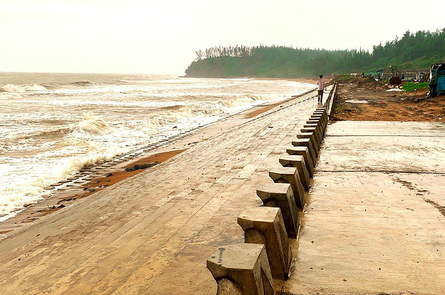
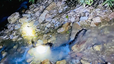
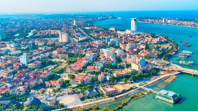
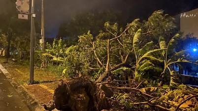
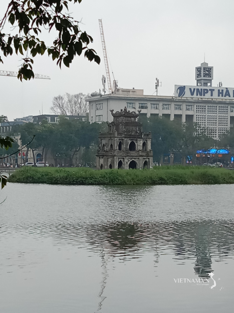
The coastal erosion control system in Vinh Thai commune, Vinh Linh district contributes to protecting the coastal corridor - Photo: TN
Faced with these urgent requirements, to meet the requirements of state management, ensure the exploitation and effective use of coastal resources in an effective and sustainable manner, and at the same time resolve and ensure the progress of investment and construction of major projects being implemented in coastal areas of Quang Tri province according to the provisions of law, the implementation of the task of establishing a coastal protection corridor in the province is very urgent.
For Quang Tri province, the coastal terrain is mainly sand dunes, sand dunes distributed discontinuously along the coast. The terrain is relatively flat, favorable for population distribution. The beach terrain is a narrow strip, average width 50m and mostly without vegetation...
Therefore, coastal erosion in the province has been and is becoming extremely serious. In many areas, erosion directly affects residential areas, disaster prevention works, infrastructure, historical and cultural relics, seriously affecting the ecological environment and people's lives.
Mr. Nguyen Van Nam in Mach Nuoc village, Vinh Thai commune, Vinh Linh district said that in the past 2 years, erosion has occurred very strongly, especially in 2017 due to the impact of some strong storms, the coastline in Mach Nuoc village was heavily eroded, in some places it encroached more than 10m inland.
In Trung Giang commune, Gio Linh district, in the past 5 years, many areas of coastal erosion have eaten into nearly 100m, thousands of meters of coastline have been eroded and erosion has occurred on the entire coastline of the commune, especially the coastline in Bac Son and Nam Son villages, which have been severely eroded by the sea.
Planting sand and wave-blocking trees seems to be ineffective against each big wave. The protective forest in Ha Loi Trung village has gradually disappeared, many old casuarina trees have been uprooted by the waves...
In addition, the construction of structures too close to the coastline, especially structures built right next to the sea, has changed the dynamic conditions of coastal waters, causing increased coastal erosion. The construction of high-rise buildings near the sea requires deep foundations and pumping too much groundwater, leading to weakened geological layers, creating conditions for seawater to encroach, increasing coastal erosion.
In 2005, when investing in the construction of the breakwater combined with the Nam Cua Tung wharf, the coastal flow changed. The beach was eroded and corroded, while the other side, the Ben Hai river mouth, was gradually filled up and shallowed, making it impossible for boats to enter or exit. Although the province had invested tens of billions of dong to build a dyke along the beach to prevent tidal erosion, after each storm season, the waves washed away and eroded deep into the shore.
Therefore, it is necessary to list the areas where coastal protection corridors are established. Because coastal protection corridors are used as a tool in the integrated management of seas and islands to contribute to the conservation of biodiversity, maintain ecosystem services, protect specific geographical areas from the risk of flooding and coastal erosion, especially in the context of climate change, rising sea levels with complex developments and increasing trends as at present.
Coastal protection corridors are used as a means to control, prevent, and limit inappropriate and unsustainable development activities in the coastal space, which is extremely sensitive and vulnerable. Coastal protection corridors are also used to ensure public safety, public benefits, and minimize risks caused by climate change, sea level rise, or coastal dynamic processes.
Currently, the goal of establishing a coastal protection corridor is agreed upon by many researchers and managers, including: creating or providing a buffer zone between coastal development areas and types of coastal natural disasters (such as flooding, erosion, landslides...) contributing to responding to climate change and rising sea levels; protecting natural resources, landscapes, conserving ecosystems, and ecosystem service values in coastal areas; supporting sustainable coastal development; ensuring access to the sea for communities, organizations, and individuals; maintaining the aesthetic value of the coast.
Based on the assessment, it is proposed that the areas where coastal protection corridors must be established in Quang Tri province should be based on three criteria: areas with important coastal ecosystems and natural landscapes that need to be protected; areas at high risk of erosion; and ensuring people's access to the sea.
Based on the assessment of the current status of coastal land use, feasibility, and suitability with the actual situation in the locality, a list of areas must be established for coastal protection corridors. In which, the coastal area of Quang Tri province includes coastal land and coastal waters, specifically defined as follows: coastal land includes 12 coastal communes, wards, and towns and 1 island district and coastal waters with a boundary from the shore to the sea of 3 nautical miles.
The width of the coastal protection corridor is determined based on calculations and forecasts of erosion rates over the next 20 or 50 years.
Therefore, no new constructions are allowed within the corridor. The coastal protection corridor is not a “hard solution” but a “soft solution” which, when established, will create a safe space, reducing erosion and damage caused by coastal erosion to coastal infrastructure and civil works.
This is a positive solution to mitigate negative impacts and manage resource exploitation and use activities within the corridor most effectively.
Tan Nguyen
Source


![[Photo] Prime Minister Pham Minh Chinh receives the delegation of the Semiconductor Manufacturing International (SEMI)](https://vphoto.vietnam.vn/thumb/1200x675/vietnam/resource/IMAGE/2025/11/06/1762434628831_dsc-0219-jpg.webp)


Comment (0)