
 |
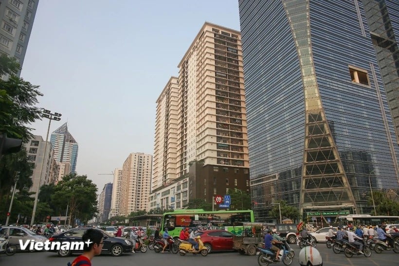
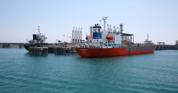
| It is necessary to assess the impact on key projects and construction works. (Photo: Hung Vo/Vietnam+) |
A 7.7-magnitude earthquake struck central Myanmar on March 28, causing casualties and damage to buildings in Myanmar and Thailand. Aftershocks from the earthquake also caused slight shaking in some high-rise buildings in Hanoi and Ho Chi Minh City.
Sharing with the press about the above phenomenon as well as early response measures, Professor Tran Tuan Anh - Director of the Institute of Earth Sciences, Vice President of the Vietnam Academy of Science and Technology, said that in the coming time, in addition to assessing earthquake hazards, specialized agencies need to update data for earthquake risk assessment maps in regions across the country.
Regularly updated earthquake hazard assessment maps
* Sir, the recent earthquake in Myanmar has affected several countries in the region, including Vietnam. It is worth mentioning that this earthquake occurred 1,700 km away from Hanoi and Ho Chi Minh City, but many people still felt the shaking clearly. Could you elaborate on this phenomenon?
Professor Tran Tuan Anh: The Myanmar region is located at the tectonic boundary of the Indian, Eurasian, and Sunda plates, so there are very strong earthquakes. In the past 100 years, this region has had 6 earthquakes larger than 7; the highest was in 1912 with a magnitude of 7.8. In general, distant earthquakes have little impact on Vietnam.
Recently, high-rise buildings in Hanoi and Ho Chi Minh City shook due to the impact of that earthquake. This phenomenon has occurred in recent years when there were large earthquakes in Laos, China, etc. The main effects were shaking in high-rise buildings in big cities. However, the effects (such as shaking) above are also small and unlikely to cause damage.
* So, in order to prevent and mitigate damage caused by earthquakes and tsunamis, especially for a country with a long coastline and an economy closely linked to the sea, in your opinion, what measures does Vietnam need to take to identify risks early?
- Professor Tran Tuan Anh: To prevent, combat and mitigate damage caused by earthquakes and tsunamis, Vietnam currently has a map assessing the risk of earthquakes and some scenarios for tsunamis. However, these maps need to be updated with additional data from recent years.
The earthquake hazard zoning map aims to identify earthquake-prone areas in Vietnam. Thanks to this map, we can know the time of earthquake recurrence in 1,000 years, 500 years and 20 years. In other words, scientists can predict earthquakes in Vietnam.
However, to build the above maps, in addition to earthquake data, scientists must research faults, conduct seismic and tectonic surveys, recalculate parameters and interpret them in an easy-to-understand manner for convenient use by users.
According to international practice, data will be updated every 5-10 years. Vietnam's earthquake hazard zoning map has not been updated in the past 10-20 years.
Need to assess the impact on key projects
* The level of damage caused by the earthquake in Myanmar to this country and neighboring countries such as Thailand is very serious. Previously, there were also some major earthquakes and tsunamis in China and Japan. So what recommendations do you have regarding the work of creating warning maps in conjunction with the work of planning and building standards for economic zones, key projects, and energy projects in Vietnam?
Professor Tran Tuan Anh: In addition to assessing the risk of earthquakes, in my opinion, it is necessary to update data for the earthquake risk assessment map in regions across the country in the coming time. In the immediate future, we need to assess the potential damage when an earthquake occurs in some key areas such as large cities, densely populated areas, key projects, and areas at risk of strong earthquakes.
For the coastal economic zone, it is necessary to assess the impact of tsunamis. It is known that the earthquake risk assessment map is currently only made for a few small areas, and the data has not been updated for many years. If these maps are available, localities and management agencies can rely on them to come up with appropriate seismic resistance plans for constructions, serving the planning and socio-economic development of the country.
For example, in Hanoi, old constructions after 5-10 years, or newly built constructions, need to be evaluated, data updated, and which constructions are at risk of being affected, and to what extent if an earthquake occurs.
In earthquake-prone areas, it is necessary to assess the impact on buildings and whether there is a risk of rocks rolling down the slope.
In my opinion, inspection and assessment are very important to help the government and people proactively prevent and mitigate damage caused by earthquakes.
Particularly for important projects and works such as nuclear power, high-speed trains, subways, hydroelectric power... it is necessary to conduct research to assess the impact of earthquakes and tsunamis (if the project is located on the coast) according to separate standards.
Normally, it is necessary to survey and monitor in advance, thereby assessing the danger and calculating the risks during operation to ensure absolute safety for these projects.
* Thank you very much, Professor!
According to Vietnam+
Source: https://baodanang.vn/xa-hoi/202504/sau-tham-hoa-dong-dat-o-myanmar-can-danh-gia-rui-ro-dong-dat-o-tren-ca-nuoc-4003027/

![[Photo] Thousands of Buddhists wait to worship Buddha's relics in Binh Chanh district](https://vstatic.vietnam.vn/vietnam/resource/IMAGE/2025/5/3/e25a3fc76a6b41a5ac5ddb93627f4a7a)


Comment (0)