
In Chapter III, Decree 53/2024/ND-CP clearly states regulations on the establishment and management of water source protection corridors and groundwater exploitation thresholds, and zoning of prohibited and restricted areas for groundwater exploitation.

Water sources must have a protection corridor with a water surface area of 2 hectares or more.
The Decree stipulates that water sources that must have a protection corridor include water sources specified in Clause 2, Article 23 of the Law on Water Resources.
Water sources that must have a protection corridor established according to the provisions of Point c, Clause 2, Article 23 of the Law on Water Resources include: lakes, ponds, lagoons, and estuaries in the List of lakes, ponds, lagoons, and estuaries that cannot be filled with a water surface area of 2 hectares or more.
Based on the actual situation of the locality, the Provincial People's Committee decides to include in the List of water sources that must establish water source protection corridors for lakes, ponds, marshes, and lagoons in the List of lakes, ponds, marshes, and lagoons that cannot be filled with a water surface area of less than 2 hectares.
Water sources must have a protection corridor established according to the provisions of Point d, Clause 2, Article 23 of the Law on Water Resources, including:
a) River, stream, canal, ditch section is the water supply source of domestic and production water supply works;
b) River and stream sections that have been eroded or are at risk of being eroded;
c) Rivers, streams, canals, ditches, and inter-district and inter-provincial ditches are drainage axes for urban areas, concentrated residential areas, industrial zones and clusters;
d) River, stream, canal, or ditch sections that are degraded, polluted, or exhausted and need water source improvement and restoration;
d) Rivers, streams, canals and ditches are closely linked to the livelihoods of riverside communities.
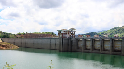
Scope of water source protection corridor for dams, hydroelectric reservoirs, irrigation reservoirs and other reservoirs on rivers and streams
For hydroelectric reservoirs with a total capacity greater than one billion cubic meters (1,000,000,000 m 3 ) or with a total capacity from ten million cubic meters (10,000,000 m 3 ) to one billion cubic meters (1,000,000,000 m 3 ) but located in a concentrated residential area or an area with national defense and security works, the scope of the water source protection corridor is the area calculated from the boundary with the highest water level corresponding to the design flood to the boundary with the same elevation as the reservoir clearance elevation (*).
For other hydroelectric reservoirs (*) mentioned above and other reservoirs on rivers and streams, the water source protection corridor is the area calculated from the boundary with elevation equal to the dam crest elevation to the boundary with elevation equal to the reservoir clearance elevation.
For dams and reservoirs, the scope and boundaries of the water source protection corridor are determined according to the boundaries of the protection scope of the irrigation works.
Marking the water protection corridor for dams, hydroelectric and irrigation reservoirs
The Decree clearly states that the marking of water source protection corridors for dams and irrigation reservoirs is carried out in accordance with the regulations on marking of the protection scope of irrigation works of the law on irrigation.
The marking of water source protection corridor boundaries is carried out for hydroelectric reservoirs with a total capacity of one million cubic meters (1,000,000 m 3 ) or more. Hydroelectric reservoirs with a total capacity of less than one million cubic meters (1,000,000 m 3 ) are encouraged to mark the water source protection corridor boundaries. The marking and handover of water source protection corridor boundaries for hydroelectric reservoirs must be completed before the reservoir is filled (**).
The organization managing and operating the hydroelectric reservoir specified in Clause (**) above shall preside over and coordinate with the People's Committee of the district where the reservoir is located to develop a plan to set up boundary markers for the protection corridor of the reservoir's water source.
Based on the approved boundary marker planting plan, the organization managing and operating the hydroelectric reservoir shall preside over and coordinate with the People's Committee of the district where the hydroelectric reservoir is located to plant boundary markers in the field; and hand over boundary markers to the People's Committee of the province where the reservoir is located.
Based on the actual situation of each locality, the Provincial People's Committee shall assign boundary markers to the District People's Committee or Commune People's Committee where the hydroelectric reservoir is located for management and protection.
According to the Government Electronic Newspaper
Source


![[Photo] 60th Anniversary of the Founding of the Vietnam Association of Photographic Artists](/_next/image?url=https%3A%2F%2Fvphoto.vietnam.vn%2Fthumb%2F1200x675%2Fvietnam%2Fresource%2FIMAGE%2F2025%2F12%2F05%2F1764935864512_a1-bnd-0841-9740-jpg.webp&w=3840&q=75)
![[Photo] National Assembly Chairman Tran Thanh Man attends the VinFuture 2025 Award Ceremony](/_next/image?url=https%3A%2F%2Fvphoto.vietnam.vn%2Fthumb%2F1200x675%2Fvietnam%2Fresource%2FIMAGE%2F2025%2F12%2F05%2F1764951162416_2628509768338816493-6995-jpg.webp&w=3840&q=75)


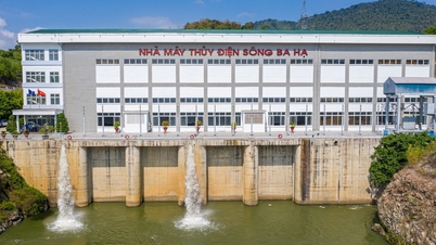


![[Photo] Close-up of Ba Ha River Hydropower Plant operating to regulate water to downstream](https://vphoto.vietnam.vn/thumb/402x226/vietnam/resource/IMAGE/2025/11/25/1764059721084_image-6486-jpg.webp)


Comment (0)