
Da Bia Mountain (Hoa Xuan Nam Commune, Dong Hoa Town, Phu Yen Province) is the highest mountain in the Dai Lanh mountain range of Deo Ca mountain range. Da Bia Mountain is 706m above sea level, the dot of the majestic Truong Son range jutting out into the East Sea. On the top of the mountain is a large rock, up to 76m high, called Thien Nam De Nhat Tru.
Da Bia Mountain is the highest mountain in the Dai Lanh mountain range of Deo Ca range, with an altitude of 706m above sea level, the dot of the majestic Truong Son range jutting out into the East Sea. The unique feature that makes many people curious and arousing curiosity is that on the top there is a large rock, up to 76m high.
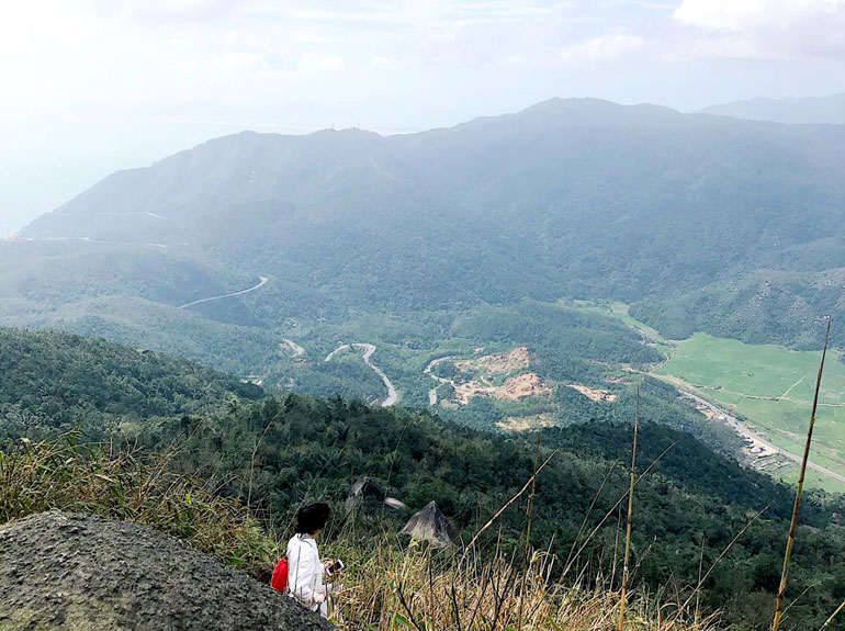
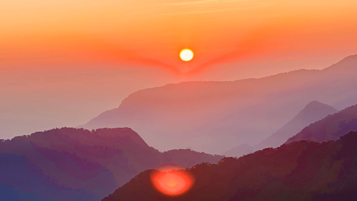
From the top of Da Bia mountain looking down at Ca pass (in Hoa Xuan Nam commune, Dong Hoa town, Phu Yen province). Photo: Contributor.
During the resistance war against the US to save the country, Da Bia mountain was an important revolutionary base, below to the east was the legendary Vung Ro wharf where the No-number ships docked.
Local people consider Da Bia Mountain as one of the famous symbols of Phu Yen land.
In September 2008, the Ministry of Culture, Sports and Tourism issued a decision to recognize this unique landscape as a national landscape. Da Bia Mountain is located in Hoa Xuan Nam commune, Dong Hoa suburb, Phu Yen province.
Before 2000, climbing to the top of Da Bia Mountain was not easy; the entire mountain was full of rocks, dense trees, tangled vines, and dangerous streams and caves.
Legendary attractive pho
Da Bia Mountain is also called Thach Bi Son, our ancestors called it Thien Nam De Nhat Tru (the only pillar of the South). According to the shape of the rock on the top of the mountain, the Cham people call it Cui Bap Mountain, the French call it Thuong Tay Chua Mountain and the locals call it Ong Bia Mountain.
Each different name is associated with thrilling and fascinating legends for the famous high mountain of Phu Yen.
Legend has it that in the spring of the year Tan Mao (1471), King Le Thanh Tong, when personally leading troops to expand the territory, stopped at Da Bia Mountain. He ordered his troops to climb to the top of the mountain and clearly marked the border of Dai Viet (Vietnam's territory) on a rock, and from then on it was called Da Bia Mountain.
For generations, Da Bia Mountain has been the inspiration for writers and poets who passed through this place. Nearly 70 years ago, when he was part of the army marching south, poet Huu Loan left behind the poem “Deo Ca” which was chosen as one of the 20 best poems of the 20th century.
On clear days, standing 50-70km away, you can still see Da Bia Mountain covered in clouds. Da Bia Mountain is very sacred, symbolizing the strength of the people and land of Phu Yen.
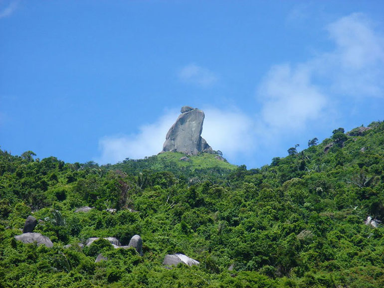
The large rock on top of Da Bia Mountain (in Hoa Xuan Nam Commune, Dong Hoa Town, Phu Yen Province) attracts curious people to come and visit. Photo: Contributor
Paradise
In 2001, the road to the top of Da Bia mountain was surveyed and built, starting at the foot of the mountain on the west side, on Highway 1.
The road is very unique, with a length of 2.5km, with 3 reinforced concrete stairs, some of which are 450 high; the entire route has 2,071 steps, sometimes the steps are created by chiseling and applying cement mortar on inclined stone slopes.
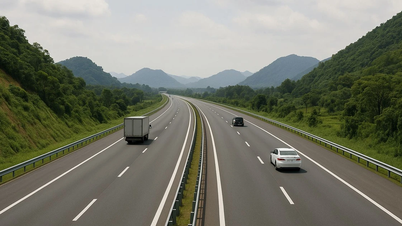
On the way up to the top of Da Bia Mountain, looking down at the convoys of vehicles going from North to South, just as big as beans, following each other like ants, occasionally the cuckoo birds called each other hurriedly, easily startling us.
Every now and then, the north-south train running at the foot of the mountain makes a loud noise, making the whole forest noisy. Trees and vines sometimes cover the entire path, and both sides of the road are covered with lush green vegetation. The palm trees along the road are laden with fruit, the pine trees stand tall on the mountainside; many caves on both sides of the road have very interesting shapes, untouched by human footprints. Sometimes we see a hawk spreading its wings and hovering on the mountainside as if searching for the sacredness and mystery of the mountains and forests.
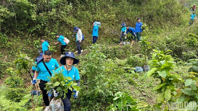
With 10 breaks, the time of about 2 hours and 30 minutes, all members of the climbing team reached the top of the mountain. That day was a beautiful Sunday, there were many groups participating in the climbing, most of them were students.
Looking at the young faces, rosy cheeks, and sweat, I feel that in the near future, this place will be an attractive tourist destination in Phu Yen.
Standing on the top of Da Bia Mountain - an ideal viewing spot in Dong Hoa Town (Phu Yen Province) looking east is the beautiful Vung Ro Bay, the returning ships bobbing on the clear blue water.
To the left is Mui Dien lighthouse, the easternmost point on the mainland of the Fatherland, further away is the vast East Sea like silver. Looking to the south is Van Phong Bay of Khanh Hoa province, the sandy shore curved like a giant banyan leaf.
Turning to the northwest is the immense Tuy Hoa rice fields embraced by rolling hills, with bright red tiled roofs looming, all immersed in the green of young rice.
Looking up, the sky is vast and blue, sometimes with clouds drifting by, we feel like we can reach out and touch it; next to it is the "gate of heaven" where the wind blows gently, the wind brings the scent of the sea under the sunlight, feeling like the cold blue mist of the afternoon.
At the foot of the mountain is the Ban Thach River winding down to the East Sea, further away is Dong Hoa town like a colorful spring flower garden, growing every day.
Going down is easier than climbing up, but you have to be careful, it is easy to slip because you are tired at this time. Experience is that you should go in the dry season, go in groups to encourage and support each other; food, shoes, clothes need to be neat, bring a light stick, 1.5m long to support yourself; ask one or two locals for help, carry common items for the whole group. The time to go up and down, eat, rest, sightsee, take pictures must be at least 5 to 6 hours.
Saying goodbye to Da Bia Mountain when the sunset fell, leaving behind the golden rays of sunlight behind the western mountain range, my soul was calm, and I was able to set foot on the mountain top, touching the sacred and majestic Da Bia Mountain.
It is known that in the future, the Bien Ho - Da Bia Cultural and Ecological Resort Urban Area project of Vietnam Construction Import-Export Corporation will open a cable car to the top of Da Bia Mountain. This is the dream of many people to reach the top of the mountain.
However, if possible, let's climb to the top of Da Bia Mountain together, then you will feel satisfied with your journey to Dong Hoa Town, the place to welcome the first sunrise on the mainland of the Fatherland on the East Sea coast.
Da Bia Mountain is a national scenic spot. Every year, the Provincial Youth Union and the Department of Culture, Sports and Tourism of Phu Yen organize a competition to conquer Da Bia Mountain on March 27 (Vietnam Sports Day), attracting a large number of people, especially young people, to participate. They come here to explore and conquer this peak.
Source: https://danviet.vn/mot-ngon-nui-cao-o-phu-yen-nguoi-cham-goi-cui-bap-nguoi-phap-goi-ngon-tay-chua-la-lam-20241113163430327.htm
![[Photo] Many young people patiently lined up under the hot sun to receive a special supplement from Nhan Dan Newspaper.](https://vphoto.vietnam.vn/thumb/1200x675/vietnam/resource/IMAGE/2025/5/18/6f19d322f9364f0ebb6fbfe9377842d3)
![[Photo] Ready for the top competitions of Vietnamese table tennis](https://vphoto.vietnam.vn/thumb/1200x675/vietnam/resource/IMAGE/2025/5/18/9c547c497c5a4ade8f98c8e7d44f5a41)
![[Photo] Party and State leaders attend the special art program "You are Ho Chi Minh"](https://vphoto.vietnam.vn/thumb/1200x675/vietnam/resource/IMAGE/2025/5/18/6895913f94fd4c51aa4564ab14c3f250)


Comment (0)