
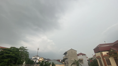
According to the National Center for Hydro-Meteorological Forecasting, at 1:00 a.m. on September 17, the center of the tropical depression was located at 17 degrees North latitude; 122 degrees East longitude, on the mainland east of Luzon Island (Philippines). The strongest wind near the center of the tropical depression was level 7, gusting to level 9; moving mainly in a westerly direction, at a speed of about 15 km/h.
At 1:00 a.m. on September 18, the tropical depression moved in a West-Southwest direction at a speed of about 25 km/h and strengthened into a storm (storm No. 4) in the North East Sea, about 420 km from Hoang Sa. The strongest wind near the storm center was level 8, gusting to level 10; natural disaster risk level 3.
At 1:00 a.m. on September 19, the storm moved west-southwest at a speed of about 15-20 km/h in the Hoang Sa area. The strongest wind near the storm center was level 9, gusting to level 10; natural disaster risk level 3.
In the next 48 to 72 hours, the storm is likely to change direction, moving in a West Northwest direction, traveling 10-15km per hour.
To proactively respond to the tropical depression that is likely to strengthen into storm No. 4, on September 17, the People's Committee of Quang Nam province issued a telegram. Requesting departments, branches, districts, towns and cities to proactively review and deploy disaster response plans according to risk levels in the area.
Closely monitor the development of tropical depressions; strictly manage means of transport going out to sea; organize counting and notify owners of means of transport, captains of ships and boats operating at sea of the location, direction of movement and development of tropical depressions to proactively avoid, escape or not move into dangerous areas.
At the same time, prepare forces and means to deploy rescue work when there is a situation.
Previously, the People's Committee of Quang Nam province approved specific plans to respond to natural disaster situations according to risk levels in the area.
In case of flood, Quang Nam will evacuate people to high places.
In Quang Ngai , Chairman of the Quang Ngai Provincial People's Committee Nguyen Hoang Giang requested district leaders to take full responsibility for implementing flood and storm prevention and response to landslides, hill and mountain landslides, and urban flooding in the area; promptly update weather conditions to have appropriate instructions.
Proactively inspect and review residential areas, houses, and offices in areas at high risk of landslides and flash floods; have early and specific plans to ensure people's safety; proactively and closely monitor natural disaster developments, promptly evacuate people to safe places.
At the same time, develop detailed scenarios to respond to landslides and flash floods to implement when rain and floods occur.
Urgently review and inspect the dredging of drainage systems, clearing of manholes, canals, sewers, ditches, and drainage shafts at risk of blockage; manholes of construction routes at risk of flooding residential areas and prevent the central area of Quang Ngai City from being flooded locally or over a long period of time; be on duty 24/7 to handle flooding and blockage of local drainage systems during the rainy and stormy season...
In Binh Dinh , the Provincial People's Committee directed localities to carefully prepare prevention plans according to the "4 on-site" motto, to minimize damage.
According to Mr. Le Xuan Son, Head of the Irrigation Sub-Department (Department of Agriculture and Rural Development), the province's Disaster Management software system has updated information on more than 403,460 households with more than 1.4 million people. In particular, more than 281,000 of these people are in vulnerable groups, needing support when natural disasters occur.
One of the urgent tasks is to identify areas at high risk of being affected by storms, floods, and landslides. Mountainous and riverside areas in Binh Dinh are always hot spots that need attention, as heavy rains and floods can cause serious landslides.
Localities such as Hoai An, An Lao, Vinh Thanh, or some high areas in Quy Nhon City and Phu Cat District are considered “sensitive” and must be specially monitored. To cope, clear plans for population evacuation have been established, from emergency evacuation to moving people to safety as soon as there is a warning of storms and floods.
The Department of Agriculture and Rural Development also requires the management unit of fishing boat anchorage areas to be on duty 24/7 to monitor the weather and the situation of boats at sea. In addition, localities also coordinate with border guards and related units to promptly notify and ensure the safety of fishermen.
![[Photo] General Secretary To Lam begins official visit to Russia and attends the 80th Anniversary of Victory over Fascism](https://vphoto.vietnam.vn/thumb/1200x675/vietnam/resource/IMAGE/2025/5/8/5d2566d7f67d4a1e9b88bc677831ec9d)
![[Photo] Prime Minister Pham Minh Chinh meets with the Policy Advisory Council on Private Economic Development](https://vphoto.vietnam.vn/thumb/1200x675/vietnam/resource/IMAGE/2025/5/8/387da60b85cc489ab2aed8442fc3b14a)


![[Photo] National Assembly Chairman Tran Thanh Man chairs the meeting of the Subcommittee on Documents of the First National Assembly Party Congress](https://vphoto.vietnam.vn/thumb/1200x675/vietnam/resource/IMAGE/2025/5/8/72b19a73d94a4affab411fd8c87f4f8d)


Comment (0)