
According to the National Center for Hydro-Meteorological Forecasting, currently (June 21), the low pressure trough has an axis at about 24-27 degrees North latitude, converging winds above 1,500m level, remaining in the Northern region.
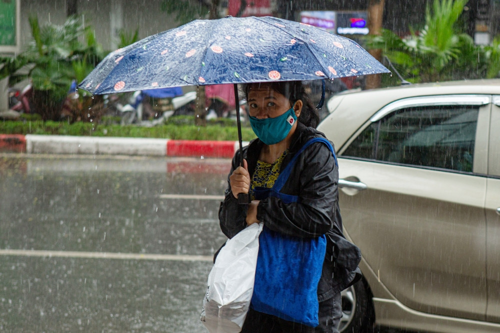
From this evening and tomorrow, in the Northern region, there will be showers and thunderstorms, locally heavy rain with rainfall of 20-40mm, some places over 60mm. Particularly in the mountainous areas of the North, tomorrow afternoon and evening (June 22), there will be moderate rain and thunderstorms, locally heavy to very heavy rain.
Commenting on this rain, Mr. Hoang Phuc Lam - Deputy Director of the National Center for Hydro-Meteorological Forecasting said that from the evening and night of June 23-25, in the North, there is a possibility of moderate rain, heavy rain and scattered thunderstorms, locally very heavy rain with common rainfall from 70-150mm/period, some places over 200mm/period.

From June 27-29, rain will still appear in the late afternoon and night in this area, but will gradually decrease, leaving only scattered showers and thunderstorms.
Thunderstorms may produce tornadoes, lightning, hail, and strong winds. Heavy rain may cause flooding in low-lying areas.
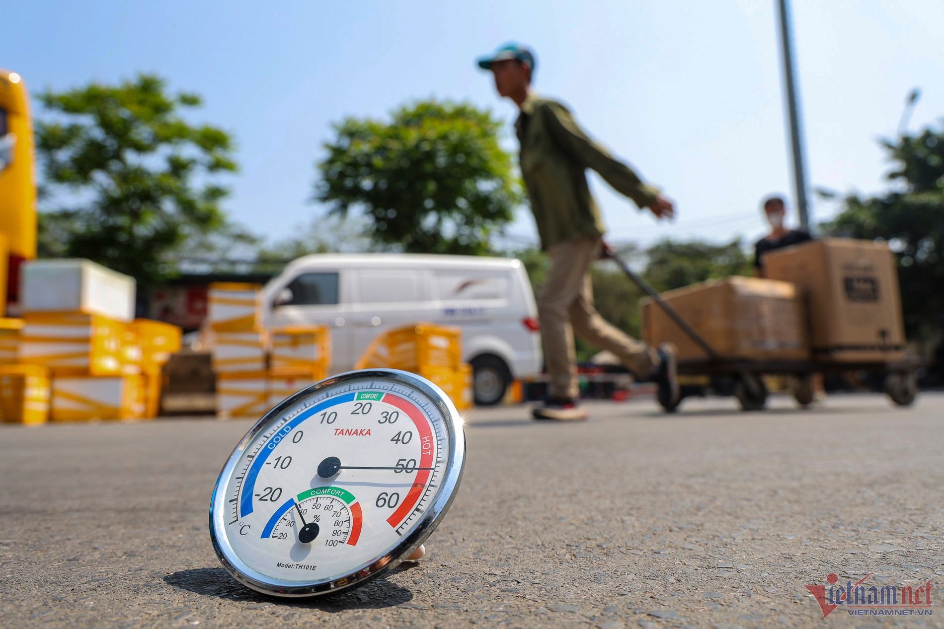
Regarding the heat wave that has lasted for many days in the North and Central regions, tomorrow (June 22), the North will continue to be hot with the highest temperature of 35-36 degrees, some places over 37 degrees. From June 23, when heavy rains appear, the heat will gradually decrease, the temperature will drop by 3-5 degrees.
For the area from Thanh Hoa to Phu Yen, the heat continues, with some places experiencing extreme heat. On June 22-23, the highest temperature is 36-38 degrees, some places over 38 degrees; the lowest relative humidity is 45-60%.
From June 24, the heat here also tends to decrease. From June 25-30, in the evening and at night, this area will have scattered showers and thunderstorms; Thanh Hoa and Nghe An in particular, from the night of June 23-27, there will be moderate to heavy rain in some areas.
Previously, the National Center for Hydro-Meteorological Forecasting said that from the second half of June, rainfall in the Northwest, Northeast, Northern Delta and North Central regions was generally 10-20% higher than the average of many years. In other places, rainfall was 10-30% lower than the average of many years in the same period. In particular, the area from Quang Nam to Khanh Hoa and some places in the Southwest region was 30-40% lower.
Experts say that rain in the North and North Central regions will tend to concentrate in mid- and late June, with the North likely to see three large-scale rains. With this development, the drought situation in the North as well as hydroelectric reservoirs in the North after June 15 may improve.
Hanoi weather for the next 10 days: Intermittent hot weather, cool heavy rain at the weekend
Weather forecast for Hanoi in the next 10 days, the first days of the week will be intermittently sunny, some places will be hot, but heavy rain will appear towards the end of the week.

The North has widespread heat wave lasting 5 consecutive days
The North is experiencing a widespread heat wave with the highest temperature above 37 degrees Celsius and the Central region above 39 degrees Celsius. By June 21, when there are thunderstorms, the heat wave in the North will end, but it will continue in the Central region.
Strong heat in the North in the second half of June, possibility of storms
In the early days of the week, the North will experience localized heat, with only 2 days of intermittent showers helping to cool down. From the second half of June, the heat will increase again. In particular, there is a possibility of storms/tropical depressions in the East Sea.
Source


![[Photo] President Luong Cuong attends the inauguration of the international container port in Hai Phong](https://vphoto.vietnam.vn/thumb/1200x675/vietnam/resource/IMAGE/2025/5/13/9544c01a03e241fdadb6f9708e1c0b65)
![[Photo] Prime Minister Pham Minh Chinh meets with US business representatives](https://vphoto.vietnam.vn/thumb/1200x675/vietnam/resource/IMAGE/2025/5/13/5bf2bff8977041adab2baf9944e547b5)


Comment (0)