
According to the National Center for Hydro-Meteorological Forecasting, from October to December, the central coastal provinces enter the "main" rainy and stormy season. Therefore, the development of scenarios for natural disaster prevention must be prepared by the provinces and cities to ensure safety and minimize damage.
Quang Nam : Shock force on duty 24/7 ready to evacuate people
Recently, the People's Committee of Quang Nam province has approved a plan to respond to natural disasters according to risk levels in the area. In particular, the evacuation of people must follow the "4 on-site" principle; maximize the work of relocation, on-site evacuation, and interleaving; limit concentrated evacuation.
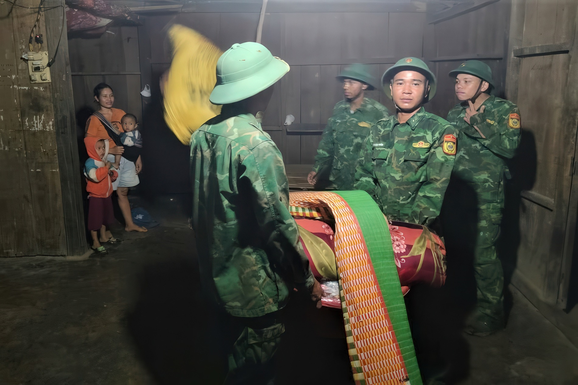
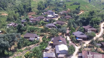
After storm No. 4 on September 19, the entire Nam Tra My district had to urgently evacuate more than 70 households with nearly 300 people in the two villages of Tak Chay and Lang Luong...
Speaking to VietNamNet reporter, Mr. Tran Duy Dung, Chairman of Nam Tra My District People's Committee said that because most of the terrain is mountainous, every area of the district is at risk of landslides when heavy rains last for a long time. Through the survey, about 40 locations were recorded as having a high risk of landslides.
Taking the serious landslide in Tra Leng commune in 2020 as a "bloody lesson", every year the district proactively inspects and reviews each residential area and house located in areas at risk of insecurity.
"To limit damage, each commune has a shock force on duty 24/7, ready to evacuate people as soon as there are signs of danger," said Mr. Dung.
Mr. Dung added that the district has reserved more than 300 tons of rice at commune warehouses, schools, village warehouses, grocery stores and among the people, and has reserved more than 1,160 boxes of dry food and 1,505 boxes of bottled water. The district's Steering Committee for Disaster Prevention and Search and Rescue also has more than 1,000 people participating, ready to respond in any situation.
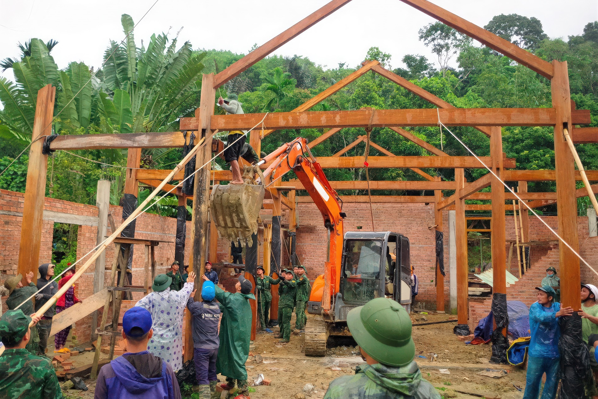
In particular, to proactively respond to the risk of flash floods and landslides before the storm season, in recent years, Quang Nam has implemented relocation and population rearrangement.
According to the Department of Agriculture and Rural Development of Nam Tra My district, from 2017 to now, the district has stabilized 64 residential areas/2,954 households, with a total cost of more than 175 billion VND. The locality is continuing to urgently build 2 resettlement areas with a total area of 2.4 hectares, aiming to soon stabilize the lives of about 70 households.
Quang Ngai: Investing 14 billion VND to overcome the consequences of natural disasters and landslides in Van Ca Vai residential area
To ensure the safety of people in mountainous areas, authorities in Quang Ngai are checking each location at high risk of landslides, flash floods and geological faults in the area.
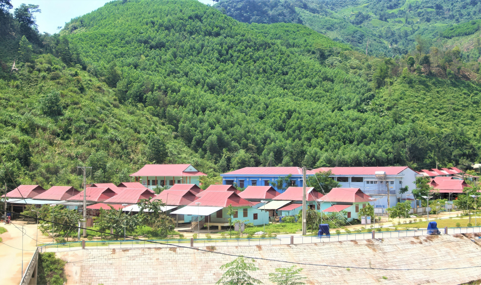
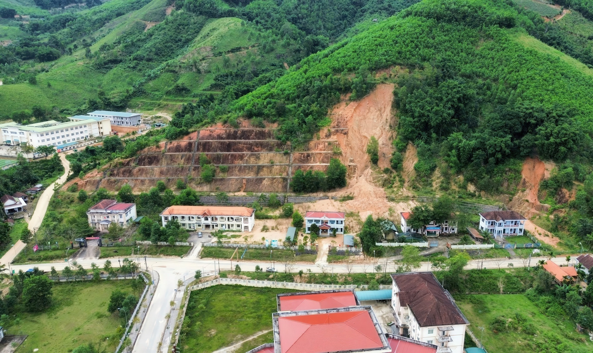
In recent years, the landslide situation on Van Ca Vai mountain (Di Lang town, Son Ha district) has been complicated, damaging a number of housing projects, making people feel insecure.
Faced with this situation, the project to overcome the consequences of natural disasters and landslides in Van Ca Vai residential area with a total investment of 14 billion VND has been implemented, to ensure the safety of life and property for 5 households with 24 people at the foot of this mountain and DH77 road.

As one of the localities where landslides often occur during the rainy and stormy season, the entire Son Tay district (Quang Ngai) currently has 6 landslide risk points at level 1 with 53 households/189 people, 32 landslide risk points at level 2 with 233 households/896 people and 2 landslide risk points at level 3 with 28 households/105 people.
According to Vice Chairman of Son Tay District People's Committee Dinh Truong Giang, the district has reviewed all old landslide sites, new risk sites and suspected landslide sites. At the same time, it has assigned forces to be on duty, stockpiled food and prepared to evacuate people in areas at risk of landslides, etc.
In areas at high risk of landslides, it will be proposed to build resettlement sites in safe locations so that people can soon stabilize their lives.
Binh Dinh: Data is available in disaster response software
In Binh Dinh province, to cope with the risk of landslides during the rainy and stormy season, localities have also developed plans to evacuate people in case of emergency.
In particular, Binh Dinh's mark is the disaster response software that helps the locality digitize data of nearly 1.5 million people.
According to statistics, Binh Dinh currently has 403,460 households with 1,478,043 people reviewed and updated on the province's Disaster Management software. Of these, 281,465 are vulnerable people who need attention and support when natural disasters occur.
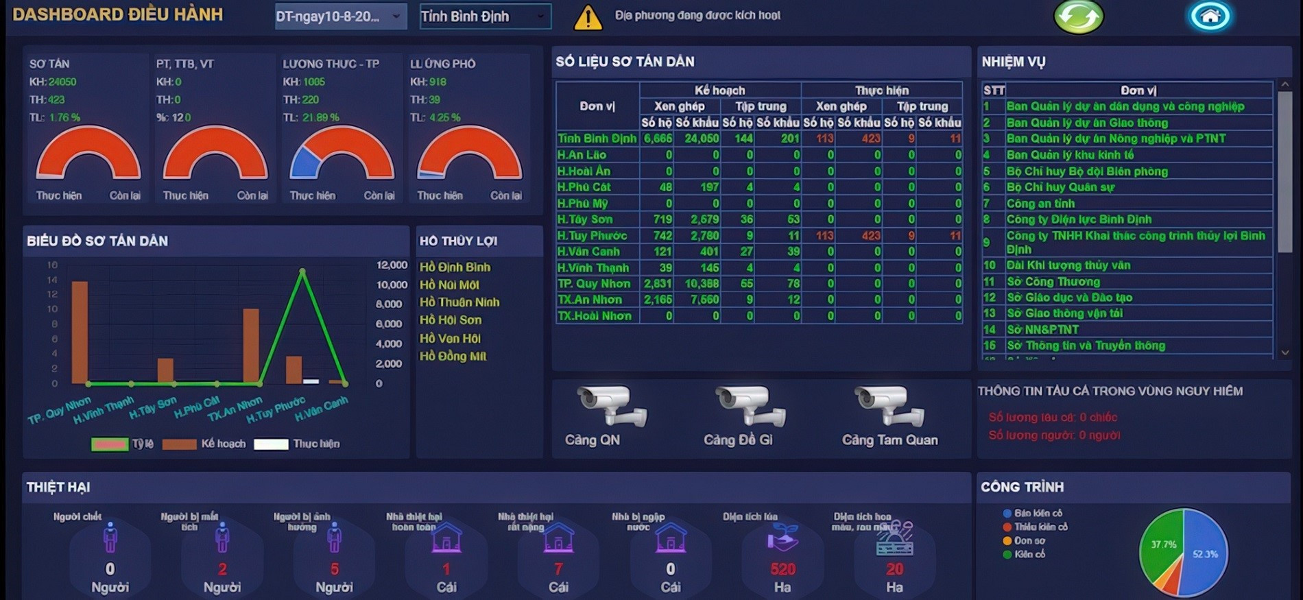
At the meeting on disaster prevention and control in the area on September 18, Chairman of Binh Dinh Provincial People's Committee Pham Anh Tuan directed localities to train in response based on data available in the Provincial Disaster Management software. The preparation of "4 on-site" must be flexible, linked to the actual situation in the locality.
"When natural disasters occur, sectors and localities activate existing plans and scenarios and notify local forces and functional units, and prepare equipment to proactively prevent storms and floods," Mr. Tuan emphasized.
Source: https://vietnamnet.vn/kich-ban-giam-thiet-hai-ve-nguoi-va-tai-san-do-sat-lo-mua-mua-bao-2326774.html

![[Photo] General Secretary To Lam attends the conference to review 10 years of implementing Directive No. 05 of the Politburo and evaluate the results of implementing Regulation No. 09 of the Central Public Security Party Committee.](https://vphoto.vietnam.vn/thumb/1200x675/vietnam/resource/IMAGE/2025/5/19/2f44458c655a4403acd7929dbbfa5039)
![[Photo] Close-up of Tang Long Bridge, Thu Duc City after repairing rutting](https://vphoto.vietnam.vn/thumb/1200x675/vietnam/resource/IMAGE/2025/5/19/086736d9d11f43198f5bd8d78df9bd41)

![[Photo] President Luong Cuong presents the 40-year Party membership badge to Chief of the Office of the President Le Khanh Hai](https://vphoto.vietnam.vn/thumb/1200x675/vietnam/resource/IMAGE/2025/5/19/a22bc55dd7bf4a2ab7e3958d32282c15)
![[Photo] Panorama of the Opening Ceremony of the 43rd Nhan Dan Newspaper National Table Tennis Championship](https://vphoto.vietnam.vn/thumb/1200x675/vietnam/resource/IMAGE/2025/5/19/5e22950340b941309280448198bcf1d9)


![[Photo] Prime Minister Pham Minh Chinh inspects the progress of the National Exhibition and Fair Center project](https://vphoto.vietnam.vn/thumb/1200x675/vietnam/resource/IMAGE/2025/5/19/35189ac8807140d897ad2b7d2583fbae)


![[VIDEO] - Enhancing the value of Quang Nam OCOP products through trade connections](https://vphoto.vietnam.vn/thumb/402x226/vietnam/resource/IMAGE/2025/5/17/5be5b5fff1f14914986fad159097a677)


Comment (0)