
From tonight, cold air will begin to flow in, then around the night of March 5-6, it will strengthen, causing the North to turn to cold rain, with some places experiencing severe cold, ending the humid situation.
According to the National Center for Hydro-Meteorological Forecasting, currently (March 4), in the North, a cold air mass is moving south.
From around the night of March 4 and the day of March 5, this cold air mass will have a weak impact on the mountainous areas of the Northeast; then around the night of March 5 and the day of March 6, it will strengthen, affecting other areas in the Northeast and North Central regions, then affecting the Northwest and some areas in the Central Central region. Inland, the wind will gradually change direction to the Northeast, increasing to level 3-4, in coastal areas to level 4-5, with gusts reaching level 6 in some places.

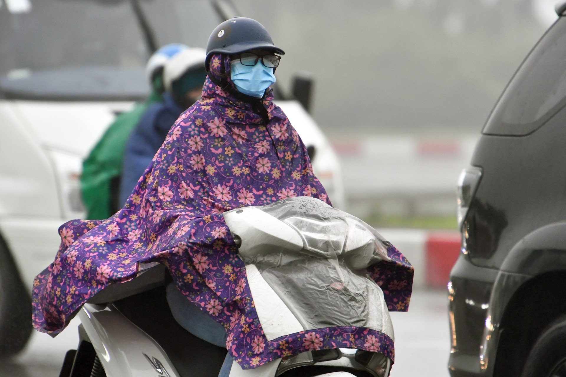
In the North, from March 5, temperatures will gradually decrease. From the night of March 5, the weather in the North and North Central regions will turn cold, with some mountainous areas in the North experiencing severe cold; from around the night of March 6, the weather will turn cold in the area from Quang Binh to Hue.
Meteorological experts said that the lowest temperature in this cold air mass in the North is generally from 12-15 degrees Celsius, in mountainous areas below 8 degrees Celsius; North Central 14-17 degrees Celsius; Quang Binh to Hue 17-20 degrees Celsius.
As for Hanoi weather , from early morning of March 6, the weather turned cold. The lowest temperature in this cold air mass is commonly 13-15 degrees.
Due to the influence of cold air strengthening combined with strong currents in the upper westerly wind zone, from March 5-8, the Northern and North Central regions will have scattered rain and light rain.
In addition, the cold air also caused the wind in the North of Bac Bo Gulf to change direction from the night of March 4 to the Northeast, level 4-5. From early morning on March 6, in Bac Bo Gulf, the Northeast wind gradually increased to level 6, sometimes level 7, gusting to level 8-9, rough seas, waves 2-3.5m high; in the North East Sea (including the sea area of Hoang Sa archipelago), the Northeast wind gradually increased to level 6, sometimes level 7, gusting to level 8-9, from early morning on March 7, it gradually increased to level 7, gusting to level 9, rough seas, waves 3-5m high. From the night of March 6, the sea area from Quang Tri to Khanh Hoa had the Northeast wind gradually increased to level 6, gusting to level 7-8; waves 2-4m high.
The meteorological agency warns that cold, severe cold, and severe cold can affect livestock and poultry and the growth and development of crops.
Strong winds and large waves at sea are likely to affect boating and other activities.

Hanoi weather for the next 3 days: Drizzle before a strong cold front arrives
The North is about to receive a series of cold air waves, the next wave is very strong, causing cold rain again.
Source: https://vietnamnet.vn/khong-khi-lanh-tran-ve-don-dap-ha-noi-ret-buot-thap-nhat-13-do-2377196.html
![[Photo] General Secretary To Lam meets and expresses gratitude to Vietnam's Belarusian friends](https://vphoto.vietnam.vn/thumb/1200x675/vietnam/resource/IMAGE/2025/5/11/c515ee2054c54a87aa8a7cb520f2fa6e)

![[Photo] General Secretary To Lam arrives in Minsk, begins state visit to Belarus](https://vphoto.vietnam.vn/thumb/1200x675/vietnam/resource/IMAGE/2025/5/11/76602f587468437f8b5b7104495f444d)


![[Photo] General Secretary To Lam concludes visit to Russia, departs for Belarus](https://vphoto.vietnam.vn/thumb/1200x675/vietnam/resource/IMAGE/2025/5/11/0acf1081a95e4b1d9886c67fdafd95ed)


Comment (0)