
SGGPO
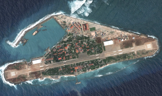
The top of a building on Truong Sa Lon Island, part of Vietnam's Truong Sa archipelago, is shown in white, while this is the location where the image of the red flag with a yellow star, the national flag of Vietnam, is displayed.
 |
| Apple Maps displays a very clear image of the Vietnamese flag in Truong Sa. |
Today, July 11, when accessing Google Maps and viewing in satellite image mode, Internet users noticed an unusual point. The top of a building on Truong Sa Lon Island, part of Vietnam's Truong Sa archipelago, was displayed in white, while this is the location where the image of the red flag with a yellow star, the national flag of Vietnam, is located. This phenomenon also appeared in the Google Earth Pro application. Meanwhile, in the Apple Maps application, the image of the Vietnamese flag was still clearly displayed.
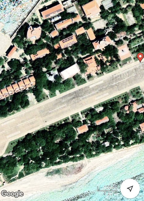 |
As of the evening of July 11, the image of the Vietnamese flag on the building on Truong Sa Lon Island was still not visible via the Google Maps application. |
The image of the red flag with yellow star on Truong Sa Lon Island is a ceramic mosaic work, made in 2012, by artist Nguyen Thu Thuy. The flag is 310 square meters wide, made from 310,000 small ceramic tiles and placed on the roof of the Hall. The idea is to help users when observing from the air, such as satellites, airplanes or Google Earth, can see it... and also affirm Vietnam's sovereignty over the islands.
Google said it did not blur or alter the satellite imagery, which was provided by third parties. The map image fix is expected to be completed next week.
The Department of Radio, Television and Electronic Information (Ministry of Information and Communications) has noted this fact and is asking Google to handle it.
Source

![[Photo] Closing of the 14th Conference of the 13th Party Central Committee](https://vphoto.vietnam.vn/thumb/1200x675/vietnam/resource/IMAGE/2025/11/06/1762404919012_a1-bnd-5975-5183-jpg.webp)


![[Photo] Prime Minister Pham Minh Chinh receives the delegation of the Semiconductor Manufacturing International (SEMI)](https://vphoto.vietnam.vn/thumb/1200x675/vietnam/resource/IMAGE/2025/11/06/1762434628831_dsc-0219-jpg.webp)


Comment (0)