
Currently, the city government is focusing resources to realize this goal, which is also considered a driving force for the real estate market to continue growing in the future.
Big direction
The year 2008 marked a particularly important event for Hanoi, when Ha Tay province (old) was officially merged into the capital, helping the city's administrative boundaries increase 3.6 times and become the 17th largest capital in the world .
The decision to expand the administrative boundaries of the Capital was considered a new way of thinking, demonstrating the strategic vision of national development of the leaders at that time, aiming to increase economic strength, while at the same time giving the Capital enough land to complete weak or non-existent functions, but more importantly, to compete successfully with similar cities in the region.
Immediately after expanding the boundaries, the Capital City authorities immediately began to rebuild the urban planning and development projects. The most important of which is the Hanoi Capital Master Plan to 2030, with a vision to 2050, approved by the Prime Minister in Decision No. 1259/QD-TTg dated July 26, 2011.
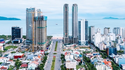
Notably, this Planning has oriented that the Capital Hanoi will develop according to the urban cluster model including the central urban area and 5 satellite urban areas: Son Tay, Hoa Lac, Xuan Mai, Phu Xuyen and Soc Son.
Satellite cities are about 25 - 30km from the city center, an optimal distance that both ensures the independence of satellite cities and provides support for the central city based on high-speed means of transport (urban railway, bus...), oriented to develop synchronous infrastructure and reduce the load on some functions for the central city such as: industry, education - training, high technology, health care, tourism...
In the context of the city center area increasingly overloaded with infrastructure system, the mechanical population increases rapidly, especially in the historical inner city districts (Dong Da, Ba Dinh, Hoan Kiem, Hai Ba Trung), the population density is at 35,000 - 40,000 people/km2. Therefore, building satellite urban areas to attract people to live, spread out population density, and reduce infrastructure pressure in the central area is very necessary.
“The capital Hanoi, as a multi-functional urban area, since the expansion of its administrative boundaries, has entered a period of equal competition with other urban areas in the region in a globalized world.
The Hanoi City's policy of building satellite urban areas is to perfect the urban functions, attract human resources to create new development momentum for the real estate market; or in other words, the planning of satellite urban areas will add new functions, in line with the trend of the times, and at the same time create greater competitiveness for the capital" - urban planning expert - Dr. Architect Hoang Huu Phe analyzed.
Need more determination in planning implementation
Since Hanoi City built a project to develop satellite urban areas, the wave of investment and real estate business has changed direction. Accordingly, both people and businesses tend to move to these areas, helping the real estate market to have positive growth.
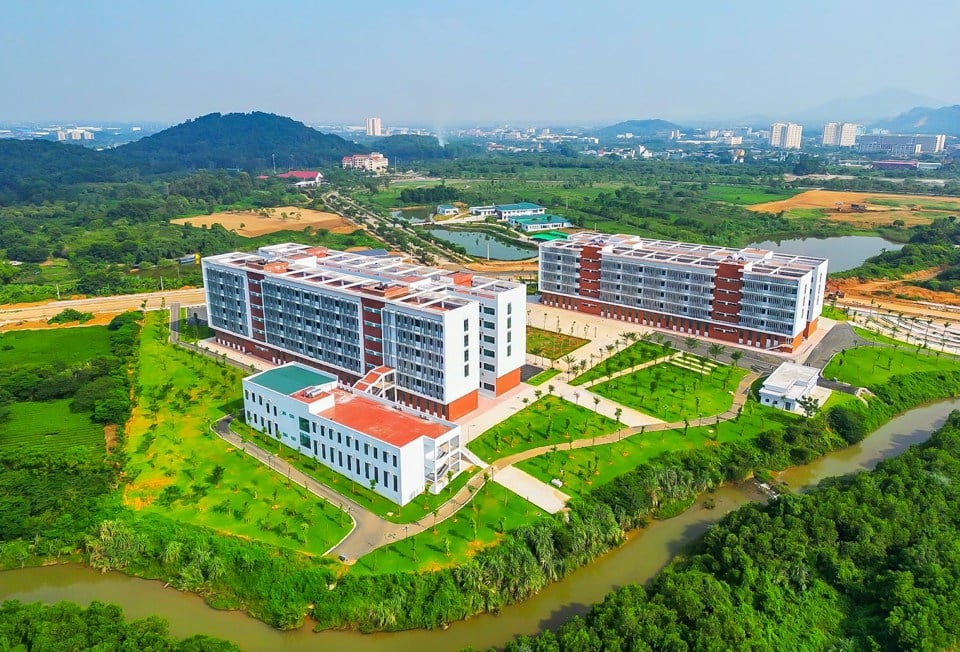
For example, in the Hoa Lac satellite urban area, in 2017, the price of land in the residential area near the urban area was advertised for sale at 6 - 10 million VND/m2, but now it has increased to 20 - 25 million VND/m2, and is expected to continue to increase when in the near future the connecting infrastructure system is filled in this entire area.
“In 2017, when the city was promoting infrastructure investment in the Hoa Lac satellite urban area, I predicted that land prices would increase, so I bought a 300m2 plot of land in Thach Hoa commune (Thach That district) for only 9 million VND/m2 to run a coffee shop. Up to this point, the plot of land I bought is valued at about 23 million VND/m2. At the time of the land fever in early 2022, a customer paid me up to nearly 30 million VND/m2,” said Mr. Nguyen Xuan Doan, residing in Dong Da district.
According to experts, along with the urbanization process leading to the need to expand the infrastructure system, the problem of epidemics, especially the negative impact of the recent Covid-19 pandemic, has caused the need to find safe shelters to increase, so the trend of people moving to the suburbs is increasing.
In particular, the top priority of people is the areas that have been planned as urban areas, infrastructure... so the attraction of satellite urban areas is increasingly greater.
“The areas of Hanoi all have their own potential and advantages, especially the areas that have been planned as satellite urban areas, which will further stimulate the development of the real estate market, because these areas have many large real estate projects that are being promoted for investment and have good price growth rates. In addition, satellite urban areas are also benefiting greatly from the technical infrastructure system, as the city continues to promote investment to serve the expansion of population to the suburbs. The Ring Roads 3.5, Ring Road 4, Ring Road 5 are being deployed to realize this process” - Deputy General Director of batdongsan.com.vn Nguyen Quoc Anh assessed.
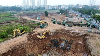
However, from an objective perspective, the implementation of investment in satellite urban areas of Hanoi still faces many difficulties and problems. It has been more than 10 years since the completion of the planning project, but in reality, the implementation has been slow due to lack of resources, leading to investment following the "oil spill", so the infrastructure system is built modernly but lacks connectivity; detailed planning changes frequently, causing the land fund to be divided and fragmented...
“In order for the satellite urban areas of the capital to develop in accordance with their stature and position, planning work needs to be more drastic, including the role of planning consultants, and must be connected and practical. In other words, planning work must be closely linked to investment reality, not just ideas left on a fragmented, divided piece of land. The construction of satellite urban areas can take experience from urban area projects of some corporations and enterprises such as Ecopark, Ocean Park...” - Architect La Thi Kim Ngan, former Director of the Hanoi Institute of Urban Planning said.
Satellite urban development is a model that has brought many successes to developed countries and this is a very suitable model for the capital Hanoi, bringing the expectation of solving many problems such as population dispersion for the central area, regional connectivity, economic development... However, after more than 10 years, most satellite cities have not developed due to the lack of policy mechanisms, facilitation, and attraction of businesses. Therefore, it is necessary to have clear criteria and standards for urban development along with plans for implementation and investment attraction.
Vice President of Vietnam Urban Planning and Development Association, Dr. Architect Dao Ngoc Nghiem
Source: https://kinhtedothi.vn/gia-tang-suc-hut-cho-thi-truong-bat-dong-san.html


Comment (0)