
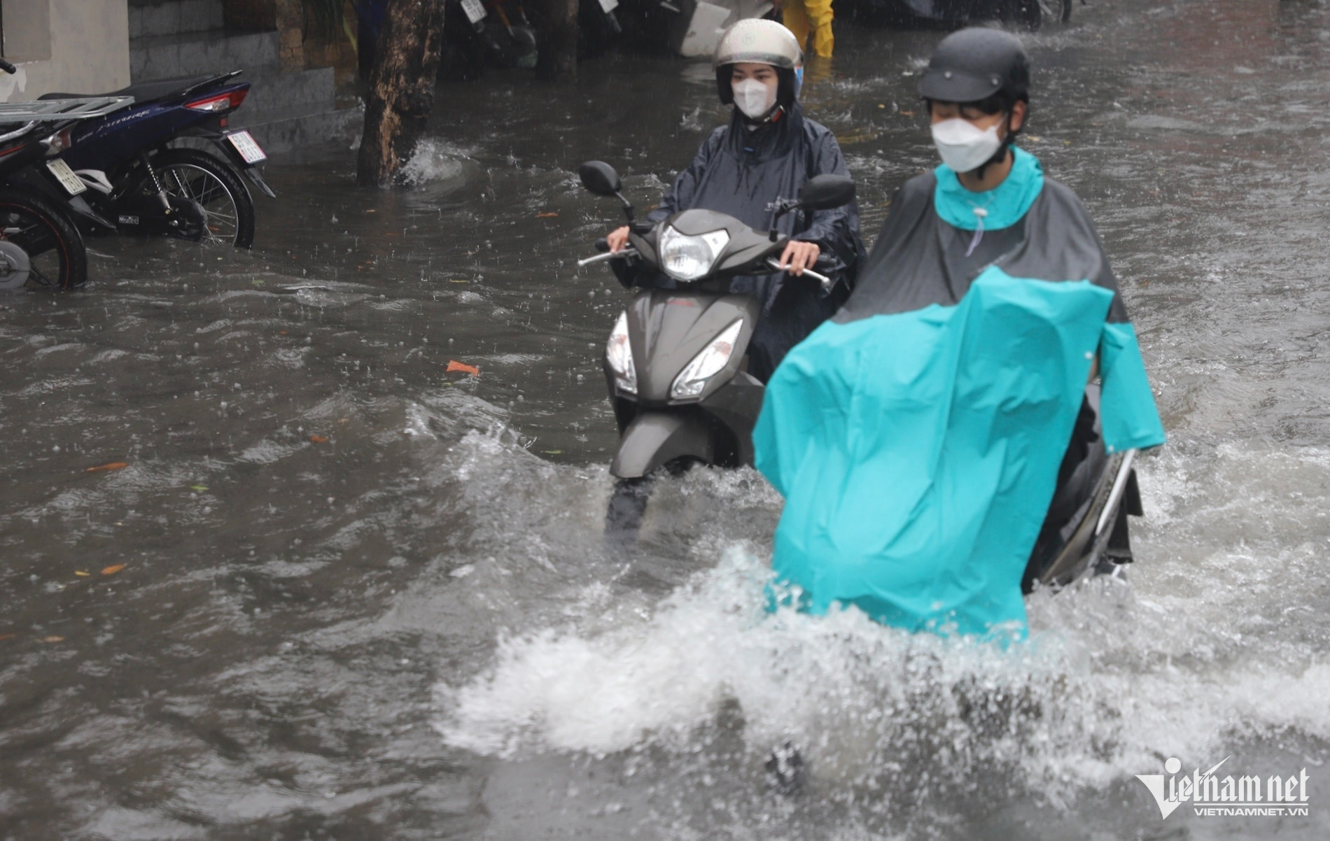
According to the National Center for Hydro-Meteorological Forecasting, last night and early this morning (September 20), there was heavy to very heavy rain in the area from Nghe An to Northern Quang Tri.
Rainfall from 7pm on September 19 to 3am on September 20 was over 100mm in some places such as: Huong Lam (Ha Tinh) 110.4mm, Hoa Thanh (Quang Binh) 237.6mm, Hien Luong (Quang Tri) 137.6mm...
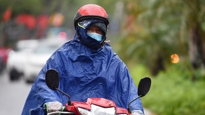
Today's weather, in the South Nghe An, Ha Tinh, Quang Binh areas, there is heavy to very heavy rain with common rainfall of 70-150mm, some places over 250mm. The Thanh Hoa and North Nghe An areas have moderate rain, heavy rain, some places very heavy rain and thunderstorms with common rainfall of 40-80mm, some places over 150mm.
From September 21, heavy rain in the above areas gradually decreased.
During the day and night of September 20, in the midlands and deltas of the North, Phu Tho, and South Son La, there will be scattered showers and thunderstorms, locally heavy rain with rainfall from 15-30mm, locally over 60mm.
In the late afternoon and evening of September 20, in the Central Highlands and the South, there will be scattered showers and thunderstorms, with some places experiencing heavy rain with rainfall of 10-30mm, and some places over 50mm.
Thunderstorms may cause tornadoes, lightning and strong gusts of wind.
Currently, the flood on Gianh River (Quang Binh) is rising rapidly and is below the alarm level (W)2.
Water level at 1:00 a.m. on September 20 on Gianh River at the following stations: Dong Tam Station 12.90m, 0.10m below BĐ2; Mai Hoa Station 4.28m, 0.72m below BĐ2;
In the next 12 hours: Flood on Gianh River continues to rise. In the next 12-24 hours, flood on Gianh River will peak at level BĐ2-BĐ3, then decrease.
Weather at sea , last night and early this morning, Huyen Tran island had gusts of level 9; Phu Quy had strong winds of level 5, sometimes level 6, gusts of level 7; the sea area west of the South China Sea (including the sea area west of Truong Sa archipelago) had strong winds of level 6, gusts of level 7.
Forecast for the next 24 hours:
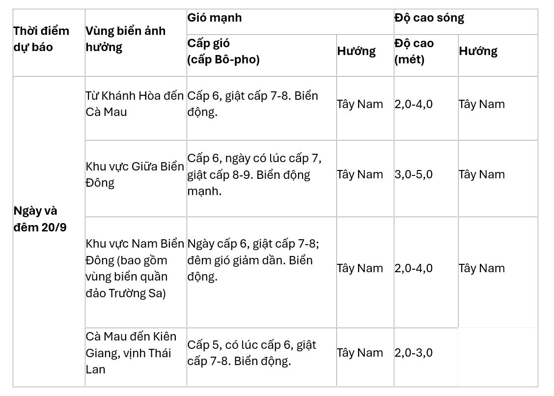
In addition, today and tonight, in the Gulf of Tonkin, the sea area from Binh Thuan to Ca Mau, Ca Mau to Kien Giang, the Gulf of Thailand, the North, Central and South East Sea (including the sea area of Hoang Sa and Truong Sa archipelagos) there will be showers and thunderstorms. During the thunderstorms, there is a possibility of tornadoes and strong gusts of wind of level 7-8.
Source: https://vietnamnet.vn/du-bao-thoi-tiet-20-9-2024-mien-trung-mua-lon-lu-tren-song-gianh-len-nhanh-2324009.html

![[Photo] President Luong Cuong presents the decision to appoint Deputy Head of the Office of the President](https://vphoto.vietnam.vn/thumb/1200x675/vietnam/resource/IMAGE/2025/5/8/501f8ee192f3476ab9f7579c57b423ad)
![[Photo] General Secretary To Lam begins official visit to Russia and attends the 80th Anniversary of Victory over Fascism](https://vphoto.vietnam.vn/thumb/1200x675/vietnam/resource/IMAGE/2025/5/8/5d2566d7f67d4a1e9b88bc677831ec9d)
![[Photo] Prime Minister Pham Minh Chinh meets with the Policy Advisory Council on Private Economic Development](https://vphoto.vietnam.vn/thumb/1200x675/vietnam/resource/IMAGE/2025/5/8/387da60b85cc489ab2aed8442fc3b14a)
![[Photo] National Assembly Chairman Tran Thanh Man chairs the meeting of the Subcommittee on Documents of the First National Assembly Party Congress](https://vphoto.vietnam.vn/thumb/1200x675/vietnam/resource/IMAGE/2025/5/8/72b19a73d94a4affab411fd8c87f4f8d)
![[Photo] General Secretary concludes visit to Azerbaijan, departs for visit to Russian Federation](https://vphoto.vietnam.vn/thumb/1200x675/vietnam/resource/IMAGE/2025/5/8/7a135ad280314b66917ad278ce0e26fa)


![[Photo] Prime Minister Pham Minh Chinh talks on the phone with Singaporean Prime Minister Lawrence Wong](https://vphoto.vietnam.vn/thumb/402x226/vietnam/resource/IMAGE/2025/5/8/e2eab082d9bc4fc4a360b28fa0ab94de)


Comment (0)