
According to the National Center for Hydro-Meteorological Forecasting, at 7:00 p.m. on September 16, the center of the tropical depression was located at about 17.1 degrees North latitude, 123.9 degrees East longitude, in the sea east of Luzon Island (Philippines). The strongest wind near the center of the tropical depression was level 7 (50-61 km/h), gusting to level 9; moving mainly west at about 15 km/h.
It is forecasted that by 7:00 p.m. today, September 17, the tropical depression will move westward at a speed of about 25 km/h, into the East Sea and strengthen into storm number 4, level 8 intensity, gusting to level 10. In the next hours, this storm is likely to strengthen further.
Mr. Nguyen Van Huong - Head of Weather Forecast Department, National Center for Hydro-Meteorological Forecasting, said that around the morning of September 17, the tropical depression entered the East Sea and on September 18, it strengthened into a storm when moving to the middle of the East Sea (Hoang Sa area). For storm No. 4, there are 2 possible scenarios:
1 : The storm is likely to move towards the Central Central region; the storm's impact on this region may be 1-2 days earlier (around September 19 and 20).
2 : The storm changes direction and moves northwest toward the Northern and North Central regions; the storm's impact on land will be this weekend.
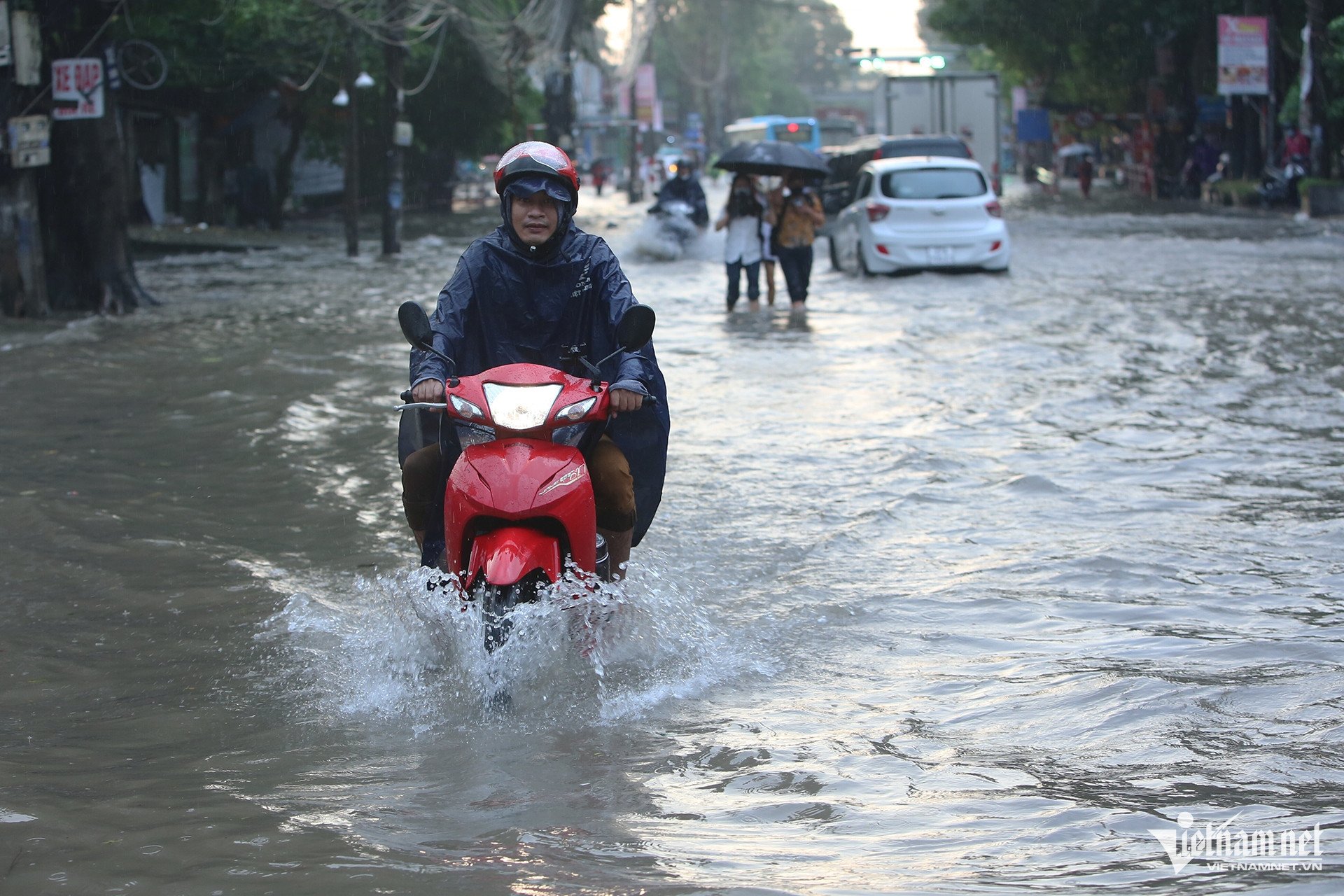
On land, the weather today until the evening of September 18, in the Central Highlands and the South, there will be moderate rain, heavy rain and thunderstorms, locally very heavy rain with common rainfall of 40-80mm, locally over 150mm (rain concentrated in the afternoon and night).
Also today, in the Northern and Central regions, there will be scattered showers and thunderstorms, locally heavy to very heavy rain with rainfall from 15-30mm, locally over 90mm (rain concentrated in the late afternoon and night). During thunderstorms, there is a possibility of tornadoes, lightning and strong gusts of wind.
The meteorological agency warned that heavy rain and localized heavy rain could cause flooding in low-lying areas; flash floods on small rivers and streams, and landslides on steep slopes.
Weather forecast September 17, 2024 in detail for regions across the country:
Hanoi
Cloudy, sunny during the day, with occasional showers and thunderstorms in the evening and at night, with some heavy rain in some places. Light wind. During thunderstorms, there is a possibility of tornadoes, lightning and strong gusts of wind.
Lowest temperature: 25-27 degrees.
Highest temperature: 32-34 degrees.
Northwest
Cloudy, with scattered showers and thunderstorms during the day; scattered showers and thunderstorms in the evening and at night, with some places experiencing heavy to very heavy rain. Light wind. Thunderstorms may produce tornadoes, lightning, and strong gusts of wind.
Lowest temperature: 23-26 degrees, some places below 22 degrees
Highest temperature: 30-33 degrees, some places above 33 degrees.
Northeast
Cloudy, with scattered showers and thunderstorms during the day; scattered showers and thunderstorms in the evening and at night, with some heavy rain in some places. Light wind. Thunderstorms may cause tornadoes, lightning, and strong gusts of wind.
Lowest temperature: 24-27 degrees, mountainous areas below 24 degrees.
Highest temperature: 30-33 degrees, some places above 33 degrees.
Thanh Hoa – Thua Thien Hue
Cloudy, with scattered showers and thunderstorms during the day; scattered showers and thunderstorms in the evening and at night, with some places experiencing heavy to very heavy rain. Light wind. Thunderstorms may produce tornadoes, lightning, and strong gusts of wind.
Lowest temperature: 24-27 degrees.
Highest temperature: 30-33 degrees.
Da Nang to Binh Thuan
Cloudy, scattered showers and thunderstorms in the afternoon and at night, locally heavy to very heavy rain. Southwest wind level 2-3. Thunderstorms are likely to cause tornadoes, lightning and strong gusts of wind.
Lowest temperature: 24-27 degrees.
Highest temperature: 30-33 degrees, some places above 33 degrees.
Central Highlands
Cloudy, moderate rain in the afternoon and at night, heavy rain and scattered thunderstorms, locally very heavy rain. West to southwest wind level 3. Thunderstorms are likely to cause tornadoes, lightning and strong gusts of wind.
Lowest temperature: 21-24 degrees.
Highest temperature: 27-30 degrees, some places over 30 degrees.
Southern Vietnam
Cloudy, moderate rain in the afternoon and at night, heavy rain and scattered thunderstorms, locally very heavy rain. Southwest wind level 3. Thunderstorms are likely to cause tornadoes, lightning and strong gusts of wind.
Lowest temperature: 24-27 degrees.
Highest temperature: 29-32 degrees, some places above 32 degrees.

The East Sea is about to welcome storm No. 4 with a more complicated path than super typhoon Yagi. A tropical depression formed at the same location as typhoon Yagi, likely to enter the East Sea and strengthen into storm No. 4; the path is forecast to be much more complicated than typhoon Yagi.
![[Photo] General Secretary To Lam arrives in Minsk, begins state visit to Belarus](https://vphoto.vietnam.vn/thumb/1200x675/vietnam/resource/IMAGE/2025/5/11/76602f587468437f8b5b7104495f444d)


![[Photo] General Secretary To Lam meets and expresses gratitude to Vietnam's Belarusian friends](https://vphoto.vietnam.vn/thumb/1200x675/vietnam/resource/IMAGE/2025/5/11/c515ee2054c54a87aa8a7cb520f2fa6e)
![[Photo] General Secretary To Lam concludes visit to Russia, departs for Belarus](https://vphoto.vietnam.vn/thumb/1200x675/vietnam/resource/IMAGE/2025/5/11/0acf1081a95e4b1d9886c67fdafd95ed)


![[Photo] National Assembly Chairman Tran Thanh Man attends the Party Congress of the Committee for Culture and Social Affairs](https://vphoto.vietnam.vn/thumb/1200x675/vietnam/resource/IMAGE/2025/5/11/f5ed02beb9404bca998a08b34ef255a6)


Comment (0)