
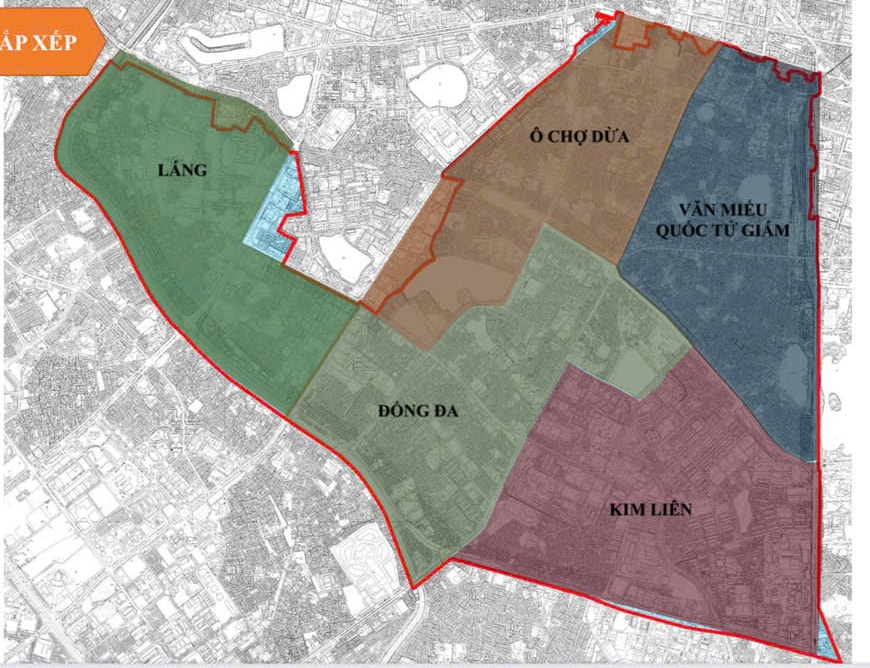
Dong Da basic administrative unit has a natural area of 2.08 km2 , population of 81,709 people; including the entire natural area and population of Thinh Quang ward, most of the natural area and population of the wards: Trung Liet, Quang Trung; part of the natural area and population of the wards: Lang Ha, O Cho Dua, Nam Dong.
.jpg)
Dong Da basic administrative unit boundary: East side borders Kim Lien basic administrative unit, Van Mieu - Quoc Tu Giam (boundary follows Xa Dan street - Nam Dong street - Dang Van Ngu street - Ho Dac Di street - Tay Son street); West side borders Lang basic administrative unit (boundary follows Lang Ha street); South side borders Thanh Xuan basic administrative unit, Khuong Dinh (boundary follows Nguyen Trai street - To Lich river); North side borders O Cho Dua basic administrative unit (boundary follows Thai Ha street - Hoang Cau street - Xa Dan street).
.jpg)
Kim Lien basic administrative unit has a natural area of 2.43 km2 , a population of 95,592 people, including the entire area and population of the wards: Kim Lien, Khuong Thuong; most of the natural area and population of the wards: Phuong Mai, Phuong Lien - Trung Tu, Quang Trung; part of the natural area and population of the wards: Nam Dong, Trung Liet.
Kim Lien basic administrative unit boundary: East side borders Bach Mai basic administrative unit (boundary follows Giai Phong street); West side borders Dong Da basic administrative unit (boundary follows Tay Son street - Ho Dac Di street - Dang Van Ngu street - Nam Dong street); South side borders Phuong Liet and Khuong Dinh basic administrative units (boundary follows Truong Chinh street); North side borders Van Mieu - Quoc Tu Giam administrative unit (boundary follows Xa Dan street).
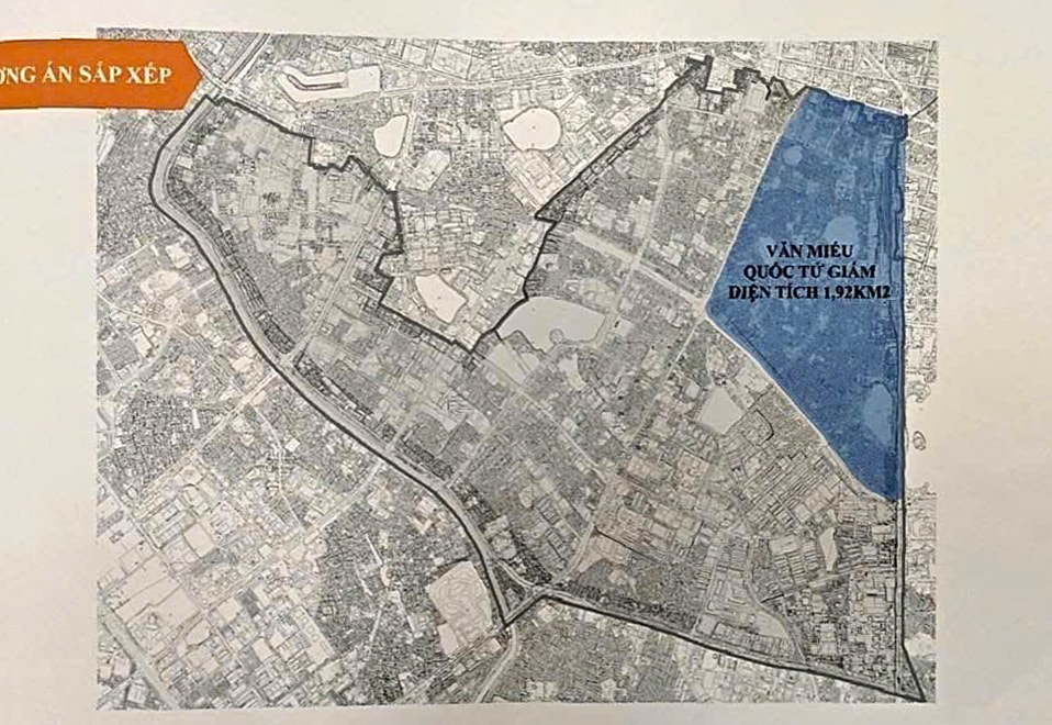
The basic administrative unit of Van Mieu - Quoc Tu Giam has a natural area of 1.92 km2 , a population of 75,009 people; including the entire area and population of the wards: Kham Thien, Van Chuong, Tho Quan; most of the natural area and population of the wards: Van Mieu - Quoc Tu Giam; part of the natural area and population of the wards: Hang Bot, Nam Dong, Phuong Lien - Trung Tu (Dong Da); Dien Bien (Ba Dinh); Cua Nam (Hoan Kiem); Nguyen Du, Le Dai Hanh (Hai Ba Trung).
Boundary of the basic administrative unit of Van Mieu - Quoc Tu Giam: The East borders the basic administrative unit of Cua Nam, Hai Ba Trung (the boundary follows Le Duan street - planned traffic route); the West borders the basic administrative unit of O Cho Dua (the boundary follows Ton Duc Thang street); the South borders the basic administrative unit of Kim Lien, Dong Da (the boundary follows Xa Dan street); the North borders the basic administrative unit of Ba Dinh (the boundary follows Nguyen Thai Hoc street).
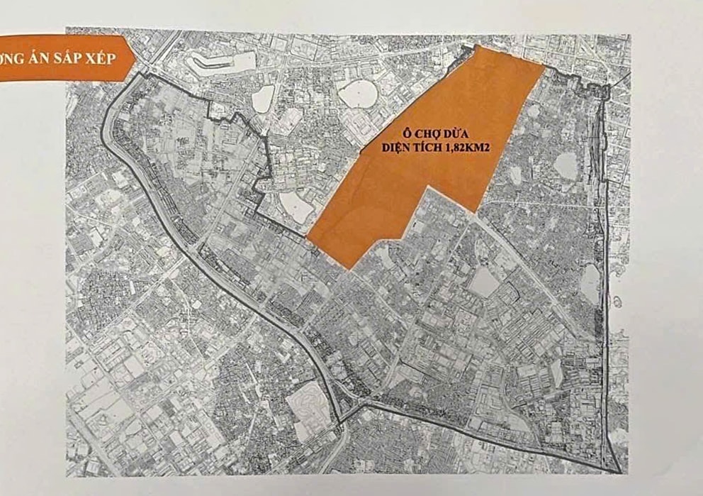
The basic administrative unit of O Cho Dua has a natural area of 1.82 km2 , the main population size is 72,586 people; including most of the natural area and population of the wards: O Cho Dua, Hang Bot, Cat Linh; part of the natural area and population of the wards: Van Mieu - Quoc Tu Giam, Trung Liet (Dong Da); Thanh Cong, Dien Bien (Ba Dinh).
Boundary of the O Cho Dua basic administrative unit: The East borders the Van Mieu - Quoc Tu Giam basic administrative unit (the boundary follows Ton Duc Thang street); the West borders the Giang Vo basic administrative unit (the boundary follows Lang Ha - Giang Vo street); the South borders the Dong Da basic administrative unit (the boundary follows Xa Dan street - Hoang Cau street - Thai Ha street); the North borders the Ba Dinh basic administrative unit (the boundary follows Nguyen Thai Hoc street).
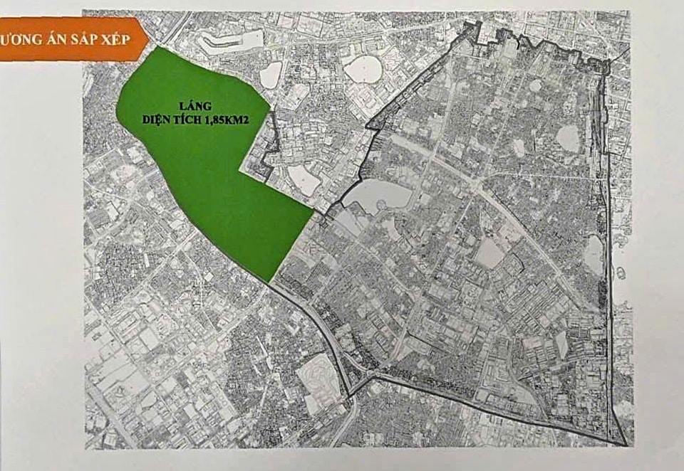
Lang administrative unit has a natural area of 1.85 km2 , population of 74,570 people; including the entire natural area and population of Lang Thuong ward (Dong Da); most of the natural area and population of Lang Ha ward (Dong Da); part of the natural area and population of Ngoc Khanh ward (Ba Dinh).
Boundary of Lang administrative unit: East side borders Giang Vo administrative unit (boundary follows Nguyen Chi Thanh street - Huynh Thuc Khang street, borders Dong Da administrative unit (boundary follows Lang Ha street); West side borders Cau Giay, Yen Hoa administrative unit (follows current commune-level boundary - along To Lich river); South side borders Thanh Xuan, Yen Hoa, Dong Da administrative unit (follows current commune-level boundary - along the river); North side borders Giang Vo, Nghia Do administrative unit (boundary follows Cau Giay - La Thanh street).
According to the plan, by April 21 at the latest, the People's Committees of wards in Dong Da district will complete collecting public opinions. The District People's Committee will synthesize public opinions in the area and approve the policy to implement the plan to arrange commune-level administrative units to synthesize the results and report to the City People's Committee before April 26, 2025.
Source: https://hanoimoi.vn/dong-da-quy-mo-dan-so-dien-tich-5-phuong-du-kien-sau-sap-xep-699629.html
![[Photo] Prime Minister Pham Minh Chinh starts construction of vital highway through Thai Binh and Nam Dinh](https://vphoto.vietnam.vn/thumb/1200x675/vietnam/resource/IMAGE/2025/5/12/52d98584ccea4c8dbf7c7f7484433af5)
![[Photo] Prime Minister Pham Minh Chinh receives Swedish Minister of International Development Cooperation and Foreign Trade](https://vphoto.vietnam.vn/thumb/1200x675/vietnam/resource/IMAGE/2025/5/12/ae50d0bb57584fd1bbe1cd77d9ad6d97)
![[Photo] Prime Minister Pham Minh Chinh works with the Standing Committee of Thai Binh Provincial Party Committee](https://vphoto.vietnam.vn/thumb/1200x675/vietnam/resource/IMAGE/2025/5/12/f514ab990c544e05a446f77bba59c7d1)


Comment (0)