
TPO - The Meteorological and Hydrological Agency forecasts showers and thunderstorms in Ho Chi Minh City this weekend, with localized heavy rain in some areas. In addition, high tides in the lower reaches of the Saigon- Dong Nai River will peak this afternoon (September 20th).
According to the National Center for Meteorological and Hydrological Forecasting, the weather in the Southern region today (September 20th) will be cloudy with scattered showers and thunderstorms in some areas, especially in the late afternoon and evening with scattered showers and thunderstorms, and locally heavy rain. During thunderstorms, there is a possibility of tornadoes, lightning, and strong gusts of wind. The lowest temperature will be 23-26 degrees Celsius, and the highest will be 30-33 degrees Celsius.
Regarding the weather patterns affecting Ho Chi Minh City in the coming days, the Southern Regional Hydrometeorological Station stated that the tropical convergence zone over Central Vietnam is currently connected to the weakened low-pressure area from Typhoon No. 4. The Southwest monsoon (causing rain) is active over Southern Vietnam, but its intensity will gradually decrease from September 21st to moderate levels. At higher altitudes, the southern branch of the subtropical high-pressure system is expected to move westward from around September 22nd, with its axis passing through Southern Vietnam.
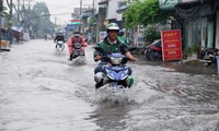
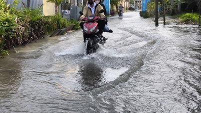
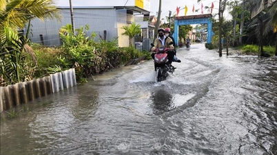
Over the weekend (September 21st and 22nd), many areas in Ho Chi Minh City are forecast to experience rain with a probability of 65-70%.
"During thunderstorms, there is a possibility of tornadoes, lightning, and strong gusts of wind. Be prepared for the possibility of heavy rain causing localized flooding in low-lying areas and areas with poor drainage," the Southern Vietnam Regional Meteorological and Hydrological Station reported.
The high tide will peak this afternoon.
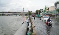
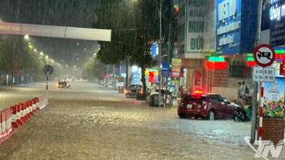
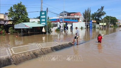
According to the Southern Vietnam Regional Hydrometeorological Station, over the past 24 hours, water levels at stations in the lower reaches of the Saigon-Dong Nai river system have continued to rise rapidly due to the high tide during the full moon of the 8th lunar month, reaching high levels.
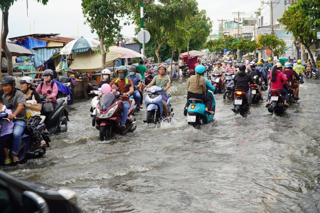 |
High tides caused flooding on Tran Xuan Soan Street (District 7) on the afternoon of September 19th. |
Water levels at monitoring stations are forecast to continue rising rapidly and reach their peak today, September 20th.
The highest tide of the day is likely to reach the following levels: At Phu An station (Saigon River) and Nha Be station (Dong Dien River), it will be 1.6-1.65m (approximately or 0.05m higher than Alert Level III). The peak tide is expected to occur between 5 PM and 6 PM this evening.
Over the weekend (September 21-22), water levels in rivers, canals, and streams in Ho Chi Minh City will recede slowly, then more rapidly. The high tide, exceeding Alert Level I, will persist until September 23.


Source: https://tienphong.vn/chieu-nay-trieu-cuong-dat-dinh-tphcm-van-mua-dong-vao-cuoi-tuan-post1674896.tpo


Comment (0)