Bu Gia Map National Park (the park) is a transitional area from the Central Highlands to the Southeast Mekong Delta. It's impossible to explore the entire 25,600 hectares, but each day spent amidst the lush green forests, majestic waterfalls, touching border markers, and admiring the scenery along the border river offers more than just a refreshing escape.
Admire the heritage of the forest.
Ha Van Kien, an employee of the Center for Propaganda, Tourism and Conservation Rescue - Park Management Board, served as our guide throughout our experience exploring the natural landscape here. Kien said that the first special feature of Bu Gia Map forest that we must see is the 39 heritage trees that have been recognized by the Vietnam Association for the Protection of Nature and Environment.
The locations of the 39 heritage trees include a cluster of 37 sandalwood trees (aged 200-400 years) in plot 6, sub-area 21 within the administrative-service zone of the park, in Bu Gia Map commune; one Sophora tree (over 350 years old) in plot 4 and one Tung tree (450 years old) in plot 3 of sub-area 27 within the ecological restoration zone of the park, in Dak O commune, Bu Gia Map district, Binh Phuoc province.
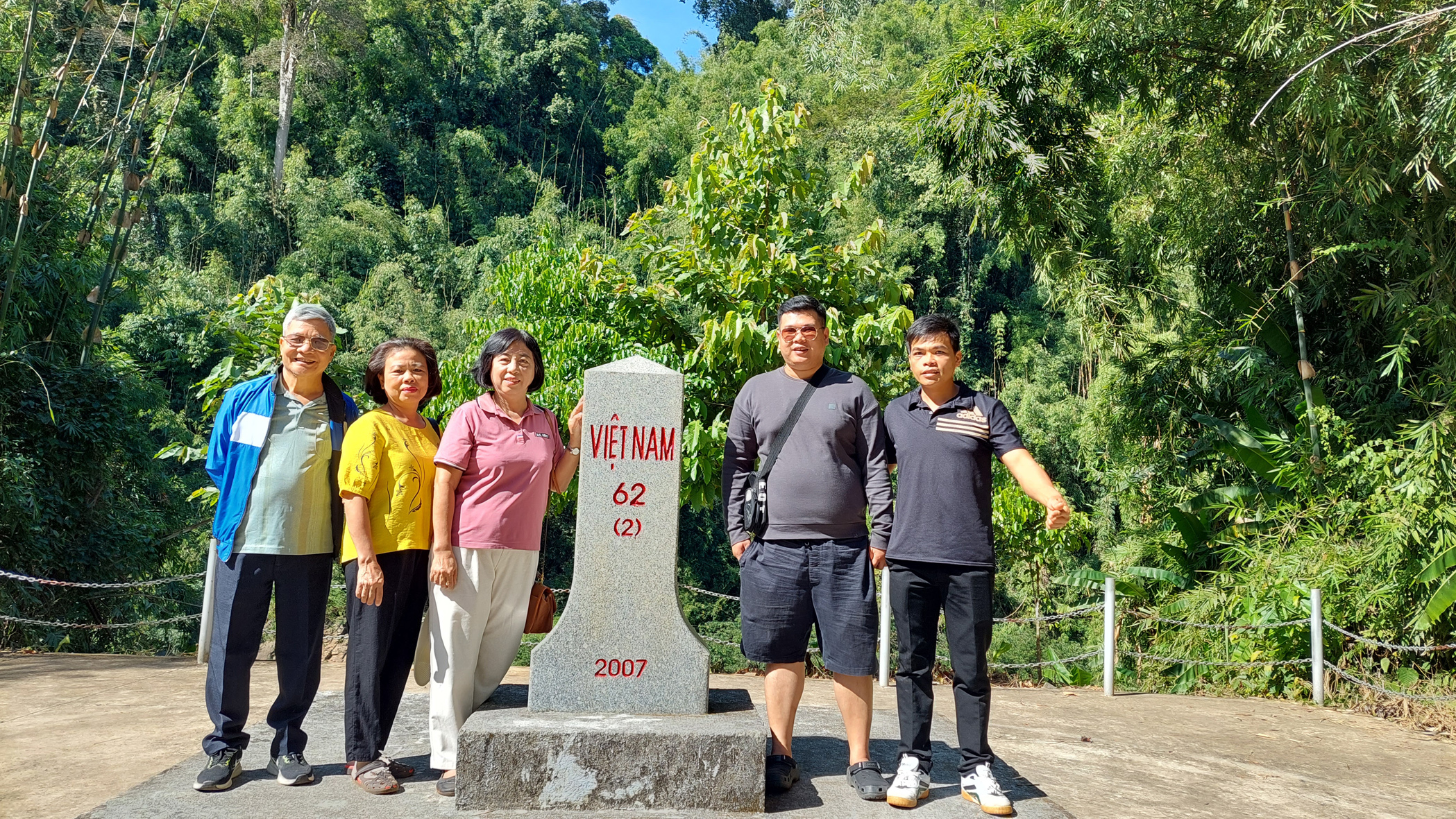
Tourists take photos at milestone 62 (2) on the banks of the Dak Huyt River.
Although each heritage tree is tagged with a QR code, allowing visitors to easily scan it with their phones to find out full information about the tree's name and age, Kien still enthusiastically explains the information as if he wants to share his love of the forest with the visitors.
The cluster of 37 crape myrtle trees (Lagerstroemia indica) is numbered for easy identification and management of each tree. Each tree has a unique shape, and anyone engrossed in taking photos could easily get lost in the forest, so even though the group was only 4 people, Kien had to constantly take attendance. Crape myrtle tree number 2 has a sturdy trunk, reaching a height of about 4-5 meters before splitting into two large branches, resembling a strongman with outstretched arms looking up at the blue sky. Crape myrtle tree number 15 has a solid, round base with a circumference of nearly 5 meters, showcasing the strength of its 295-year lifespan, supporting a trunk 35 meters high.
Kudos to those forest lovers who noticed the tree's intertwined branches and put up a sign that read "Love Crape Myrtle Tree," prompting couples to stop and snap a commemorative photo whenever they see it.
Keep the forest peaceful.
The prolonged heatwave has kept forests on high alert for wildfires. The garden is no exception.
Leaving the forest of heritage trees, our car drove along the road between the forest sub-areas bordering the buffer zone in Bu Gia Map and Dak O communes. Suddenly, seeing a line of fire burning in the distance, we panicked, thinking we had passed through a forest fire zone. Kien reassured us that it was just burning dry leaves, carried out by forest rangers and local people contracted to protect and cultivate the forest to create firebreaks and prevent forest fires during the dry season. Kien explained: "The garden has a very large area of bamboo trees, and this species is very prone to fire in the dry season. Meanwhile, many sub-areas bordering the rubber and cashew plantations of local people pose a high risk of fire spreading to the forest because people often burn their gardens during the dry season."
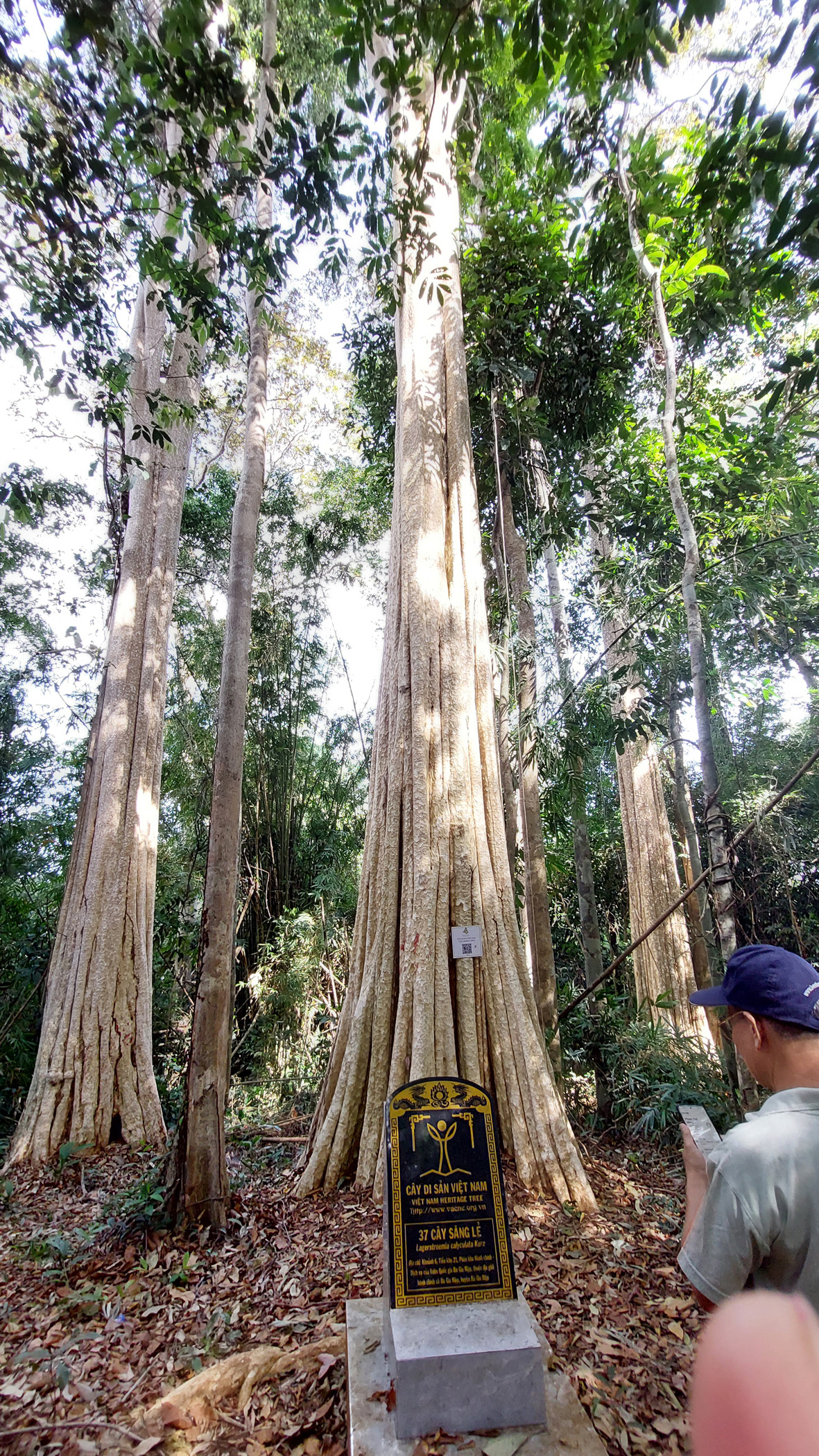
Heritage tree cluster
Observing how they create firebreaks, we saw that locals gather dry leaves in open areas at the edge of the forest bordering their orchards, then burn them to ashes to create a space to prevent the spread of fire. The burning of dry leaves isn't done quickly; instead, they gather just enough leaves to control the height of the flames, preventing scorching or damage to the lower branches of the forest trees.
Kien said that the work of creating firebreaks each day is quite arduous for forest rangers and contracted forest protection teams, sometimes requiring them to bring their own lunch to eat on-site. Their happiness comes from ensuring that no forest fires occur throughout the dry season.
In our eyes, how beautiful those rows of lights along the firebreaks were! Beautiful was the image of each cluster of fire emitting smoke that touched the afternoon sun, creating magical patches of light that shone across the path. Beautiful was the image of the people who, undeterred by difficulties, patiently kept the forest peaceful.
At this point, we understood better why the Management Board did not allow visitors to freely enter the forest without a guide, ensuring observation and reminding visitors to comply with regulations on forest fire safety.
Emotions surge
The next day, we toured the border region along the Dak Huyt River, nestled within a pristine forest of the park.
Lieutenant Colonel Nguyen Tien Sy, Deputy Head of the Mass Mobilization Team of Border Guard Station 783 located in Dak O commune, guided us to milestone 62 (2), through beautiful forest road bends. Binh Phuoc is in the Southeast region, with 3 border districts: Bu Gia Map, Bu Dop, and Loc Ninh, bordering the Kingdom of Cambodia, with 28 main milestones and 173 auxiliary milestones. The border line of Bu Gia Map district is 63.319 km long, bordering O Rang district, Mondulkiri province of Cambodia, demarcated with 2 main milestones and 38 auxiliary milestones, managed and protected by 5 border guard stations. Border Guard Station 783 manages and protects 15.896 km of border line including 2 main milestones and 7 auxiliary milestones.
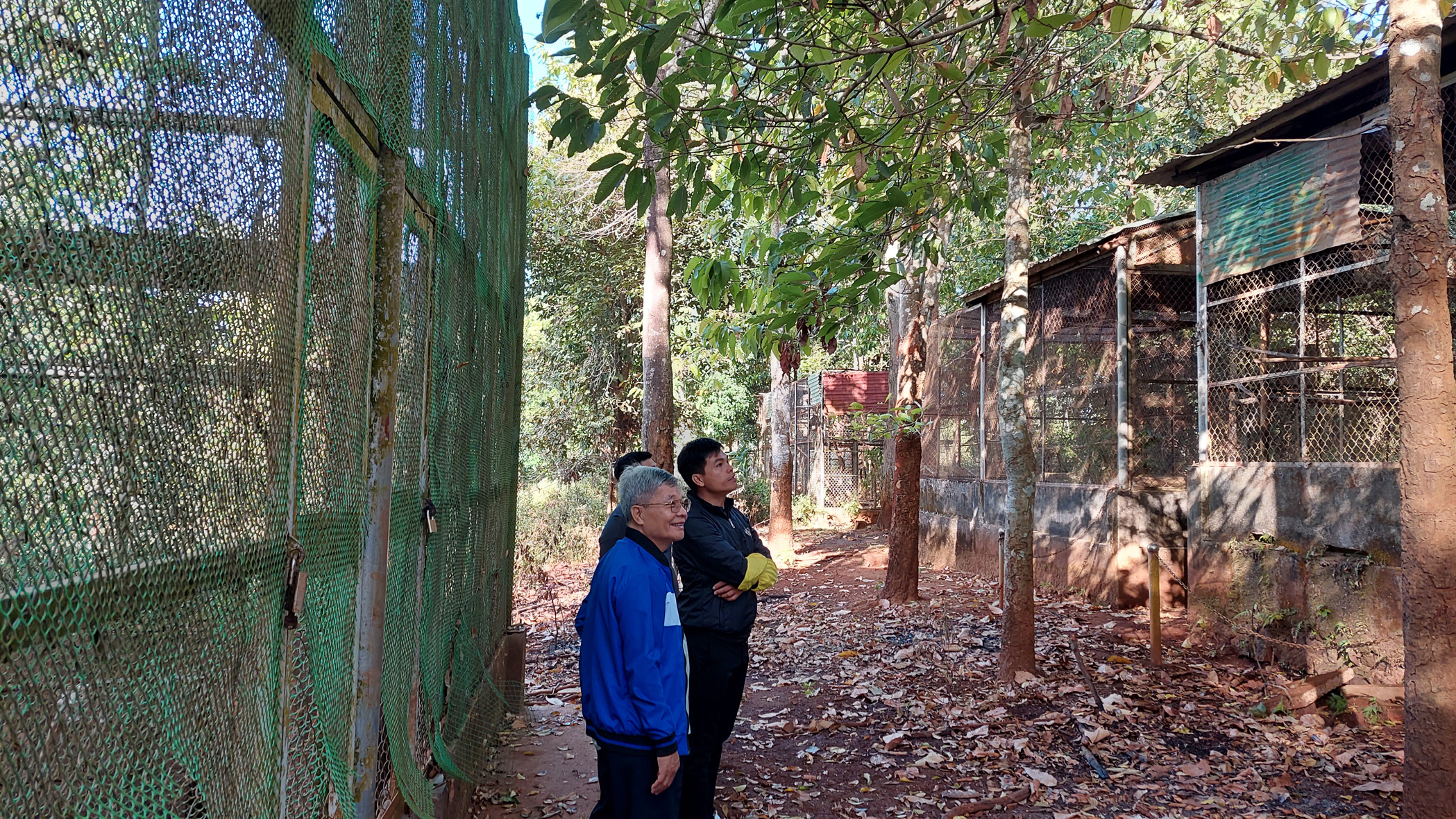
Visitors at the wildlife rescue center
Lieutenant Colonel Nguyen Tien Sy stated that the border within the area managed and protected by Border Guard Post 783 is demarcated along the Dak Huyt River. Along the river border, boundary markers are located on the riverbanks of both countries. Markers planted on Vietnamese territory are marked with the number 2 in parentheses; markers on the Cambodian side of the river are marked with the number 1 in parentheses.
Milestone 62 (2) was built in 2007 and completed in March 2009. Lieutenant Colonel Sy said the border area is located on hilly terrain with many rivers and streams, so the construction of milestones is extremely difficult. The most difficult is the border line of Bu Gia Map district, where most of the auxiliary milestones are located on the banks of the Dak Huyt River. At that time, there was no road through the forest, so the transportation of construction materials was done by river. Currently, when patrolling some auxiliary milestones, officers and soldiers still have to trek through the forest and wade through rivers and streams, which is quite difficult.
Border guards not only perform the task of protecting the border, territorial sovereignty , and national security, but also cooperate with the garden in forest protection work, especially welcoming visiting groups as if to spread love for the homeland and help people recognize the territorial boundaries. Listening to the clear and emotional explanations of those directly performing border protection duties, when taking commemorative photos next to milestone 62 (2), we felt the sacredness of the place we set foot in.
Cultivating a love for the forest.
On our last day, Mr. Kien took us to the park's wildlife rescue center. This is where many rescued animals are cared for, trained in survival skills before being released back into the forest. Many animals that were injured or had lost the ability to survive in the wild are permanently cared for here.
Mr. Kien gave us a very interesting biology lesson, providing us with a lot of knowledge about various wild species. For example, long-tailed monkeys are not only good climbers but also excellent swimmers and divers. Weasels sleep during the day and eat at night. Pangolins eat termites and yellow ants. Yellow-cheeked gibbons are very loyal; when one parent dies, the other takes care of the offspring and does not seek another mate.
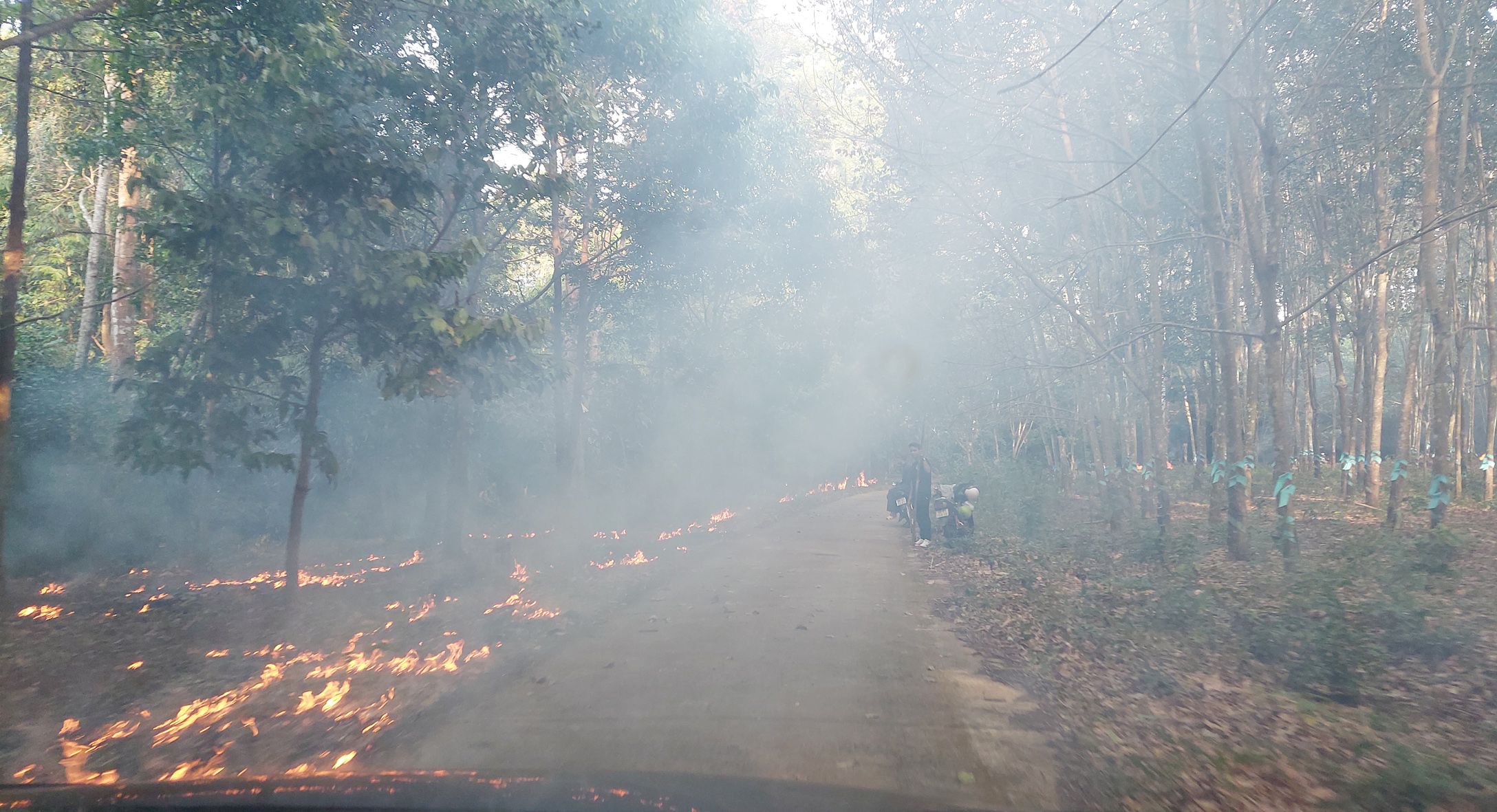
Firebreaks for forest fire prevention
The staff at this rescue center are busy all day long, from cleaning animal cages; picking vegetables and fruits, cooking rice and food for the animals; searching for special food sources for the animals such as termite nests and yellow ant nests; and planting some vegetables and fruits to provide a regular food supply for the animals here.
Seeing a charming wooden house in the rescue area, I asked if it was a guesthouse for tourists. Mr. Kien said it was a shared house for volunteers involved in caring for wildlife. It turned out the park had a volunteer registration program. Their main job was to care for rescued wildlife under the guidance of park staff. Volunteers only needed to cover the cost of travel to Bu Gia Map and their own food and lodging during their stay; they didn't have to pay any other fees to the park.
Mr. Kien said that after a week of experiencing the work, many volunteers thanked the park staff for instilling in them a love for the forest and the animals living in their natural environment. Some volunteers were even lucky enough to participate in releasing rescued animals back into their natural habitat, making them feel even more that their work was meaningful.
Unfortunately, on the day we arrived, a team of volunteers had just left after a week of work, so we didn't have the chance to interact with them and hear their feelings. If we could arrange a week to come here and volunteer, perhaps we would have developed a greater love for nature.
When preparing to go into the forest, everyone brought a fan because the weather was quite hot, but walking under the tall trees in the forest, no one sweated. The sunlight filtering through the leaves in the upper canopy created beautiful lighting for the photos, so the hats were only for posing; sometimes we took them off to feel the pleasant breeze in the forest.
Source: https://nld.com.vn/cham-vao-thien-nhien-bu-gia-map-196240622185442581.htm




Comment (0)