
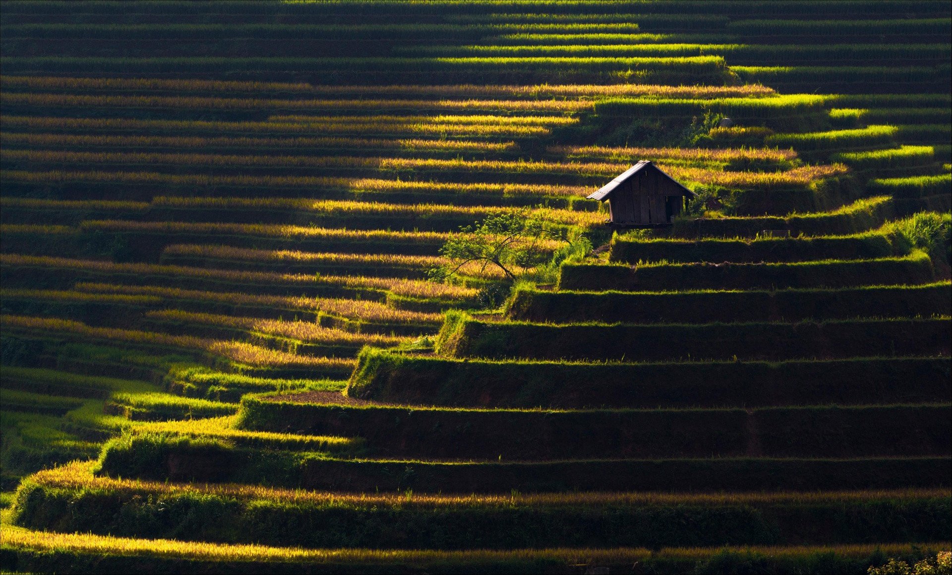
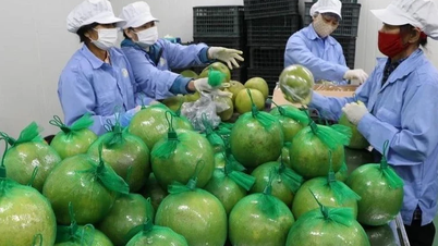
La Luoc Lake, Dau Tieng, T'Nung, Ta Dung or the mountainous landscapes in the North such as Bac Son valley, Mu Cang Chai terraced fields... are 6 of the attractive tourist destinations in the three regions of North - Central - South, attracting the attention of tourists.

Along with Ngang Pass, Gianh River is the geographical symbol of Quang Binh province. The river is 160 km long, originating from the edge of Co Pi mountain, 2,017 m high, in the Truong Son range. Gianh River flows through Minh Hoa, Tuyen Hoa, Quang Trach, Bo Trach districts and flows into the East Sea at Giang estuary. The riverbed is deep, the water flow is strong, starting from the rugged Truong Son mountains, dodging mountains, crossing thousands, creating many rapids and waterfalls, then flowing into the East Sea at Gianh estuary. Photo: Tran An.

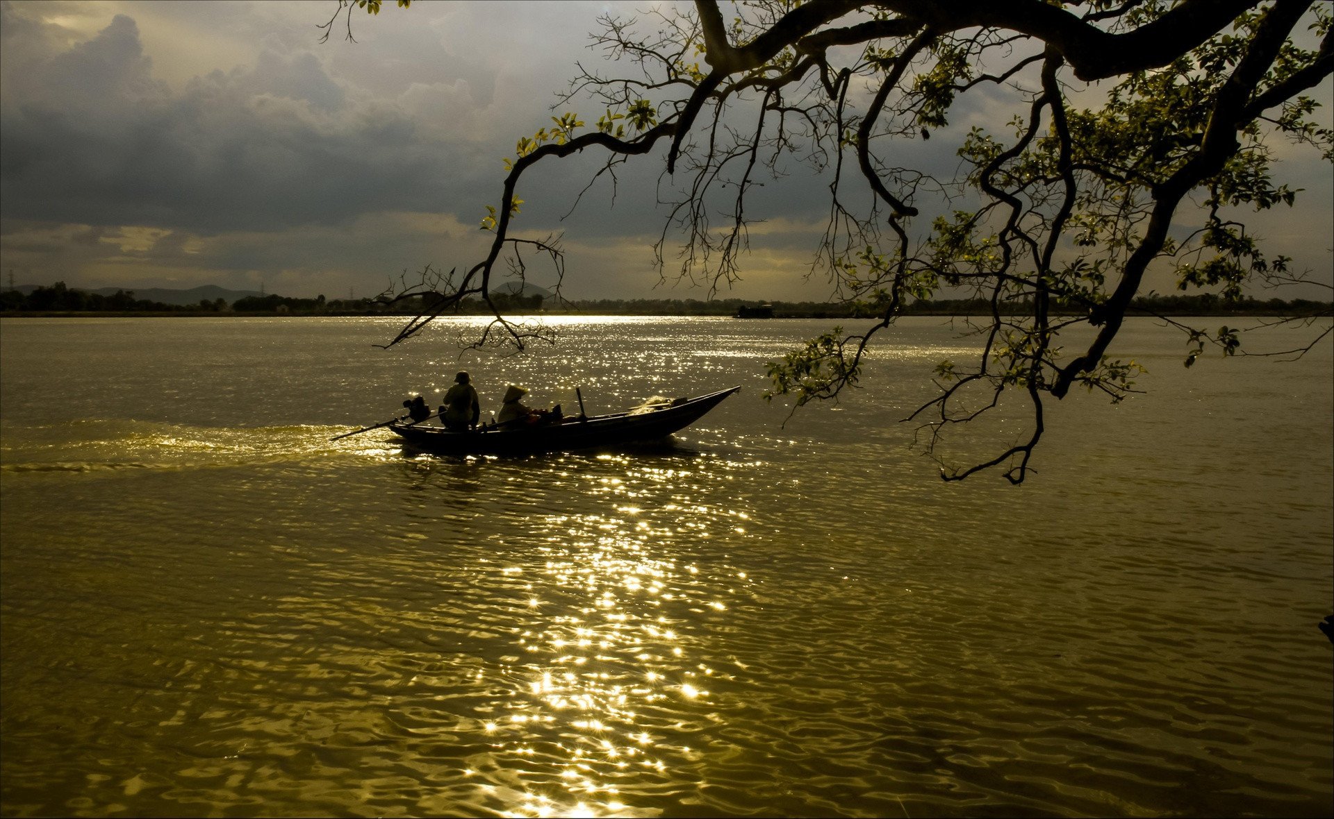
The Han River ( Da Nang ) is a large branch of the river from the upstream to the sea, flowing along the banks of bustling streets, creating a peaceful picture, beyond the hustle and bustle of the city. Since the reign of King Le Thanh Tong (Hong Duc 21st year - 1490), the king re-determined the map of 13 provinces in the country for the last time, each province was drawn on a separate map which was later often called the "Hong Duc map". On the top of the map is written in large letters: "Thuan Hoa Thua Tuyen Son Xuyen Hinh The Chi Do" which means the map of the mountains and rivers of Thuan Hoa province. The Han River today belongs to Dien Ban district, Trieu Phong prefecture, Thuan Hoa province in ancient times. Photo: Huynh Nam Dong.
The Lam River is 361 km long and is one of the two largest rivers in the North Central region. Along with Hong Linh Mountain, the Lam River is considered a symbol of Nghe An. On both sides of the river are cultural villages of Nghe An and Ha Tinh such as Yen Ho (Duc Tho), Tien Dien, Uy Vien (Nghi Xuan), Trung Luong (Hong Linh town), Trung Can, Hoanh Son, Kim Lien village (Nam Dan), creating a Lam Hong cultural area. Photo: Nguyen Anh Duc.
Dau Tieng Lake, covering 27,000 hectares, is the largest artificial lake in Vietnam, located at the junction of three provinces: Tay Ninh, Binh Duong, and Binh Phuoc. The project was built in 1981 and completed after 4 years of construction in 1985. As the main source of water for the Saigon River, the East and West canals, this lake irrigates more than 93,000 hectares of agricultural land in Tay Ninh as well as neighboring provinces. Photo: Ngoc Diem.
Formed from a volcanic crater, the naturally beautiful and poetic T'Nung Lake (also known as Pleiku Sea Lake or Ea Nueng Lake) is located in the north of Pleiku City, Gia Lai Province. Around the lake, there are small fishing peaks for visitors to climb to admire the scenery. Looking out over the immense T'Nung Lake, the shimmering waves in the sunlight at dawn is a very interesting thing to do when exploring this Central Highlands region. Photo: Tran Thao Nhi.
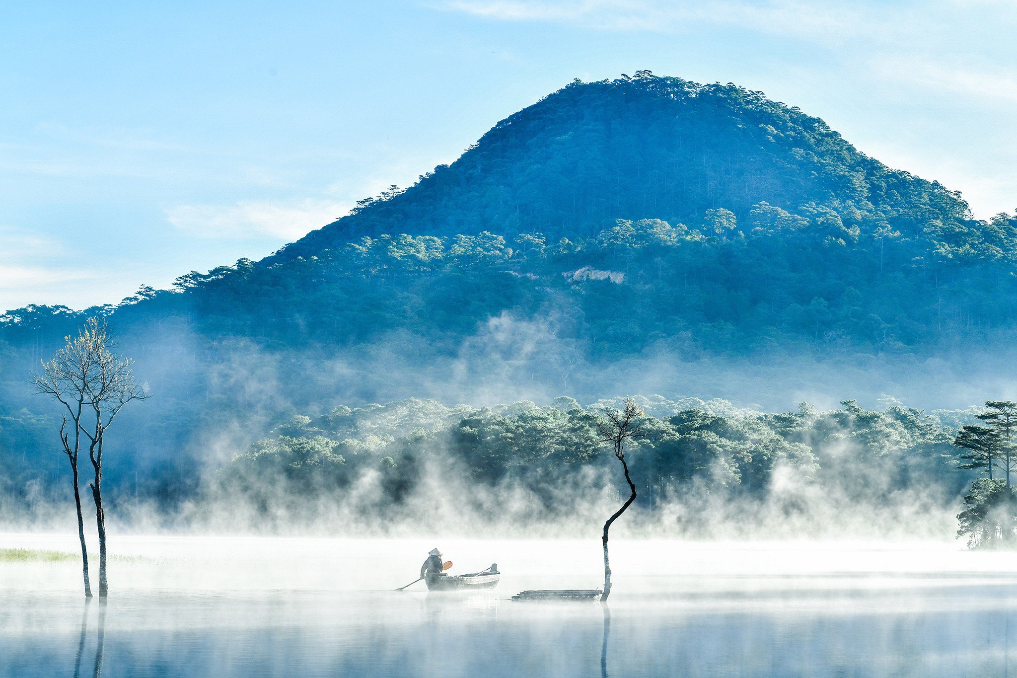
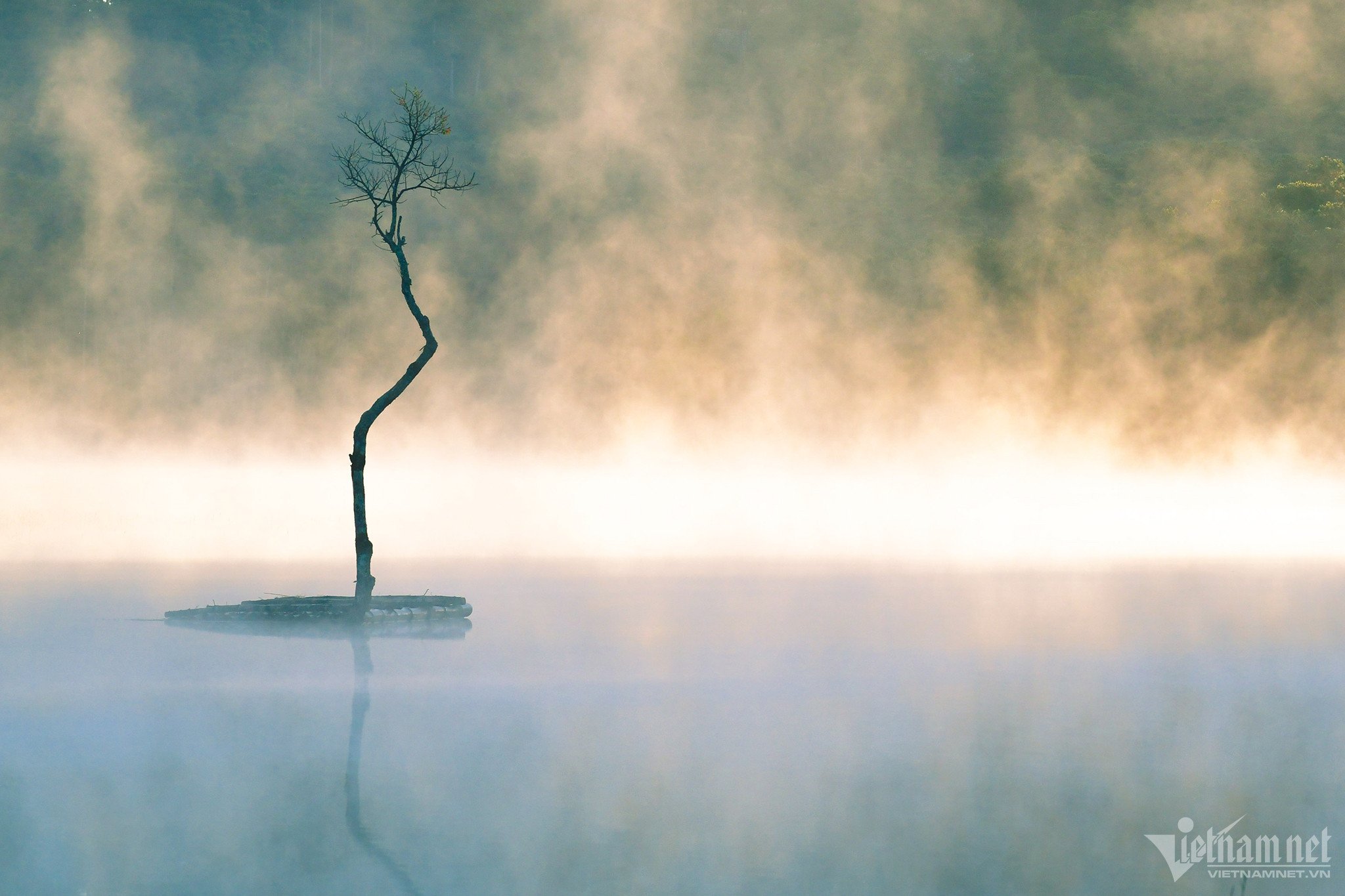
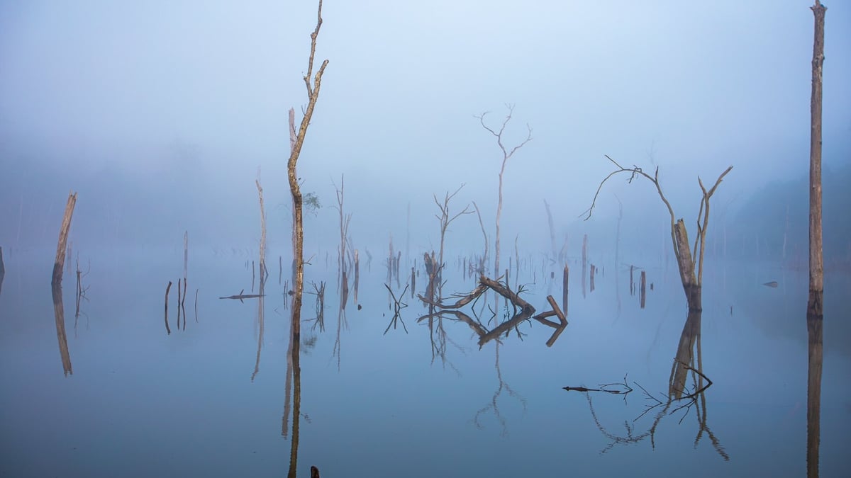
Ham Ky Lake in Ha Hoa District (Phu Tho) is an artificial lake that supplies water for agriculture in the entire region. In spring, when the weather is humid, there is a lot of fog and the water level recedes, revealing dead trees due to flooding, appearing vaguely and dreamily like a watercolor painting. Photo: Ngoc Vu.
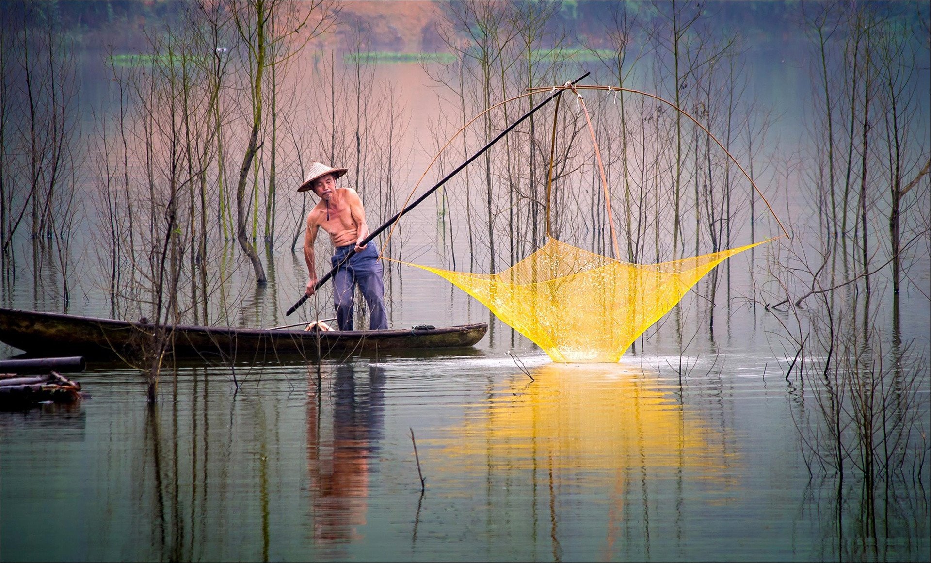
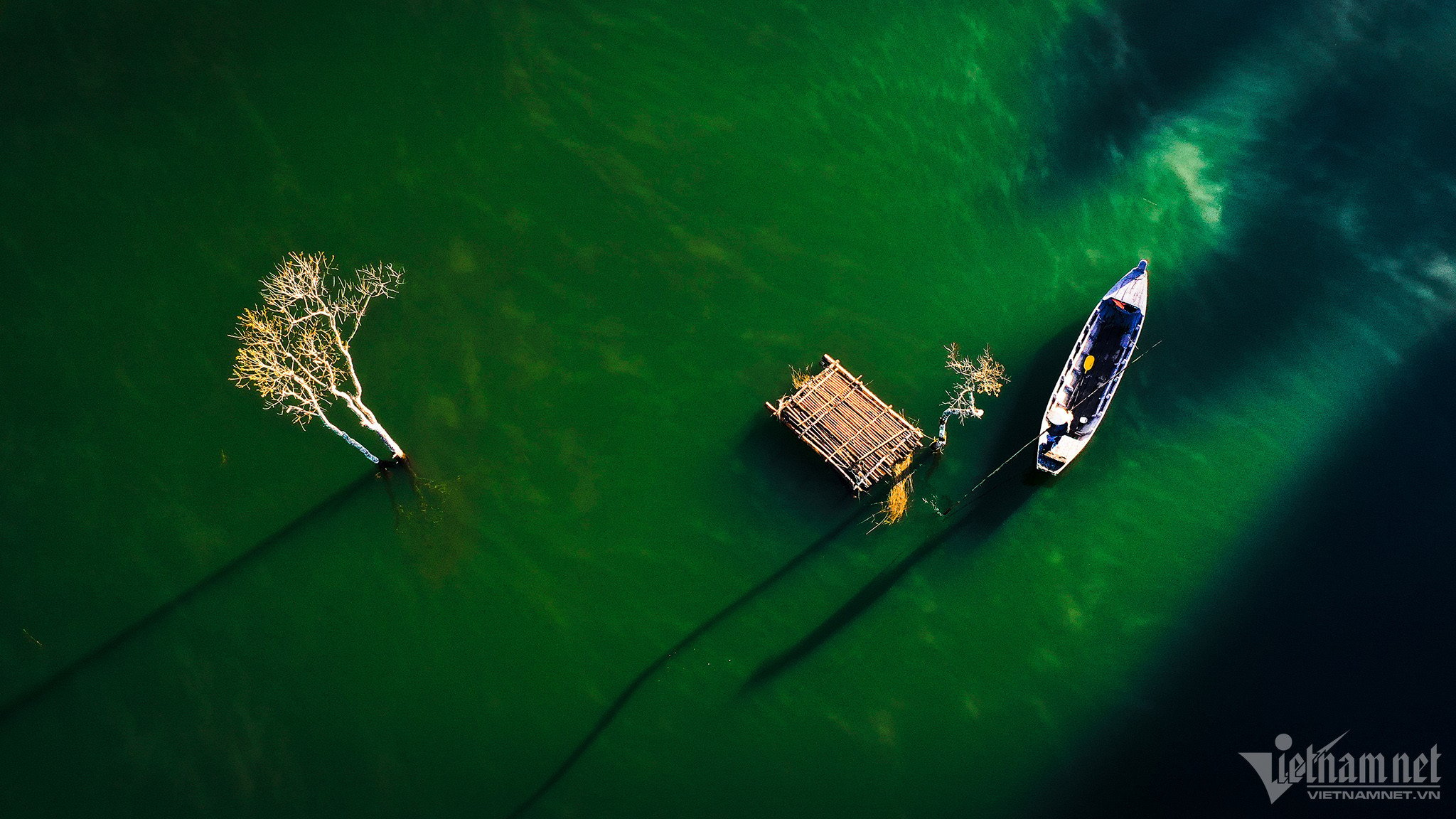
The scenery of La Luoc Lake (Coc San Commune, Bat Xat District, Lao Cai) is most beautiful every afternoon, when the sunlight shines down on the lake, reflecting the bare dry tree branches, making you feel like you are lost in an ancient fairy tale. Photo: Dinh Yen Hiep.
Quan Son Lake has a total area of about 850 hectares, located in 5 communes of My Duc district (Hanoi), a small part of Kim Boi district (Hoa Binh). This scenic spot is poetic with 20 large and small mountains on the lake surface, the surrounding vegetation is rich, green all year round, creating a sense of peace. Photo: Vu Trung Huan.
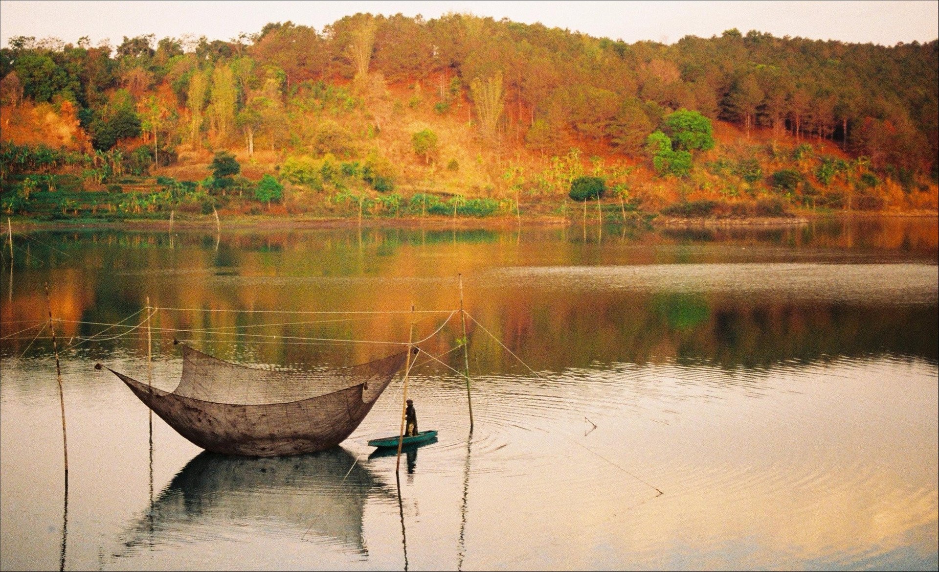
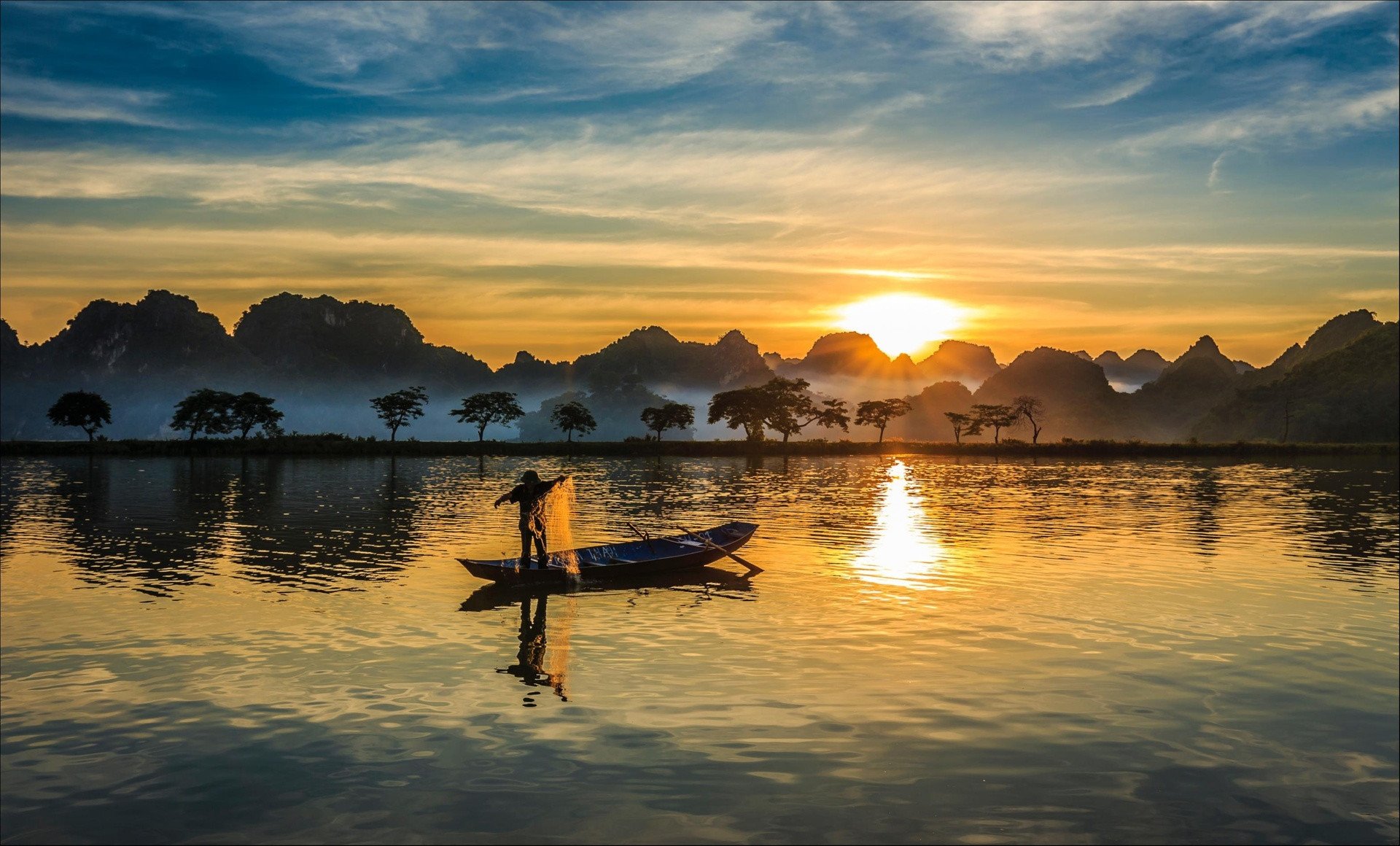
Lak Lake is located in Lien Son town, Lak district, Dak Lak province (about 60 km from Buon Ma Thuot city center). The lake's main water source comes from the Krong Ana river. The wild beauty of the white waterfall and the clarity of the immense lake have created an artistic scene. If you travel by motorbike from the center of Dak Lak, it will take you just over 1 hour to reach this famous natural landmark. With an area of about 6.2 km2, this is the largest freshwater lake in the Central Highlands, and also the second largest natural freshwater lake in Vietnam. Photo: Tuan Nguyen.

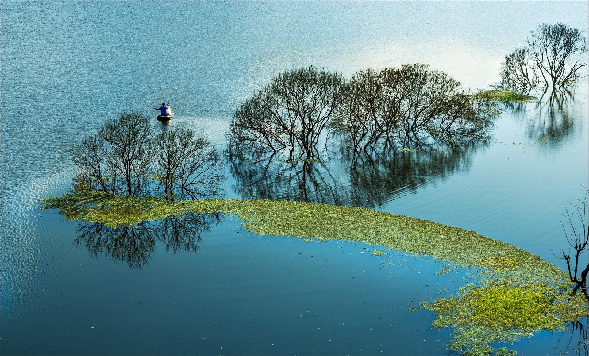
Ta Dung Lake is located in the territory of Dak P'lao and Dak Som provinces, in the Ta Dung Nature Reserve, which has the most unique terrain in Dak Nong province. This lake has a very large area, about 5,000 hectares. Due to the strongly dissected terrain, inside the lake there are about 40 large and small islands undulating interspersed. The islands are all covered with green trees, the surrounding air is fresh and cool.
Tuyen Lam Lake is 320 hectares wide, located near the Phoenix Mountain range, in Ward 4, about 7 km south of Da Lat city center. This tourist area is not too far from the center nor too close to the residential area, helping visitors feel the peace, especially at dawn. Tuyen Lam is also voted as one of the 3 most beautiful lakes in the foggy city, surrounded by vast pine forests. On the lake surface, there are also small oases jutting out with all kinds of unique shapes. The overall tourist area is like a watercolor painting created from the blue of the sky, water and pine hills. Photo: Hoang Ha.

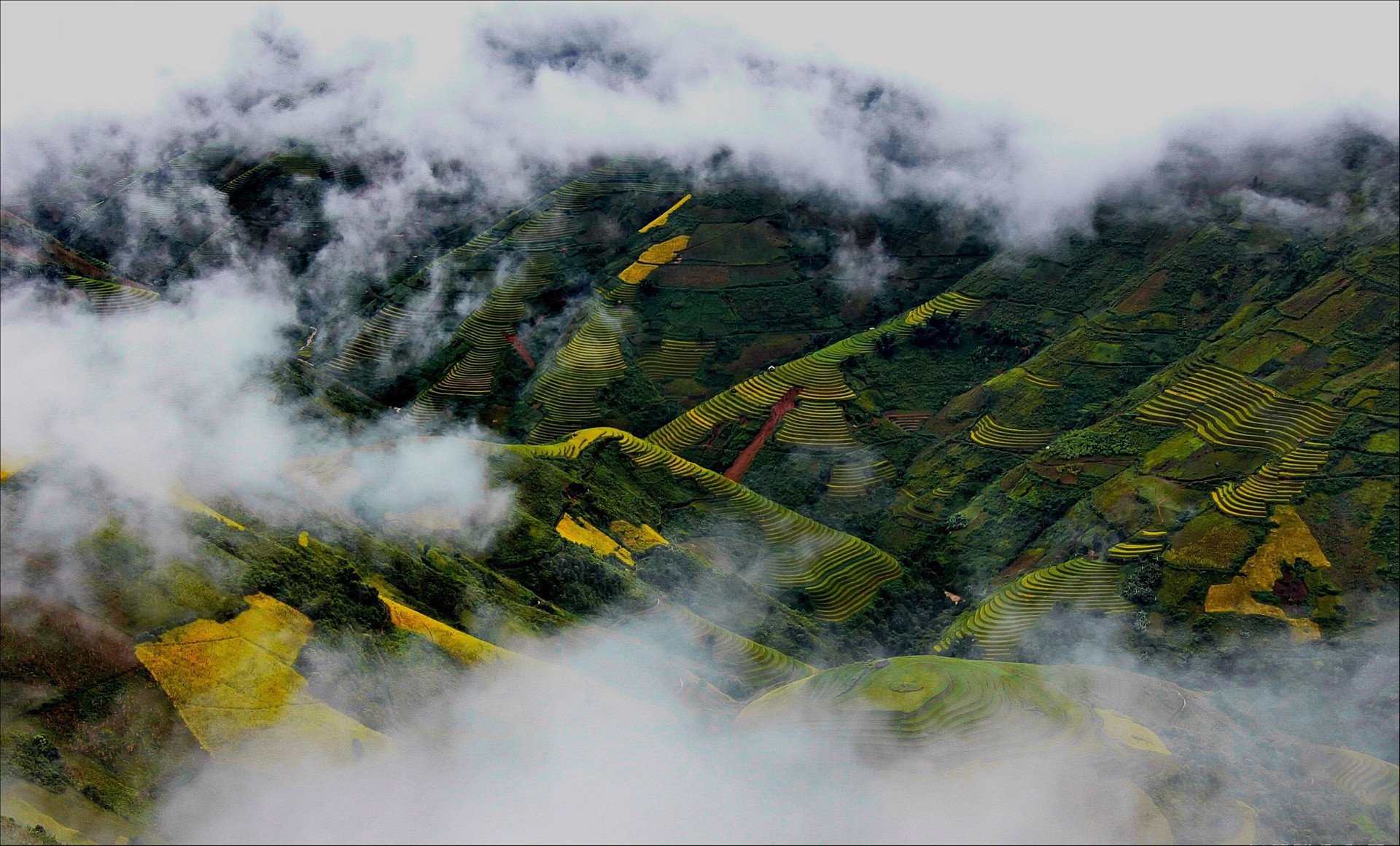
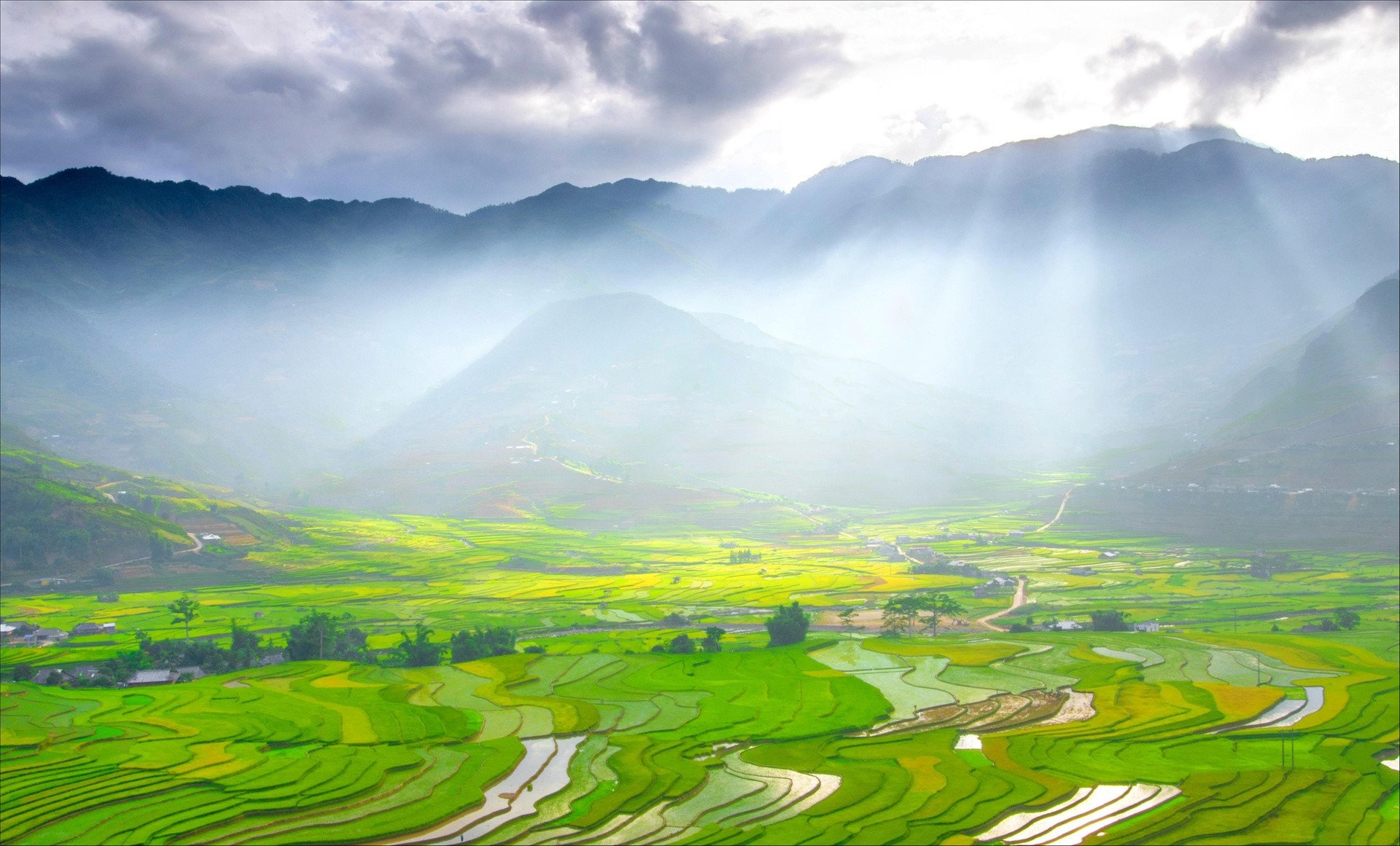
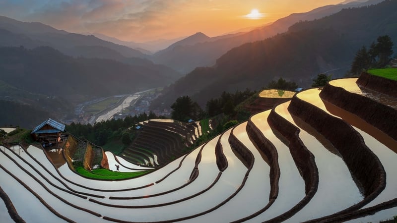
Mu Cang Chai terraced fields (Yen Bai) are spread over an area of over 2,300 hectares, concentrated mainly in the three communes of La Pan Tan, De Xu Phinh and Che Cu Nha. This is where the Mong people cultivate wet rice and is also a testament to the creativity in rice cultivation adapted to the climate, land and irrigation conditions of the ethnic minorities in the mountainous region. Photo: Bui Thien Mai.
When Mu Cang Chai terraced fields are dyed by the golden color of sunlight and ripe rice grains, the terraced fields in September and October have a deep color, a wild look, true to the Northwest mountains and forests. Photo: Nguyen Anh Tuan - Dang Hong Long.
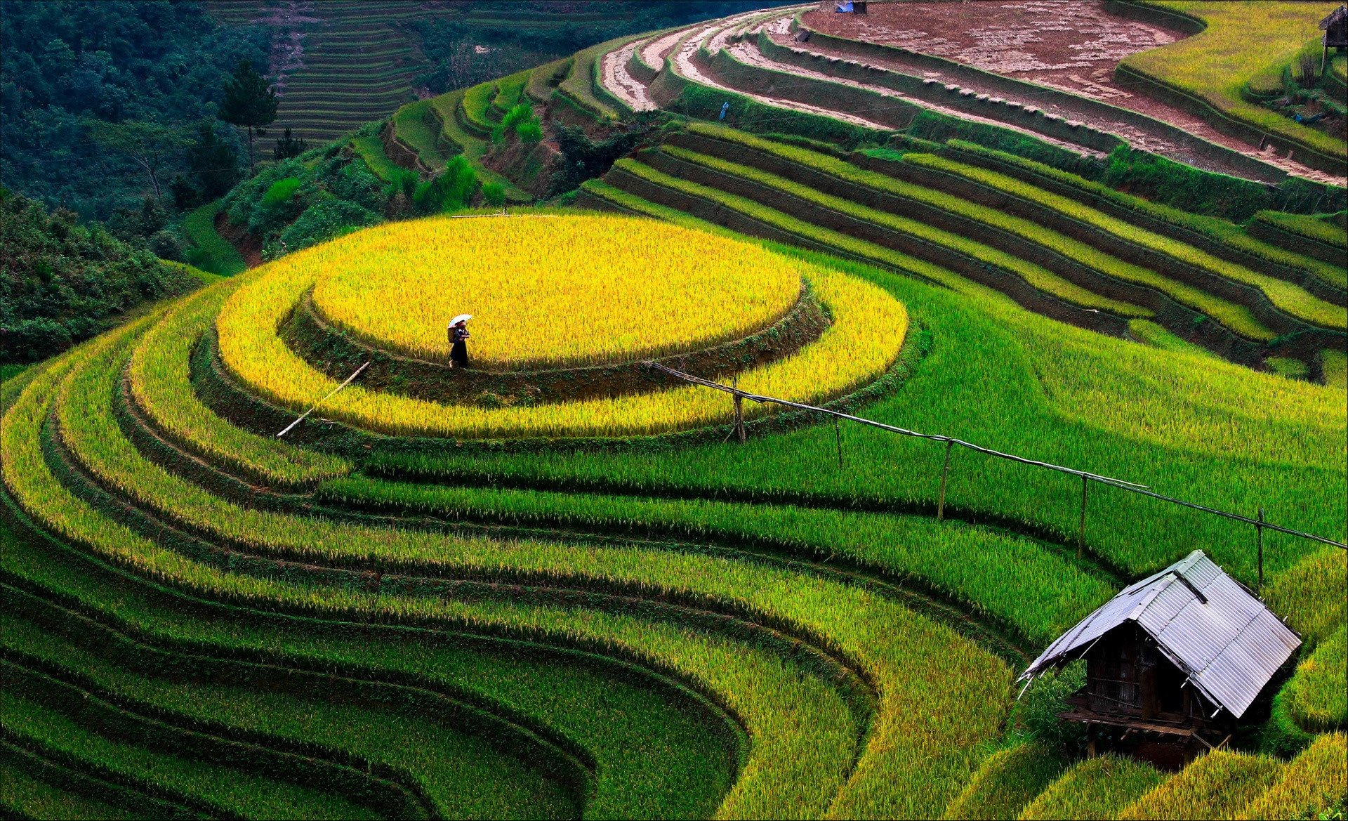
To have terraced fields, the Mong people in Mu Cang Chai (Yen Bai) must choose land on hillsides and mountain slopes with a fairly large area, moderate slope and favorable location to receive rainwater and stream water. Photo: Dang Hong Long.
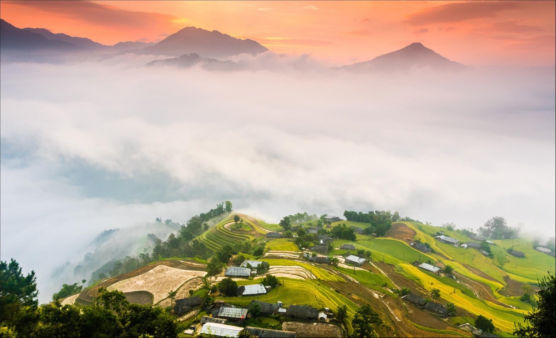
Ban Phung Commune is located about 30 km from the center of Hoang Su Phi District, Ha Giang Province. Nearly 100% of the people here are La Chi ethnic people, and their lives have many unique cultural features that are still quite intact. The clouds in Ban Phung are not as dense as in Mu Cang Chai or Ta Xua, but are filled with poetry. Ban Phung also does not have a wide valley like Muong Hoa in Sa Pa, but the terraced fields here are located precariously on steep slopes - related to the living habits of La Chi residents from about 800 years ago. Photo by Ngoc Vu.
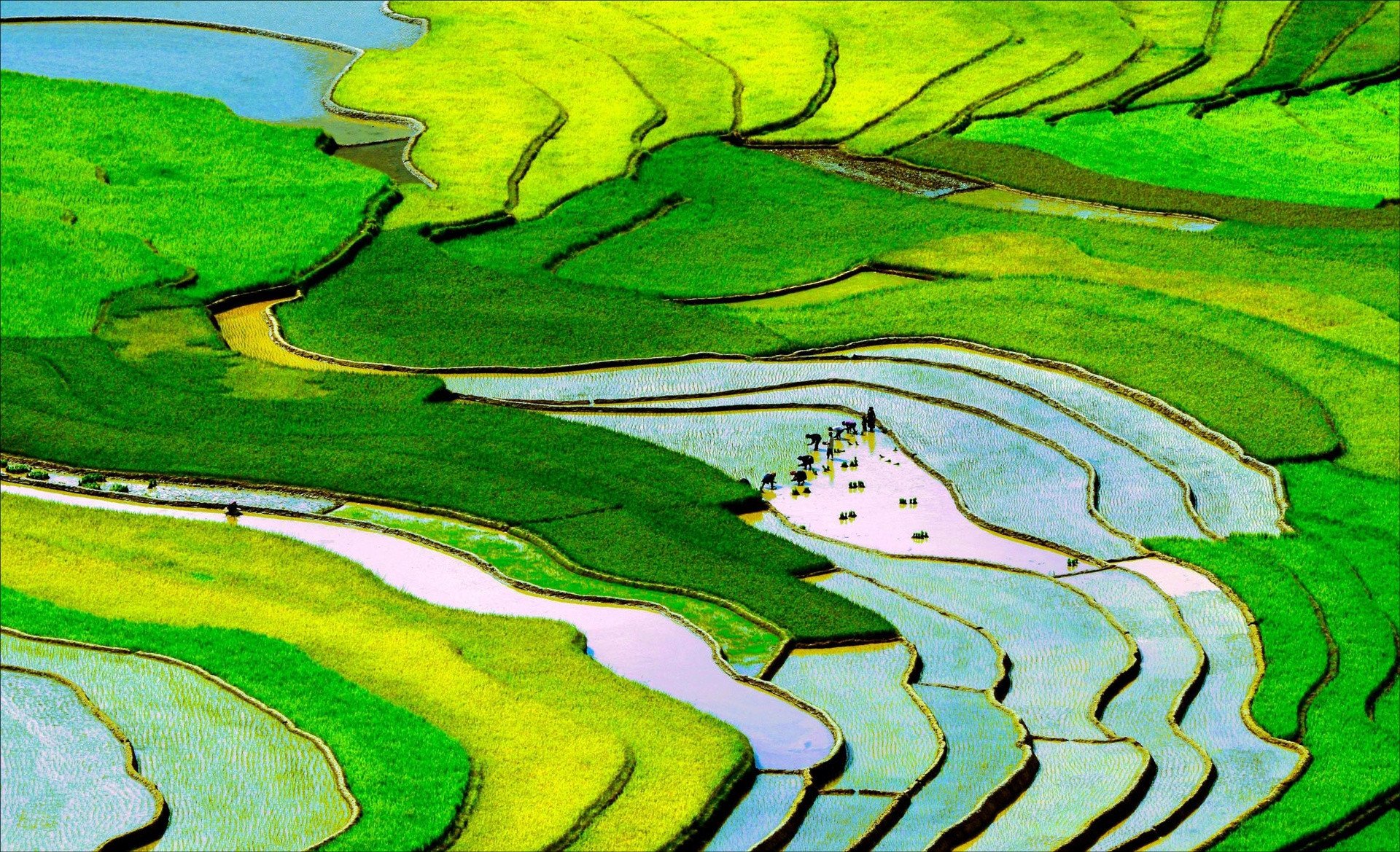
7 - 11 km from the center of Sa Pa town depending on the route, Lao Chai - Ta Van are two large villages of Sa Pa, Lao Cai, home to many ethnic minorities such as Mong, Dao Do, Giay... If you come to Lao Chai during the harvest season, around April or September, visitors will have the opportunity to admire the beautiful giant landscape painting of the mountainous region with golden ripe rice fields on terraced fields. Photo: Thanh Tu.
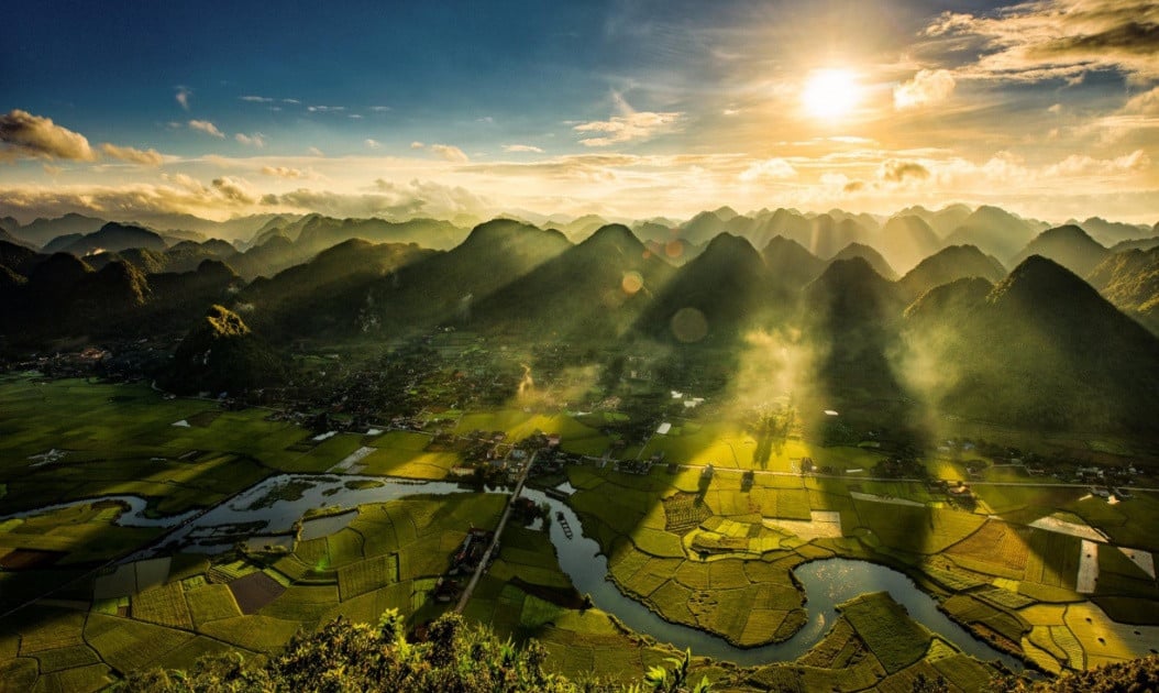
World Travel Magazine voted Bac Son valley as one of the 10 most beautiful karst valleys in the world. “Karst terrain is a wonderful gift that nature bestowed upon Bac Son people. Not only creating an attraction in terms of eco-tourism, the caves, fields, lakes, and karst wells also have high archaeological and cultural value.” Photo: Bui Thuan.
Na Lay Mountain is a great location to enjoy the panoramic view of Bac Son Valley. Looking out over the golden rice fields, it is easy to see Quynh Son Community Cultural Tourism Village (Quynh Son Commune, Bac Son District) with over 400 Tay and Nung households living there. Photo: Nguyen Anh Tuan.
Tu Le, located close to the Khau Pha Pass, is a familiar destination for many backpackers on the way to explore Yen Bai. This place is actually a valley located between three high mountains: Khau Song, Khau Than and Khau Pha. Early in the morning, visitors can wake up very early to watch the sunrise. The sun from the hillside spreads gold down the valley, blending with the misty clouds and gradually disappearing, giving way to new, brilliant sunlight. During the flood season or when the rice is ripe, waking up early to watch the sunrise is a wonderful thing here. Photo: Nguyen Anh Tuan.
Lim Mong village is located on National Highway 32, in Cao Pha commune, Mu Cang Chai district, Yen Bai province. There are two beautiful times for tourists to visit this place: May and June, the water pouring season, and from mid-September to October, the rice ripening season. In May and June, the first rains of the season pour down, water is led from the mountains into the terraced fields, flooding the fields, making the dry soil softer and expanding, allowing people to plant rice. Mid-September and October are the most beautiful times of Lim Mong, when the terraced fields are dyed golden by ripe rice flowers. Photo: Viet Manh.
Source

![[Photo] National Assembly Chairman Tran Thanh Man meets with Thai Prime Minister Paetongtarn Shinawatra](https://vphoto.vietnam.vn/thumb/1200x675/vietnam/resource/IMAGE/2025/5/15/e71160b1572a457395f2816d84a18b45)
![[Photo] Prime Ministers of Vietnam and Thailand visit the Exhibition of traditional handicraft products](https://vphoto.vietnam.vn/thumb/1200x675/vietnam/resource/IMAGE/2025/5/15/6cfcd1c23b3e4a238b7fcf93c91a65dd)


Comment (0)