
TPO - The Standing Office of the Steering Committee for Natural Disaster Prevention and Search and Rescue of Binh Duong province announced the situation of high tides in the lower reaches of the Saigon River. Meanwhile, in Binh Phuoc, prolonged heavy rain caused a commune to be deeply flooded.
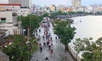
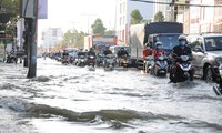
On September 17, the Binh Duong Province Hydrometeorological Station warned that from September 19 to 21, the water level downstream of the Saigon River will be at the peak of high tide. The highest daily peak water level will occur in the morning from 6:30 to 8:30, in the evening from 17:00 to 19:30 and is likely to be from 1.62m to 1.67m, higher than alert level III at Thu Dau Mot station (Ba Lua port). The level of natural disaster risk due to high tide in Thu Dau Mot City and Thuan An City is at level 1.
Binh Duong Province's Hydrometeorological Station recommends that people be on guard against peak tides combined with heavy rains that could cause banks to overflow and flood low-lying areas along the Saigon River.
Specifically, Thu Dau Mot City: Doan Tran Nghiep Street, Ong Danh Canal (Phu Cuong Ward); Nguyen Tri Phuong Street, Bau Bang Canal (Chanh Nghia Ward; area outside Tan An dike).
Thuan An City: Area outside the An Son - Lai Thieu embankment (Vinh Phu ward, Binh Nham ward); canals: Mieu, Sau Em, Cau Nho, Ba Tam, Muong Do, Bung canal branch (An Thanh ward); embankments, sunken and low canal banks in Vinh Phu ward.
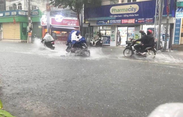 |
Binh Duong has been raining these past days. |
To proactively prevent flooding caused by high tides, the Standing Office of the Steering Committee for Natural Disaster Prevention and Search and Rescue of Binh Duong province requested the Steering Committee for Natural Disaster Prevention and Search and Rescue of Ben Cat, Thuan An, Thu Dau Mot cities and the Center for Investment and Exploitation of Irrigation and Rural Clean Water to widely inform people in low-lying areas along the Saigon River to proactively implement preventive measures to reduce damage.
At the same time, strengthen inspection and review of dikes, embankments, canal banks... especially the weak sections that have been broken or overflowed; immediately reinforce and build dike, embankment, canal banks that are likely to be broken or overflowed; operate sluice gates and tide gates in accordance with procedures to prevent flooding that affects people's lives and production. Organize 24/7 on-duty to monitor the situation of high tides and heavy rains; prepare forces, materials, and means to proactively respond and promptly overcome incidents.
On the same afternoon, Mr. Ly Trong Nhan - Secretary of Bu Gia Map District Party Committee ( Binh Phuoc ) said that the District's Steering Committee for Natural Disaster Prevention, Search and Rescue directly inspected the flooded area due to heavy rain.
Prolonged heavy rain causes flooding in Binh Phuoc
According to the report, due to the heavy rain that lasted from the night of September 16 to the early morning of September 17, flooding occurred in some areas in Dak O commune (Bu Gia Map district). There were 3 flooded areas, with strong water flow and a water level of about 1 meter, including Dak O bridge on National Highway 14C, Hamlet 4 bridge (Bu Xia hamlet route to Hamlet 4 intersection) and the green tree bridge area (National Highway 14C).
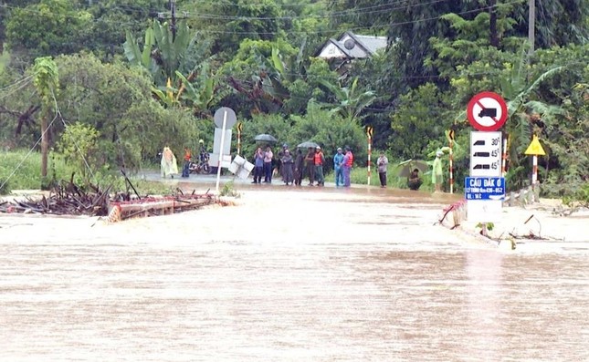 |
The road to Dak O commune (Bu Gia Map district, Binh Phuoc province) was flooded. |
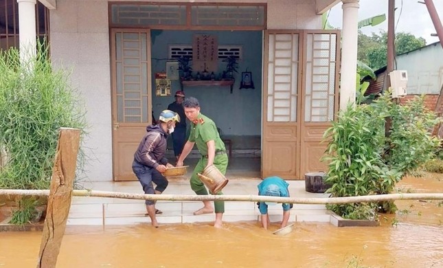 |
After the water receded, authorities assisted people in repairing and cleaning up. |
Initial statistics show that about 7 households in the flooded area have been instructed by the local authorities to evacuate safely, and some crops are in the flooded area. At the same time, the road from Dak Con village to Bu Ren village, Bu Gia Map commune has been eroded. Currently, local forces are coordinating to support and place warning signs to guide people to travel safely and clean up the receding water area.
Source: https://tienphong.vn/canh-bao-trieu-cuong-vung-ha-luu-song-sai-gon-dat-dinh-binh-phuoc-mot-xa-bi-ngap-sau-post1673936.tpo
![[Photo] Prime Minister Pham Minh Chinh and Prime Minister of the Kingdom of Thailand Paetongtarn Shinawatra attend the Vietnam-Thailand Business Forum 2025](https://vphoto.vietnam.vn/thumb/1200x675/vietnam/resource/IMAGE/2025/5/16/1cdfce54d25c48a68ae6fb9204f2171a)


![[Photo] President Luong Cuong receives Prime Minister of the Kingdom of Thailand Paetongtarn Shinawatra](https://vphoto.vietnam.vn/thumb/1200x675/vietnam/resource/IMAGE/2025/5/16/52c73b27198a4e12bd6a903d1c218846)


Comment (0)