
Winter in the northern mountainous provinces is the cloud-hunting season, with the "specialty" being seas of white clouds that only appear in certain locations.
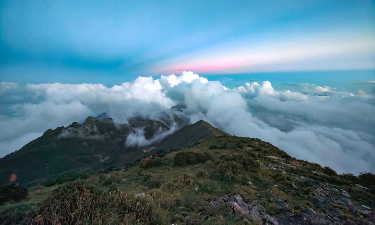
Lao Cai is known as one of the provinces with the most beautiful cloud-watching spots in the northern mountainous region. The most famous cloud-watching location is Fansipan peak (3147.3 m), the "roof of Indochina," located on the Hoang Lien Son mountain range.
Bat Xat district has two famous cloud-watching spots: "Y Ty Cloud Paradise," located at an altitude of 2,000m above sea level, in the communes of Y Ty and Ngai Thau, a high-altitude border commune of the district. Tourists can also trek and camp at Lao Than, the "roof of Y Ty" (2,860m), or Bach Moc Luong Tu peak (3,046m) to watch clouds and gaze at the stars.
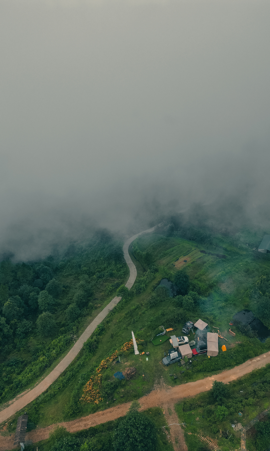
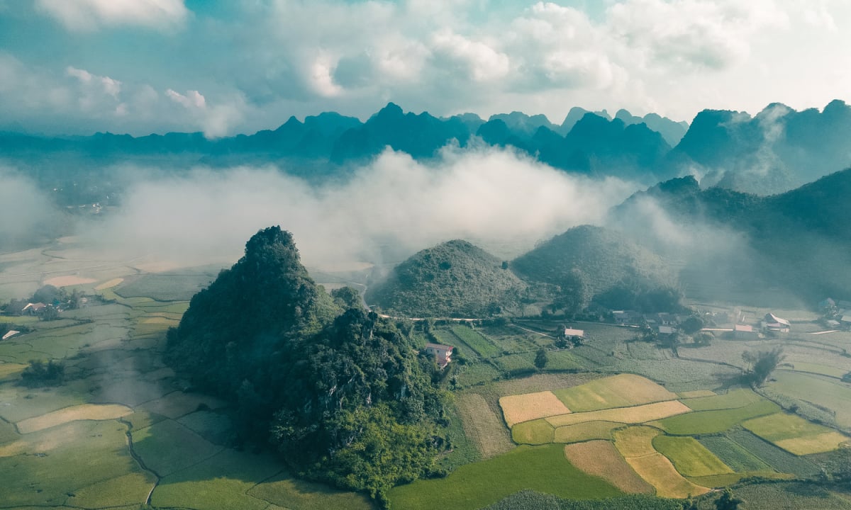
A lesser-known cloud-watching spot in Lao Cai is Hau Chu Ngai village, located at an altitude of 1,700m in Sa Pa, offering panoramic views of the sea of white clouds over the Ta Van valley, according to the Lao Cai Provincial Tourism Information Portal website. Photo: Nguyen Ngoc Minh

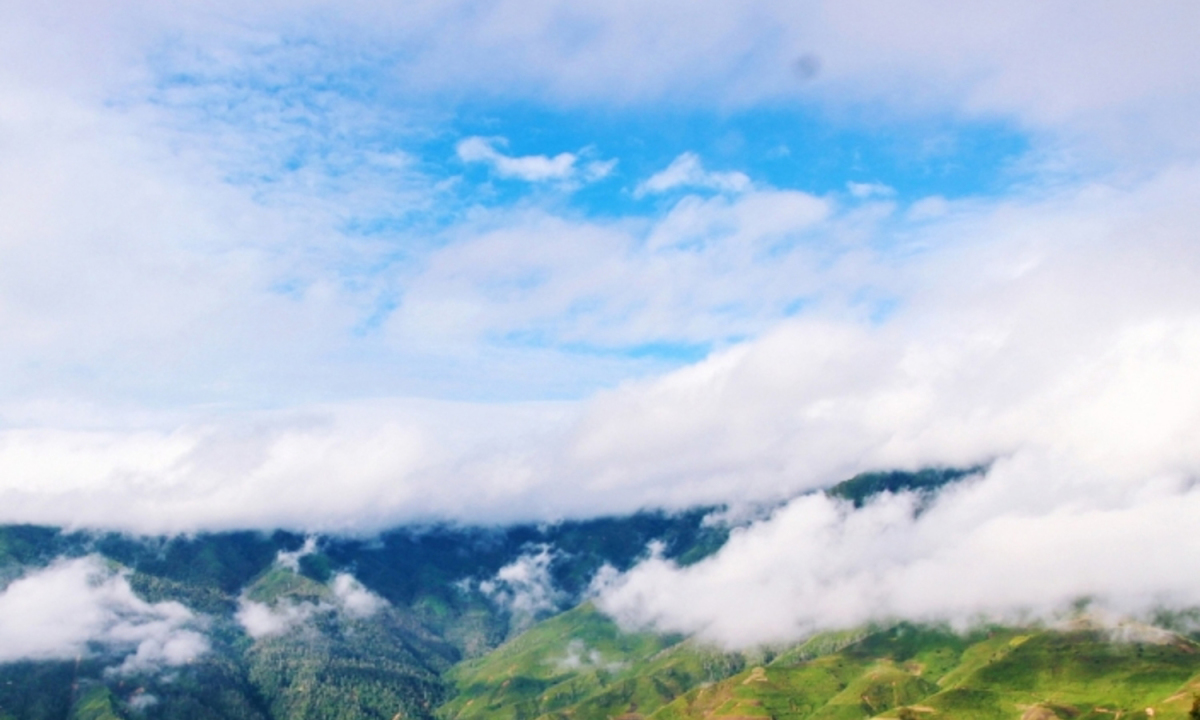
Located at an altitude of 1,500-1,800m above sea level, Ta Xua, in Bac Yen district, is known as a "cloud paradise" with its vast, endless valleys of clouds. According to the Vietnam National Tourism Administration website, January to March is the best time to go cloud hunting here.
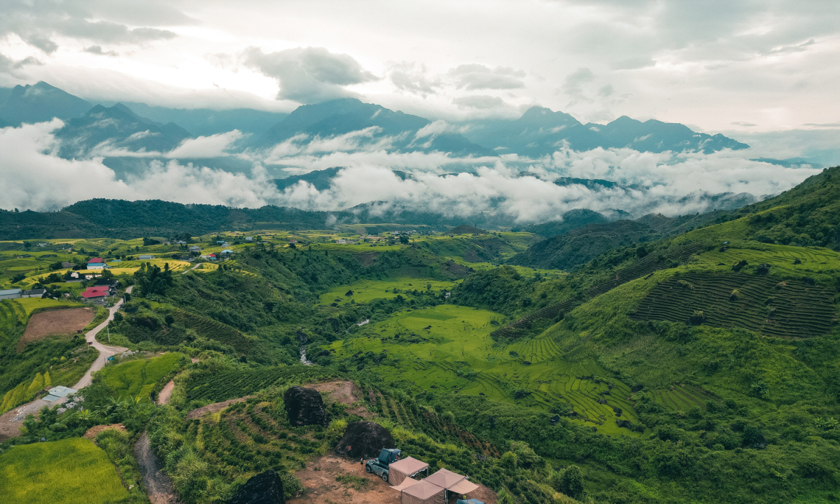
Hang Dong, a highland commune in Bac Yen district, is one of the highest peaks in Son La province, reaching an altitude of over 2,000 meters. The terrain here resembles a giant basin, nestled against the pristine Ta Xua mountain range behind it, facing Bac Yen district in the valley below. The best time to see the sea of clouds in Hang Dong is from September to March of the following year. When the weather turns cold with light rain and high humidity, it creates ideal conditions for the sea of clouds to appear every early morning. Photo: Nguyen Ngoc Minh

Ha Giang
A famous cloud-watching spot in Ha Giang is Ma Pi Leng Pass, one of the four great mountain passes of Vietnam, connecting Dong Van town and Meo Vac district. While cloud-watching on Ma Pi Leng Pass, visitors can also admire the emerald green Nho Que River winding through the Tu San gorge.
Tourists can also combine trekking, camping, and cloud hunting at the end of the year in Ha Giang. Popular trekking destinations for cloud hunting include Tay Con Linh (2,428 m), the highest peak in the Northeast region, and Chieu Lau Thi (2,402 m), the second highest mountain in Ha Giang, according to the Ha Giang Tourism Information and Promotion Center. Photo: Nguyen Ngoc Minh
Lai Chau
As one of Vietnam's four famous mountain passes, O Quy Ho Pass has two-thirds of its route in Tam Duong District, Lai Chau Province, and the remaining part in Sa Pa, Lao Cai Province. Located at an altitude of 2,000 meters on the Hoang Lien Son mountain range, the O Quy Ho "Heaven's Gate" area is a must-see destination for tourists wishing to admire the sea of clouds covering the mountain peaks, the winding pass roads, and the terraced rice fields.
Long Ty Phung Peak, over 1,100m high, is a popular cloud-watching spot near the center of Lai Chau City. The sea of clouds usually only appears in the morning. When the sun rises, visitors will see a panoramic view of Lai Chau City behind the curtain of clouds.
Sin Ho is a mountainous district in Lai Chau province. Although the roads are long and difficult to navigate, few places boast a sea of clouds bathed in a golden hue by the setting sun like this. Tourists can travel to Mo village to admire the sea of clouds swirling below amidst the mountains and forests, according to the Lai Chau Provincial Electronic Information Portal and the Vietnam National Tourism Administration website. Photo: Nguyen Ngoc Minh
Yen Bai
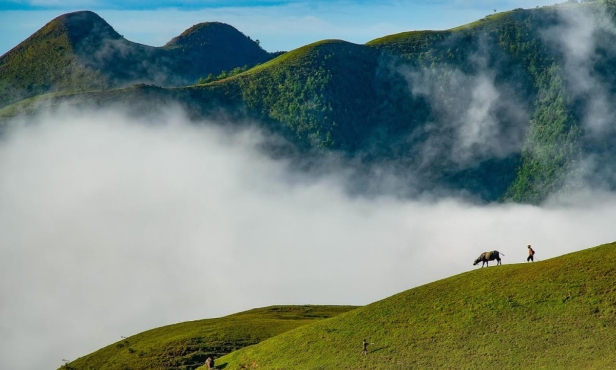
Ta Chi Nhu, located in Xa Ho village, Tram Tau district, ranks 7th in the top 10 highest mountains in Vietnam with an altitude of 2,979m. Ta Chi Nhu is famous as a "cloud paradise on earth". Visiting in October and November, in addition to the swirling sea of clouds on the mountaintop, tourists can also immerse themselves in the vast purple expanse of the Chi Pau flower, according to the website of the Vietnam National Tourism Administration.
Soft, silken wisps of clouds drift over the mountain passes, then curl up to envelop the high peaks, spreading across the vast expanse to create an endless sea of white clouds that leaves visitors in awe. Photo: Nguyen Trong Cung
Lang Son
Mau Son is located in the high mountainous region of Cao Loc and Loc Binh districts, with approximately 80 mountains of varying sizes situated close together. The highest peaks are Phia Po (Father Mountain) at 1,541m and Phia Me (Mother Mountain) at 1,520m.
Viewed from above, Mau Son appears as a series of rolling hills interspersed with narrow valleys. The "dinosaur's spine" area in Mau Son is a steep mountainside with a trail running down the middle, flanked by high cliffs, creating a unique shape resembling the back of a dinosaur, similar to the "dinosaur's spine" in Ta Xua.
From December to March of the following year is the ideal time to go cloud hunting on Mau Son peak. In winter, clouds wrap around the mountains, descending into the primeval forest area. Walking on Mau Son peak is like strolling through a celestial paradise. Mau Son is one of the few places in Vietnam where snow and ice appear in winter for tourists to explore, according to the Lang Son Tourism Promotion Information website. Photo: Luu Minh Dan
Cao Bang
Cao Bang has many mountain peaks over 1,000m above sea level, including Phia Oac (Nguyen Binh district) at 1,931m, the second highest peak in the province (after Phia Da mountain in Son Lap commune, Bao Lac district, which is 1,987m high). The cloud season in Phia Oac lasts from December to March of the following year, especially in February when thick clouds descend into the forest in the early morning or at sunset.
In Bao Lac district, Phan Thanh "heaven's gate," located at an altitude of over 1,000m, is a little-known cloud-watching spot. Along the road from Lung Na hamlet, Thuong Ha commune to Co Ba commune (Bao Lac), tourists may also unexpectedly encounter seas of clouds.
The Luc Khu area of Ha Quang district is known as Cao Bang's "rocky plateau" due to its pristine rocky mountain ranges and the lives of its people closely intertwined with the rocks. It's a little-known, unspoiled cloud-watching spot in Cao Bang. On early winter mornings, seas of clouds envelop the mountain peaks, obscuring even the villages in the valleys below, according to the Cao Bang Provincial Information Portal. Photo: Nguyen Ngoc Minh
Dien Bien
With its high mountainous terrain and cold climate, Dien Bien boasts many beautiful cloud-covered areas in winter. Near the center of Dien Bien Phu city, the Ke Nenh and Na Nghe villages in Thanh Minh commune are popular spots for tourists and photographers to take pictures and admire the sea of clouds. Further afield, there's the Tang Quai pass with its sea of clouds covering the Muong Ang valley; the Chop Ly peak in Dien Bien Dong district with its fluffy white clouds floating on the mountain slopes; and the Nam Po and Muong Nha districts also frequently feature seas of clouds.
Early morning is the ideal time for cloud watching; however, the thickness of the clouds varies depending on the time and weather. If lucky, visitors can admire the sight of swirling clouds and streams rising and filling the valley, according to the website of the Dien Bien Provincial Department of Culture, Sports and Tourism. Photo: Dien Bien Provincial Tourism Information and Promotion Center.
Tuyen Quang
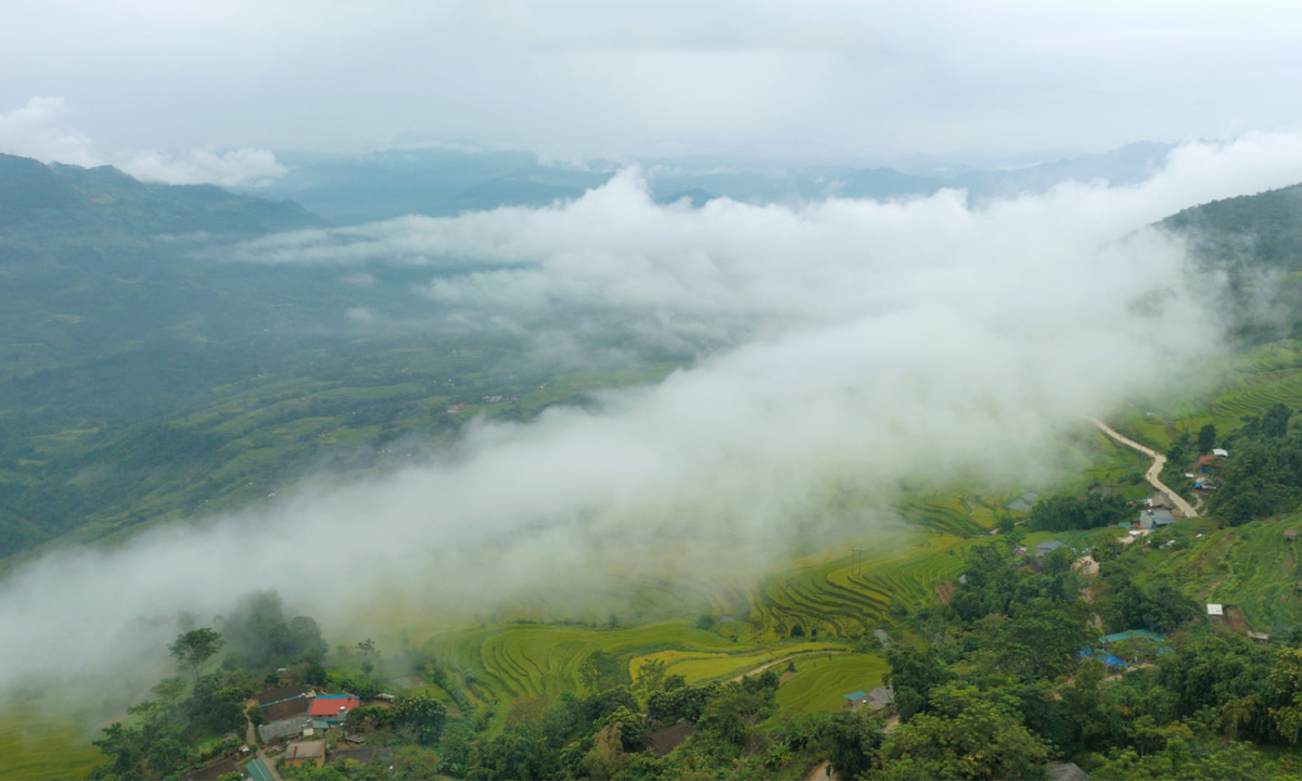
Although not as famous for cloud-watching spots as Son La, Lao Cai, Tuyen Quang also has some locations where sea of clouds can appear, such as Pac Ta Mountain; Tuyen Quang Hydroelectric Power Plant; Na Hang - Lam Binh Ecological Lake; Cao Duong village, Yen Thuan commune; Ga Pass in Tan Thinh commune; Thanh Tuong, Khau Tinh, Sinh Long, Thuong Giap, Son Phu, and Da Vi communes.
The most impressive sea of clouds can be seen in Hong Thai commune in the early morning. Clouds rise from the valley, spilling over the terraced rice fields and layering on the mountaintops, according to the Tuyen Quang provincial online portal. Photo: Nguyen Thanh Hai
Peace
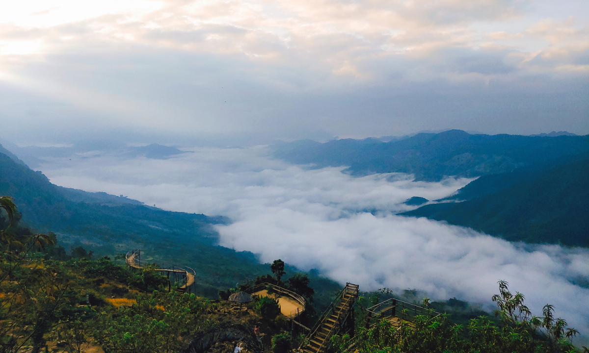
The Hang Kia - Pà Cò valley (Mai Châu district, Hòa Bình province) is situated between the Xà Lĩnh and Lương Xa mountain ranges. At an average altitude of about 900 meters above sea level, the climate here is cool and foggy year-round. Visitors often seek out the "heaven's gate" area to witness the cloud formations.
The sea of clouds at Hang Kia - Pà Cò is lower than the view, giving visitors the feeling of standing on clouds. Layers of clouds hang halfway up the mountain like a white cloth stretched endlessly between two mountain ranges. At dawn, the sunlight shining down on the sea of clouds creates a soft pinkish-orange hue. After the sun rises higher, the clouds turn a fluffy white, swirling around the undulating mountain peaks, according to the website of the Department of Culture, Sports and Tourism of Hoa Binh province. Photo: Pham Tu

According to VNE
Source


![[Image] 20 islands in the Spratly Islands special administrative region hold early elections.](https://vphoto.vietnam.vn/thumb/1200x675/vietnam/resource/IMAGE/2026/03/08/1772949669607_img-20260308-112026-90-jpg.webp)


Comment (0)