
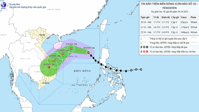
Storm Toraji is in the sea east of Luzon Island (Philippines) and heading towards the East Sea, likely to become storm number 8 in the evening and night of November 11.
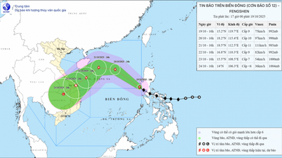
The National Center for Hydro-Meteorological Forecasting has just released the latest bulletin on the developments of the storm near the East Sea, which is likely to become storm number 8 in 2024.
Accordingly, currently, the storm, internationally named Toraji, is active in the sea east of Luzon Island (Philippines).
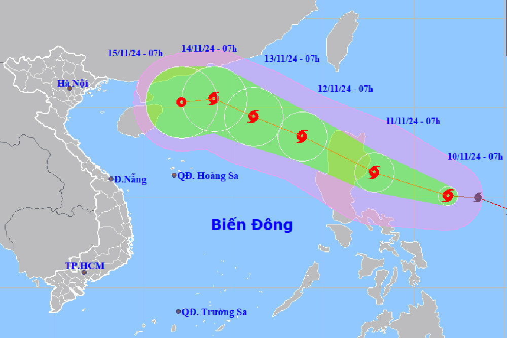
At 7:00 a.m. this morning (November 10), the center of the storm was at about 15.1 degrees North latitude; 126.9 degrees East longitude, in the sea northeast of Lu Dong island. The strongest wind near the center of the storm was level 10 (89-102 km/h), gusting to level 12. Moving in the West Northwest direction, speed 15-20 km/h.
It is forecasted that around the evening and night of November 11, storm Toraji will move into the East Sea with strong winds of level 9, gusting to level 11. Thus, right after storm number 7 weakens, the East Sea will welcome storm number 8.
Storm forecast (next 24 to 72 hours) :
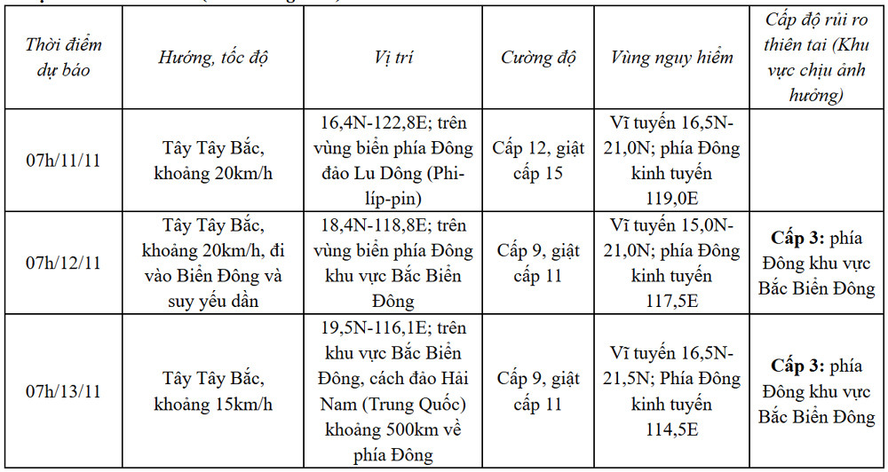
From the next 72 to 120 hours, the storm will move in the West Northwest direction and then possibly change to the West Southwest direction, traveling 10-15km per hour, and its intensity will continue to weaken.
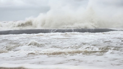
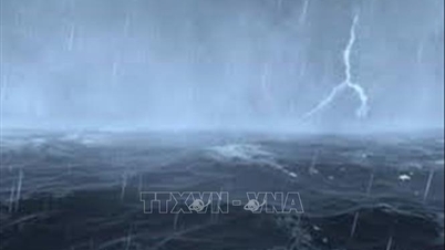
From tonight, the weather in the eastern sea area of the North East Sea will be strong winds of level 6-7, near the storm center will be level 8-9, gusts of level 11, waves 2-4m high, near the center 4-6m; very rough seas. Ships operating in the above-mentioned dangerous areas are likely to be affected by storms, whirlwinds, strong winds, and large waves.

Weather forecast for the next 10 days: Sunny in the North, possibility of storm No. 8 in the East Sea
Storm No. 7 Yinxing begins to change direction, moving towards the sea area of Quang Tri - Quang Ngai
Source: https://vietnamnet.vn/bao-toraji-gan-bien-dong-kha-nang-tro-thanh-bao-so-8-2340554.html
![[Photo] Prime Minister Pham Minh Chinh chaired a meeting to evaluate the operation of the two-level local government model.](https://vphoto.vietnam.vn/thumb/1200x675/vietnam/resource/IMAGE/2025/10/29/1761751710674_dsc-7999-jpg.webp)
![[Photo] Hue: Inside the kitchen that donates thousands of meals a day to people in flooded areas](https://vphoto.vietnam.vn/thumb/1200x675/vietnam/resource/IMAGE/2025/10/29/1761738508516_bepcomhue-jpg.webp)


![[Photo] Prime Minister Pham Minh Chinh chaired a meeting to discuss solutions to overcome the consequences of floods in the central provinces.](https://vphoto.vietnam.vn/thumb/1200x675/vietnam/resource/IMAGE/2025/10/29/1761716305524_dsc-7735-jpg.webp)


![[Photo] Flooding on the right side of the gate, entrance to Hue Citadel](https://vphoto.vietnam.vn/thumb/1200x675/vietnam/resource/IMAGE/2025/10/28/1761660788143_ndo_br_gen-h-z7165069467254-74c71c36d0cb396744b678cec80552f0-2-jpg.webp)


![[Live] Concert Ha Long 2025: "Heritage Spirit - Brightening the Future"](https://vphoto.vietnam.vn/thumb/402x226/vietnam/resource/IMAGE/2025/10/29/1761743605124_g-anh-sang-am-thanh-hoanh-trang-cua-chuong-trinh-mang-den-trai-nghiem-dang-nho-cho-du-khach-22450328-17617424836781829598445-93-0-733-1024-crop-1761742492749383512980.jpeg)


Comment (0)