
Storm No. 6 (Tra Mi storm) is on the coastal area of Thua Thien Hue - Da Nang with wind gusts of level 12. In the coming hours, the storm will move inland in this area before turning back out to sea and weakening.
According to the National Center for Hydro-Meteorological Forecasting, due to the influence of storm No. 6 (storm Tra Mi), Con Co Island (Quang Tri) has strong winds of level 8, gusting to level 9; Cu Lao Cham Island (Quang Nam) has strong winds of level 8, gusting to level 10; Ly Son Island (Quang Ngai) has strong winds of level 6, gusting to level 7; Nam Dong (Thua Thien Hue) has strong winds of level 8, gusting to level 10; Cam Le (Da Nang) has strong winds of level 8, gusting to level 9.
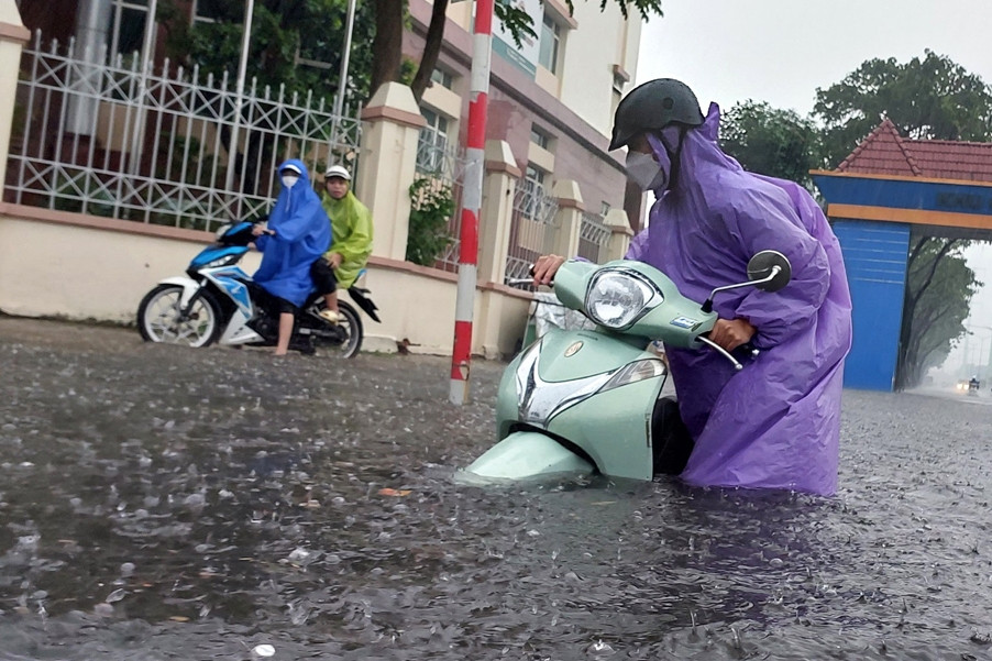
Last night and this morning (October 27), the area from Ha Tinh to Da Nang had heavy to very heavy rain, total rainfall from 100-200mm, locally over 350mm.
At 10am this morning, the eye of storm No. 6 was located on the coastal area of Thua Thien Hue - Da Nang. The strongest wind near the eye of the storm was level 9 (75-88km/h), gusting to level 12. Moving southwest at a speed of 15-20km/h.
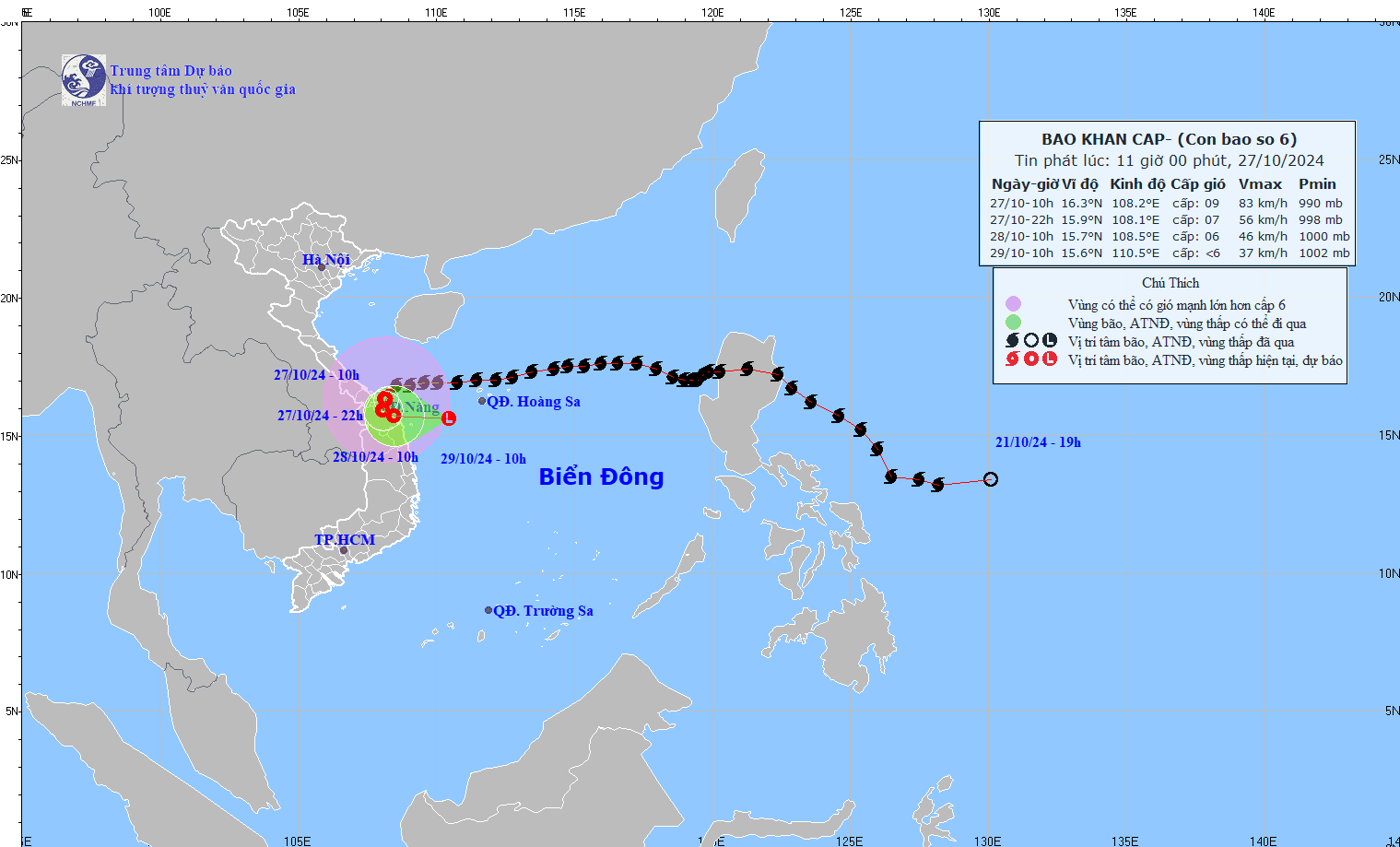
In the next 12 hours, the storm will change direction, moving to the South-Southwest, with the center of the storm over the mainland of Thua Thien Hue, Quang Nam - Da Nang and tending to turn back to the sea. The storm intensity will decrease to level 7, gust level 10, speed will be about 5km/h and weaken into a tropical depression.
At 10am tomorrow morning (October 28), the center of the tropical depression will be located over the coastal area of Thua Thien Hue - Quang Ngai, moving east at a speed of 3-5km/h and wind force level 6, gusting to level 8.
About 24 hours later, the tropical depression maintained its direction, speed of 5-10km/h and moved back out to sea. At 10am on October 29, the center of the depression was located in the sea southwest of Hoang Sa archipelago.
At 7:00 p.m. on October 29, the tropical depression moved eastward at a speed of 10km/h, in the southern area of Hoang Sa archipelago, with winds of level 6, gusting to level 8.
Due to the influence of storm No. 6, the sea areas of the provinces from Quang Binh to Quang Ngai (including Con Co Island, Cu Lao Cham, Ly Son) have strong winds of level 6-7, near the storm center of level 8-9, gusts of level 11, waves 3-5m high; very rough seas.
Coastal areas from Quang Binh to Quang Nam provinces are likely to experience storm surges of 0.4-0.6m high.
Ships/boats operating in coastal areas from Quang Binh to Quang Ngai are likely to be affected by storms, whirlwinds, strong winds, and big waves.
High risk of landslides of sea dikes and embankments along the coast of provinces from Quang Tri to Quang Nam due to the impact of big waves and storm surges.
On land from Quang Binh to Quang Nam, there will be strong winds of level 6-7, gusting to level 8-9; near the storm center, level 8-9, gusting to level 11. From today until the end of the night of October 28, in the area from Quang Binh to Quang Nam, there will be heavy to very heavy rain with total rainfall from 200-400mm, locally over 600mm. Warning of the risk of local heavy rain (>100mm/3h). The areas of Ha Tinh, Quang Ngai, Binh Dinh and the Northern Central Highlands will have heavy rain, locally very heavy rain with total rainfall from 100-200mm, some places over 250mm.
The development of storm No. 6 is still very complicated and may change; people need to pay attention to updates in the next storm bulletins.
Storm No. 6 makes landfall, Quang Binh - Quang Nam rains heavily
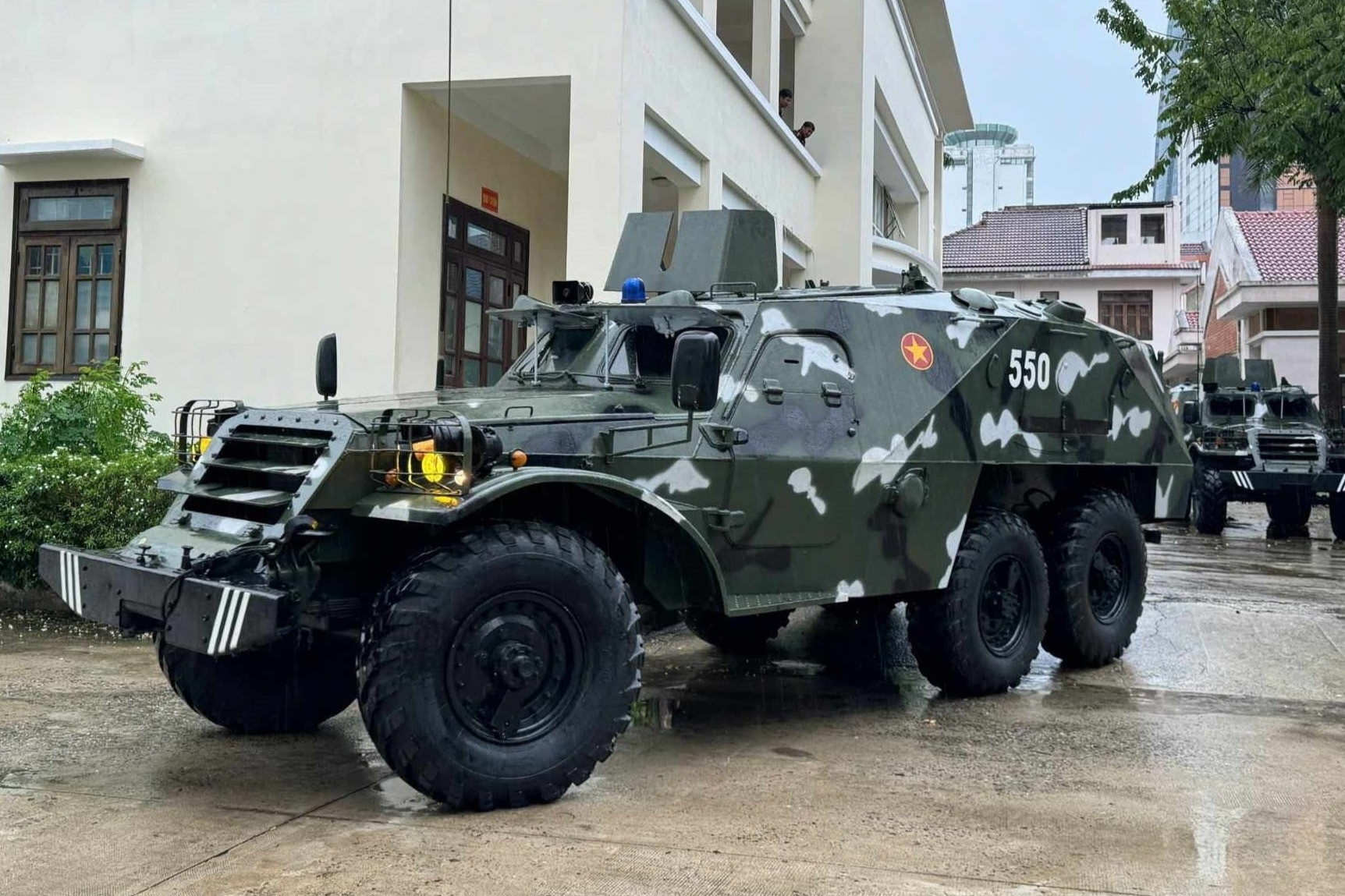
Da Nang mobilizes armored vehicles to respond to storm No. 6 Tra Mi

The abnormality of storm number 6 Tra Mi, after making landfall, it circled out to the East Sea
Source: https://vietnamnet.vn/bao-so-6-bao-tra-mi-giat-cap-12-dang-vao-thua-thien-hue-quang-nam-da-nang-2336042.html
![[Photo] President Luong Cuong attends the inauguration of the international container port in Hai Phong](https://vphoto.vietnam.vn/thumb/1200x675/vietnam/resource/IMAGE/2025/5/13/9544c01a03e241fdadb6f9708e1c0b65)
![[Photo] Prime Minister Pham Minh Chinh receives Ambassador of the French Republic to Vietnam Olivier Brochet](https://vphoto.vietnam.vn/thumb/1200x675/vietnam/resource/IMAGE/2025/5/13/f5441496fa4a456abf47c8c747d2fe92)

![[Photo] Many people in Hanoi welcome Buddha's relics to Quan Su Pagoda](https://vphoto.vietnam.vn/thumb/1200x675/vietnam/resource/IMAGE/2025/5/13/3e93a7303e1d4d98b6a65e64be57e870)

![[Photo] President Luong Cuong awarded the title "Heroic City" to Hai Phong city](https://vphoto.vietnam.vn/thumb/1200x675/vietnam/resource/IMAGE/2025/5/13/d1921aa358994c0f97435a490b3d5065)


Comment (0)