
According to the National Center for Hydro-Meteorological Forecasting, at 11:00 am on September 19, the center of storm No. 4 was located at about 17.2 degrees North latitude; 107.3 degrees East longitude, in the coastal waters from Quang Binh to Thua Thien Hue. The strongest wind is level 8-9, gusting to level 11.
Forecast in the next 3 hours, the storm moves west, speed about 20-25 km/hour.
At 4:00 pm on September 19, the center of storm No. 4 was at about 17.2 degrees North latitude; 106.7 degrees East longitude, on the mainland of Quang Binh-Quang Tri provinces. The strongest wind near the center of the storm was level 8, gusting to level 10-11; moving mainly westward at a speed of about 20-25 km/hour.
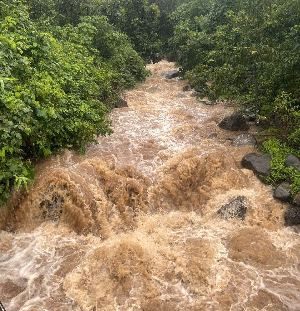
The impact of storm No. 4 caused moderate to heavy rain, and in some places very heavy rain, in the morning of September 19 in some central provinces. In particular, heavy rain from dawn to noon on the same day caused floodwaters from upstream to flow, causing many spillways and inter-village roads in the highland communes of Quang Tri to be flooded and partially isolated.
According to the Standing Office of the Steering Committee for Natural Disaster Prevention and Control of Quang Tri province, in the past hours, there has been heavy rain in the area, with average rainfall ranging from 80 - 140mm, some places in the mountainous district of Dakrong higher such as: La To 223mm, Ta Long 195.8mm, Ba Nang 152.8mm.
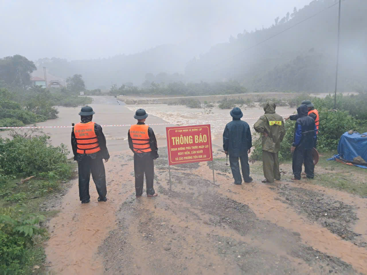
Heavy rain has cut off traffic in some areas of the two mountainous districts of Dakrong and Huong Hoa due to flooded culverts.
In Dakrong district, the spillways were flooded from 0.3 - 0.5m causing traffic disruption including: A Ngo - A Bung, Ta Rut - A Ngo, Ly Ton, Lang Cat. In Huong Hoa district, some spillways were flooded from 0.5 - 1m causing traffic disruption including: Cooc village, Huong Linh commune; Loa village and Trum village, Ba Tang commune; Bu village, Tan Lap commune; Lia commune spillway, Xy commune; Huc Thuong, Huc commune.
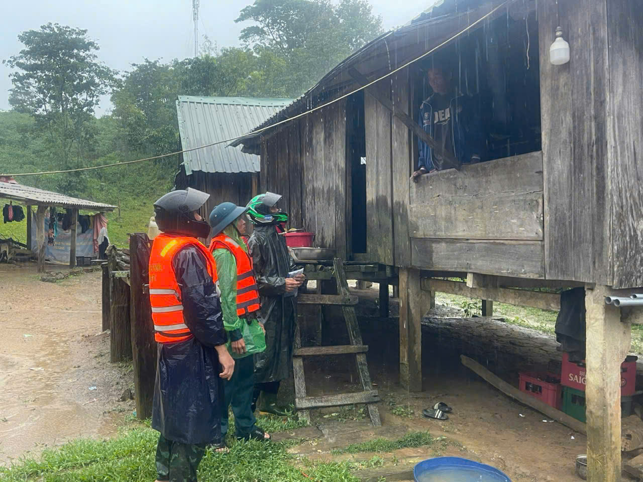
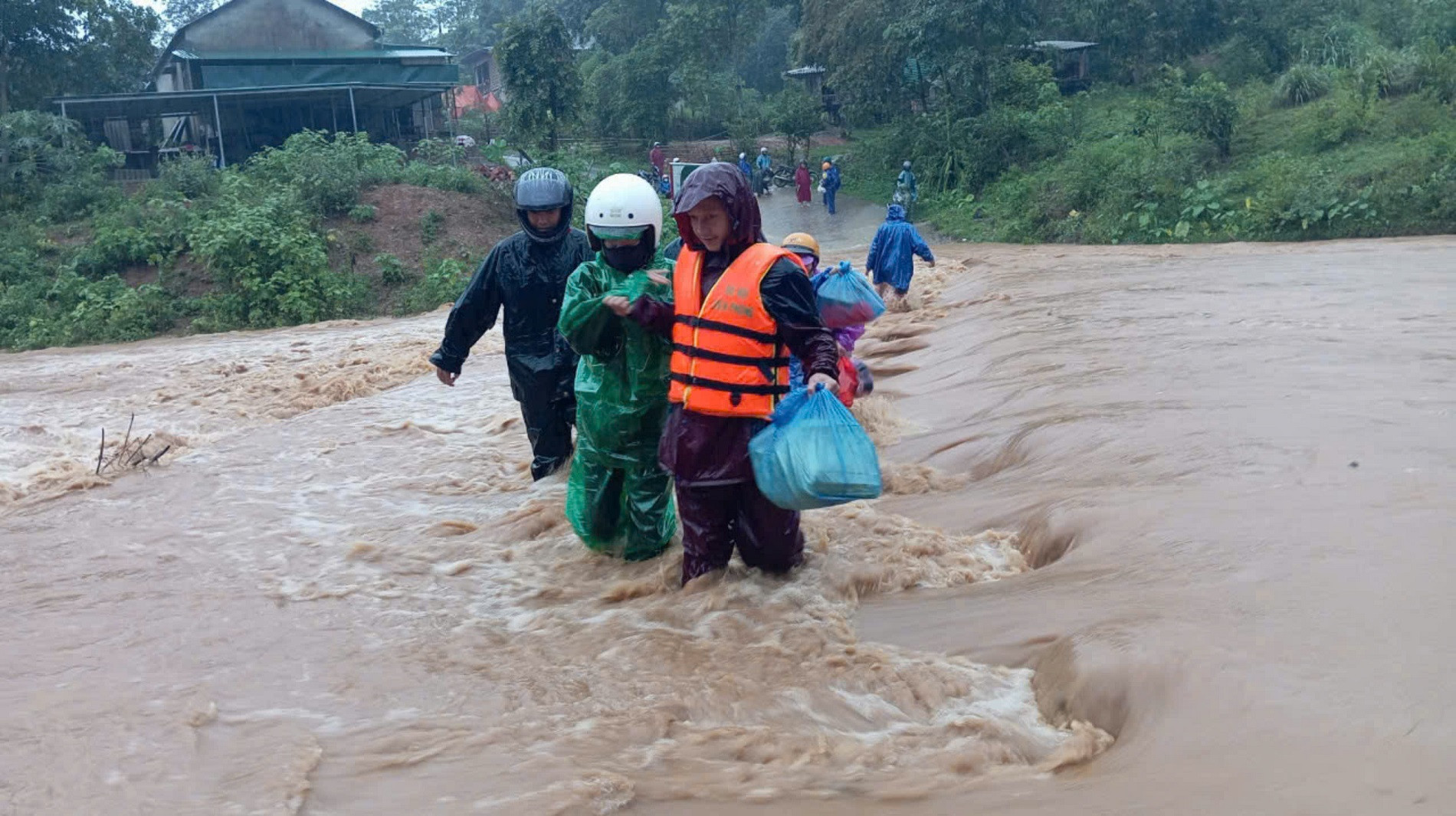
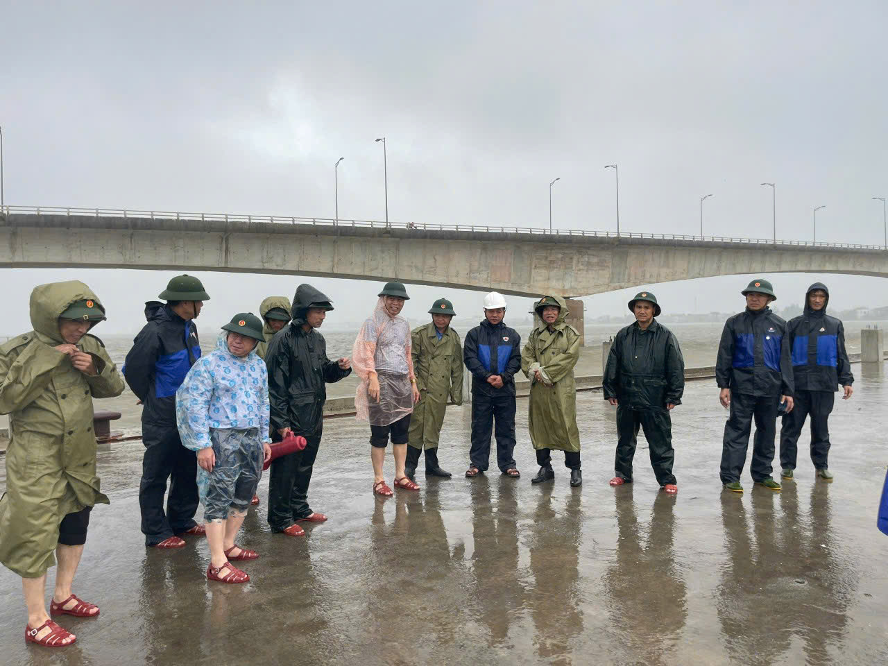
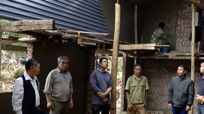
The leader of Huong Lap Border Guard Station (Quang Tri) said that on the morning of September 19, there was a slight landslide at the Cup village resettlement area (Huong Lap commune). To ensure safety, the locality coordinated with border guards, police, and military forces to urgently evacuate 4 households with 15 people from areas at risk of landslides and flash floods.
Thua Thien Hue plans to relocate more than 16,000 households
Also on the morning of September 19, the Steering Committee for Disaster Prevention and Search and Rescue of Thua Thien Hue province said that due to the influence of storm No. 4, there will be moderate and heavy rain in the province....
Due to the influence of the tropical depression and storm on land, from this morning, September 19 to September 21, there will be heavy rain, very heavy rain and scattered thunderstorms. The total rainfall for the entire period is commonly 200-300 mm, with some places over 500 mm.
To respond to storm No. 4, Thua Thien Hue province has planned to evacuate more than 16,000 households with more than 52,000 people for safety.
At the same time, functional forces in Thua Thien Hue province have made plans to mobilize people and vehicles to be on standby, ready to rescue and support people when natural disasters occur.
Source: https://vietnamnet.vn/bao-so-4-ap-sat-bo-quang-tri-di-doi-khan-cap-cac-ho-dan-2323843.html


Comment (0)