
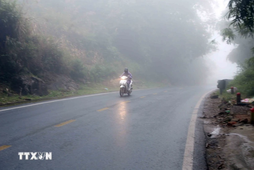
On February 25, the Northern and North Central regions will have rain, showers and thunderstorms in some places, locally moderate rain, heavy rain with rainfall of 10-30mm, in some places over 50mm.
According to the National Center for Hydro-Meteorological Forecasting, on the day and night of February 25, the area from Quang Tri to Khanh Hoa and the Eastern Central Highlands will have rain, moderate rain, locally heavy rain and thunderstorms with rainfall of 15-30mm, in some places over 70mm.
The Northern and North Central regions will have rain, showers and thunderstorms in some places, locally moderate rain, heavy rain with rainfall of 10-30mm, in some places over 50mm, in thunderstorms there is a possibility of tornadoes, lightning, hail and strong gusts of wind.
Localized heavy rains are likely to cause flash floods on small rivers and streams, landslides on steep slopes and flooding in low-lying areas. Warning level 1 for natural disaster risks due to tornadoes, lightning and hail.
At sea, the Gulf of Tonkin has strong northeast wind level 5, sometimes level 6, gusting to level 7-8, rough sea, waves 2-3m high; in the North East Sea area (including the sea area of Hoang Sa), strong northeast wind level 6, especially in the East Sea area level 6-7, gusting to level 8-9, rough sea, waves 4-6m high.
The central East Sea area, the western sea area of the southern East Sea area (including the western sea area of Truong Sa area) and the sea area from Quang Tri to Ca Mau have strong northeast winds of level 6, gusting to level 7-8, rough seas, waves 3-5.5m high.
The sea area from Ca Mau to Kien Giang has strong northeast wind level 5, sometimes level 6, gusting to level 7-8, rough sea, waves 1.5-3m high.
On the day and night of February 26, the eastern sea area of the North East Sea will have strong northeast winds at level 6, gusting to level 7-8, rough seas, and waves 3-5m high.
The sea area from Binh Thuan to Ca Mau and the sea area west of the South China Sea (including the sea area west of Truong Sa area) has strong northeast wind level 5, sometimes level 6, gusting to level 7-8, rough sea, waves 2-3.5m high. The risk level of natural disasters due to strong winds at sea is level 2.
Weather in regions on February 25:
Northwest
- There will be rain, showers and thunderstorms in some places, locally heavy rain. Light wind.
- Cold weather, severe cold in some places, thunderstorms with possibility of tornadoes, lightning, hail and strong gusts of wind.
- Lowest temperature 12-15 degrees Celsius, some places below 8 degrees Celsius. Highest temperature 14-17 degrees Celsius, some places above 18 degrees Celsius.
Northeast
- There will be rain, showers and thunderstorms in some places, locally heavy rain. Northeast wind level 2-3.
- Cold weather, severe cold in mountainous areas, thunderstorms with possibility of tornadoes, lightning, hail and strong gusts of wind. Lowest temperature 12-15 degrees Celsius, in high mountainous areas below 9 degrees Celsius. Highest temperature 15-17 degrees Celsius.
Hanoi capital
- Rain, showers and thunderstorms in some places. Northeast wind level 2-3.
- Cold weather. Lowest temperature 13-15 degrees Celsius. Highest temperature 15-17 degrees Celsius.
Thanh Hoa to Hue
- Scattered showers and thunderstorms, locally moderate to heavy rain; in the South there is rain, moderate rain, locally heavy rain and thunderstorms. North to Northwest wind level 2-3, coastal areas level 3-4.
- It's cold, especially in the North where it's very cold.
- Lowest temperature: North 14-16 degrees Celsius; South 16-19 degrees Celsius. Highest temperature: North 16-18 degrees Celsius; South 19-22 degrees Celsius.
Da Nang to Binh Thuan
- There will be rain, moderate rain, locally heavy rain and thunderstorms; Ninh Thuan-Binh Thuan will have showers and thunderstorms in some places.
- Northeast wind level 2-3, coastal areas level 3-4, some places have gusts of level 6, in thunderstorms there is a possibility of tornadoes, lightning and strong gusts. Lowest temperature: North 21-23 degrees Celsius; South 23-25 degrees Celsius.
- Highest temperature: North 23-26 degrees Celsius; South 27-30 degrees Celsius, some places over 30 degrees Celsius.
Central Highlands
- There will be showers and thunderstorms in some places; in the East there will be rain, moderate rain, locally heavy rain and thunderstorms. Northeast to east wind level 2-3, in thunderstorms there is a possibility of tornadoes, lightning, hail and strong gusts of wind.
- Lowest temperature 18-21 degrees Celsius. Highest temperature 25-28 degrees Celsius, some places above 28 degrees Celsius.
Southern Vietnam
- There will be showers and thunderstorms in some places. Northeast to East wind level 2-3, with the possibility of tornadoes, lightning, hail and strong gusts of wind in thunderstorms.
- Lowest temperature 24-27 degrees Celsius. Highest temperature 30-33 degrees Celsius, some places above 33 degrees Celsius.
Source: VNA
Source: https://baophutho.vn/thoi-tiet-ngay-25-2-bac-bo-vua-mua-vua-ret-co-noi-duoi-8-doc-228392.htm


![[Photo] Closing ceremony of the 18th Congress of Hanoi Party Committee](https://vphoto.vietnam.vn/thumb/1200x675/vietnam/resource/IMAGE/2025/10/17/1760704850107_ndo_br_1-jpg.webp)


![[Photo] Nhan Dan Newspaper launches “Fatherland in the Heart: The Concert Film”](https://vphoto.vietnam.vn/thumb/1200x675/vietnam/resource/IMAGE/2025/10/16/1760622132545_thiet-ke-chua-co-ten-36-png.webp)


Comment (0)