
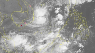
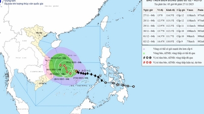
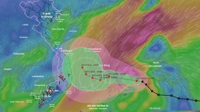
According to the National Center for Hydro-Meteorological Forecasting, at 4:00 AM on September 18th, the center of the tropical depression was located at approximately 16.7 degrees North latitude and 113.8 degrees East longitude, about 250km east of the Hoang Sa (Paracel) Islands. The strongest winds near the center of the tropical depression were at level 7 (50-61km/h), with gusts up to level 9; it was moving mainly westward at a speed of about 25km/h.
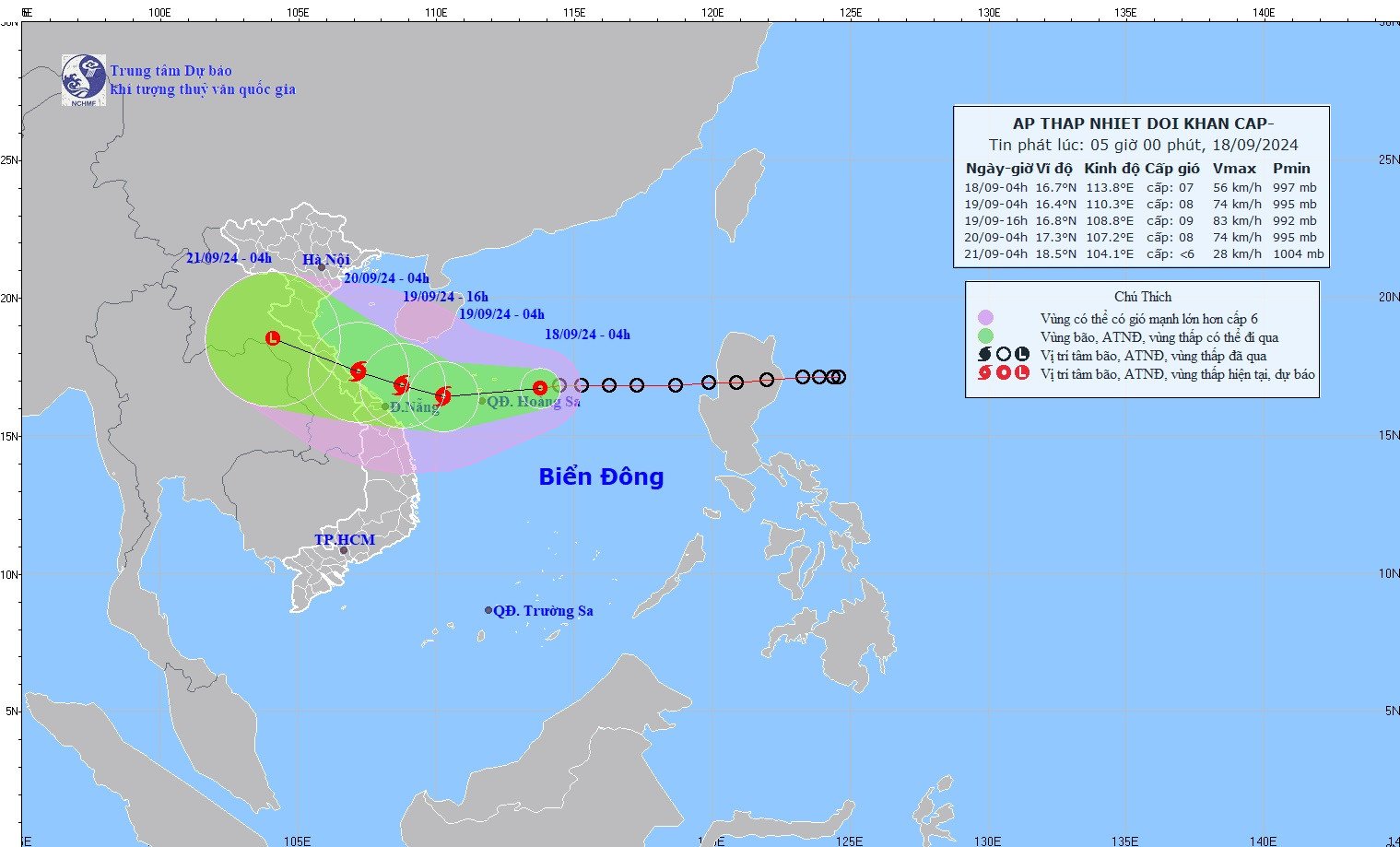
Forecasts indicate that within the next 24 hours, the tropical depression is likely to strengthen into typhoon number 4, with an intensity of level 8 and gusts of level 10.
A tropical depression becomes a storm when it has maximum wind speeds of level 8 or higher, possibly with gusts, wind speeds of 62 km/h or more, and average wave height of 5.5m.
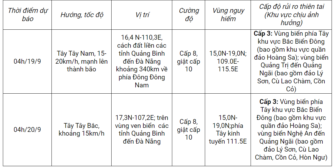
Over the next 48 to 72 hours, the storm will move west-northwest at a speed of 10-15 km/h and weaken into a low-pressure area over central Laos.
Forecast of the impact of the tropical depression/storm:
Strong winds, rising tide, big waves
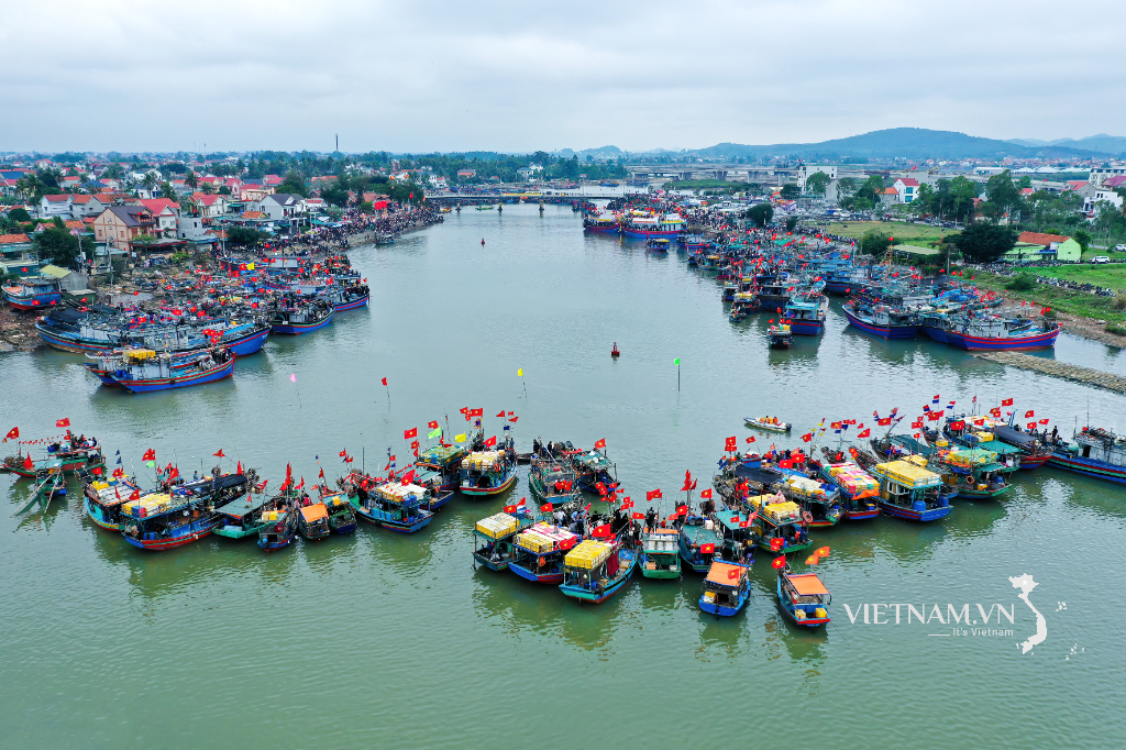
At sea: In the northern South China Sea (including the Paracel Islands), and the sea area from Nghe An to Quang Ngai (including Ly Son, Cu Lao Cham, Con Co, and Hon Ngu islands), there will be strong winds of force 6-7, reaching force 8 (62-74 km/h) near the storm's center, with gusts up to force 10 (89-102 km/h). Sea waves will be 2-4 meters high, and 3-5 meters near the storm's center, resulting in rough seas.
Vessels operating in the aforementioned hazardous areas are susceptible to the effects of thunderstorms, tornadoes, strong winds, and high waves.
On land: From early morning and throughout September 19th, coastal areas from Ha Tinh to Quang Ngai will experience increasingly strong winds of force 6-7, reaching force 8 (62-74 km/h) near the storm's center, with gusts up to force 10 (89-102 km/h); further inland, winds will gust at force 6-7.
Heavy rain
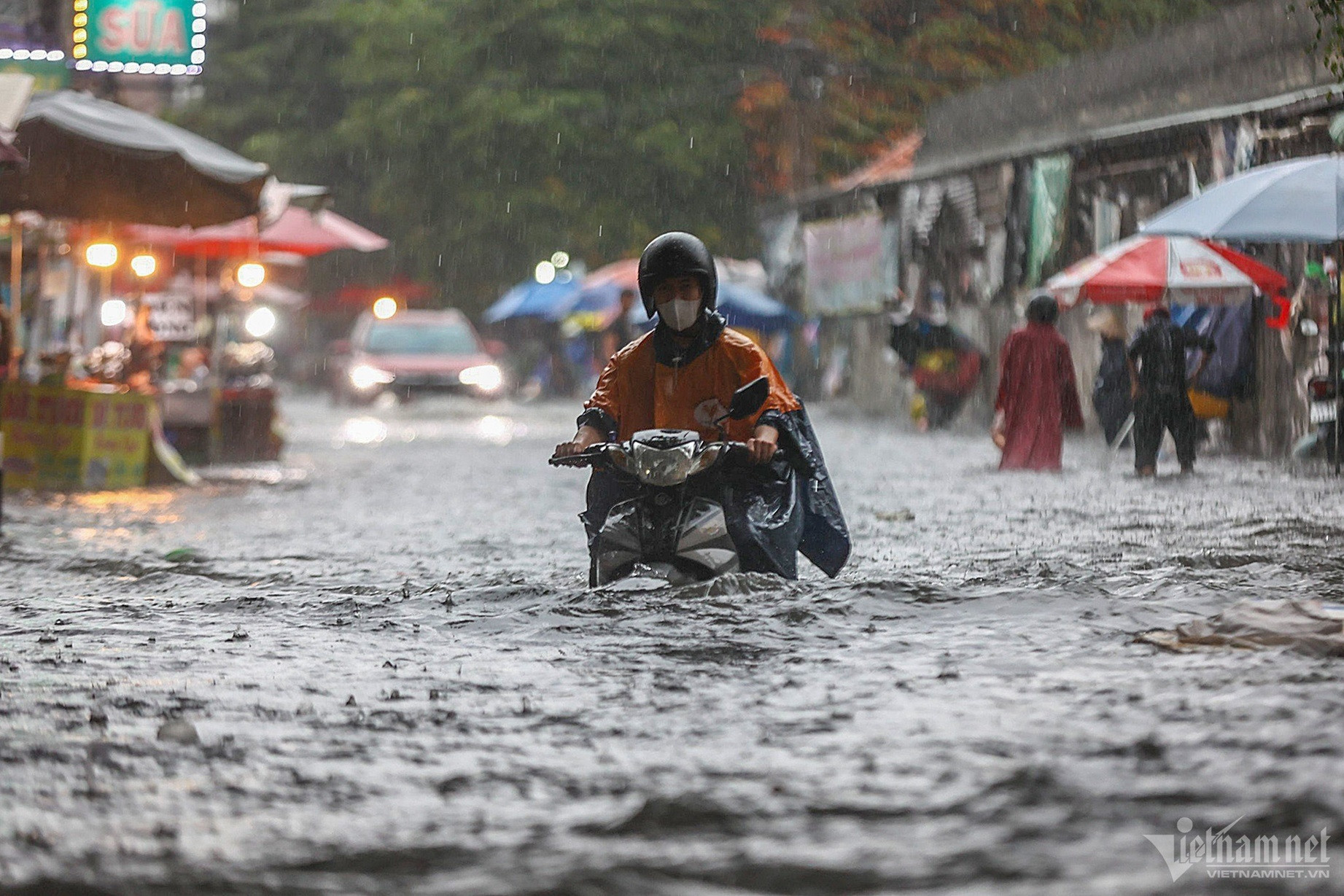
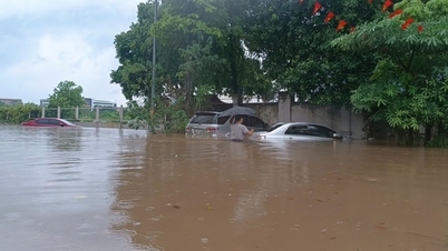
From September 18th to 20th, the northern and central parts of Central Vietnam will experience heavy to very heavy rain with rainfall amounts generally ranging from 100-300mm, and in some areas exceeding 500mm. From September 18th to 19th, the Central Highlands and Southern Vietnam will have moderate to heavy rain and thunderstorms, with localized very heavy rain, with rainfall amounts generally ranging from 40-80mm, and in some areas exceeding 150mm (rain concentrated in the afternoon and night).
Source: https://vietnamnet.vn/ap-thap-nhiet-doi-cach-hoang-sa-250km-sap-manh-thanh-bao-so-4-giat-cap-10-2323246.html

![[Image] Leaked images ahead of the 2025 Community Action Awards gala.](/_next/image?url=https%3A%2F%2Fvphoto.vietnam.vn%2Fthumb%2F1200x675%2Fvietnam%2Fresource%2FIMAGE%2F2025%2F12%2F16%2F1765882828720_ndo_br_thiet-ke-chua-co-ten-45-png.webp&w=3840&q=75)
![[Live] 2025 Community Action Awards Gala](/_next/image?url=https%3A%2F%2Fvphoto.vietnam.vn%2Fthumb%2F1200x675%2Fvietnam%2Fresource%2FIMAGE%2F2025%2F12%2F16%2F1765899631650_ndo_tr_z7334013144784-9f9fe10a6d63584c85aff40f2957c250-jpg.webp&w=3840&q=75)
![[Photo] Prime Minister Pham Minh Chinh receives Lao Minister of Education and Sports Thongsalith Mangnormek](/_next/image?url=https%3A%2F%2Fvphoto.vietnam.vn%2Fthumb%2F1200x675%2Fvietnam%2Fresource%2FIMAGE%2F2025%2F12%2F16%2F1765876834721_dsc-7519-jpg.webp&w=3840&q=75)
![[Photo] Prime Minister Pham Minh Chinh receives the Governor of Tochigi Province (Japan)](/_next/image?url=https%3A%2F%2Fvphoto.vietnam.vn%2Fthumb%2F1200x675%2Fvietnam%2Fresource%2FIMAGE%2F2025%2F12%2F16%2F1765892133176_dsc-8082-6425-jpg.webp&w=3840&q=75)
![[Image] The tenacious fighting spirit of Vietnamese women's football](/_next/image?url=https%3A%2F%2Fvphoto.vietnam.vn%2Fthumb%2F1200x675%2Fvietnam%2Fresource%2FIMAGE%2F2025%2F12%2F17%2F1765990260956_ndo_br_4224760955870434771-copy-jpg.webp&w=3840&q=75)


![[Live] Closing Ceremony and Award Presentation for the "Impressive Vietnam Tourism" Video/Clip Creation Contest 2025](https://vphoto.vietnam.vn/thumb/402x226/vietnam/resource/IMAGE/2025/12/17/1765974650260_z7273498850699-00d2fd6b0972cb39494cfa2559bf85ac-1765959338756946072104-627-0-1338-1138-crop-1765959347256801551121.jpeg)


Comment (0)